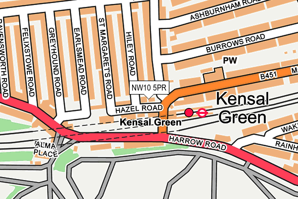
NW10 5PR lies on Hazel Road in London. NW10 5PR is located in the Queens Park electoral ward, within the London borough of Brent and the English Parliamentary constituency of Brent Central. The Sub Integrated Care Board (ICB) Location is NHS North West London ICB - W2U3Z and the police force is Metropolitan Police. This postcode has been in use since January 1980.


GetTheData
Source: OS OpenMap – Local (Ordnance Survey)
Source: OS VectorMap District (Ordnance Survey)
Licence: Open Government Licence (requires attribution)
| Easting | 523161 |
| Northing | 182816 |
| Latitude | 51.530829 |
| Longitude | -0.225855 |
GetTheData
Source: Open Postcode Geo
Licence: Open Government Licence
| Street | Hazel Road |
| Town/City | London |
| Country | England |
| Postcode District | NW10 |
➜ See where NW10 is on a map ➜ Where is London? | |
GetTheData
Source: Land Registry Price Paid Data
Licence: Open Government Licence
Elevation or altitude of NW10 5PR as distance above sea level:
| Metres | Feet | |
|---|---|---|
| Elevation | 40m | 131ft |
Elevation is measured from the approximate centre of the postcode, to the nearest point on an OS contour line from OS Terrain 50, which has contour spacing of ten vertical metres.
➜ How high above sea level am I? Find the elevation of your current position using your device's GPS.
GetTheData
Source: Open Postcode Elevation
Licence: Open Government Licence
| Ward | Queens Park |
| Constituency | Brent Central |
GetTheData
Source: ONS Postcode Database
Licence: Open Government Licence
| Kensal Green Station (Harrow Road) | Kensal Green | 106m |
| St Mary's Cemetery | Kensal Green | 128m |
| Kensal Green Station | Kensal Green | 129m |
| Kensal Green Station (Harrow Road) | Kensal Green | 195m |
| St Mary's Cemetery (Harrow Road) | Kensal Green | 214m |
| Kensal Green Underground Station | Kensal Green | 67m |
| Willesden Junction Underground Station | Willesden Junction | 1,288m |
| Queen's Park Underground Station | Queen's Park | 1,522m |
| Ladbroke Grove Underground Station | Ladbroke Grove | 1,835m |
| Kensal Green Station | 0.1km |
| Kensal Rise Station | 0.6km |
| Willesden Junction Station | 1.3km |
GetTheData
Source: NaPTAN
Licence: Open Government Licence
| Percentage of properties with Next Generation Access | 100.0% |
| Percentage of properties with Superfast Broadband | 100.0% |
| Percentage of properties with Ultrafast Broadband | 0.0% |
| Percentage of properties with Full Fibre Broadband | 0.0% |
Superfast Broadband is between 30Mbps and 300Mbps
Ultrafast Broadband is > 300Mbps
| Percentage of properties unable to receive 2Mbps | 0.0% |
| Percentage of properties unable to receive 5Mbps | 0.0% |
| Percentage of properties unable to receive 10Mbps | 0.0% |
| Percentage of properties unable to receive 30Mbps | 0.0% |
GetTheData
Source: Ofcom
Licence: Ofcom Terms of Use (requires attribution)
GetTheData
Source: ONS Postcode Database
Licence: Open Government Licence


➜ Get more ratings from the Food Standards Agency
GetTheData
Source: Food Standards Agency
Licence: FSA terms & conditions
| Last Collection | |||
|---|---|---|---|
| Location | Mon-Fri | Sat | Distance |
| College Road | 17:30 | 12:00 | 151m |
| Harrow Road Post Office | 18:30 | 12:00 | 207m |
| Wakeman Road | 17:30 | 12:00 | 273m |
GetTheData
Source: Dracos
Licence: Creative Commons Attribution-ShareAlike
The below table lists the International Territorial Level (ITL) codes (formerly Nomenclature of Territorial Units for Statistics (NUTS) codes) and Local Administrative Units (LAU) codes for NW10 5PR:
| ITL 1 Code | Name |
|---|---|
| TLI | London |
| ITL 2 Code | Name |
| TLI7 | Outer London - West and North West |
| ITL 3 Code | Name |
| TLI72 | Brent |
| LAU 1 Code | Name |
| E09000005 | Brent |
GetTheData
Source: ONS Postcode Directory
Licence: Open Government Licence
The below table lists the Census Output Area (OA), Lower Layer Super Output Area (LSOA), and Middle Layer Super Output Area (MSOA) for NW10 5PR:
| Code | Name | |
|---|---|---|
| OA | E00002575 | |
| LSOA | E01000532 | Brent 033C |
| MSOA | E02000125 | Brent 033 |
GetTheData
Source: ONS Postcode Directory
Licence: Open Government Licence
| NW10 5PP | Hazel Road | 47m |
| NW10 5PU | Hazel Road | 56m |
| NW10 5EN | College Road | 60m |
| NW10 5PS | Hiley Road | 99m |
| NW10 5QA | Hazel Road | 102m |
| NW10 5PT | Hiley Road | 102m |
| NW10 5PX | St Margarets Road | 115m |
| NW10 5EL | College Road | 118m |
| NW10 5EP | College Road | 120m |
| NW10 5PY | St Margarets Road | 135m |
GetTheData
Source: Open Postcode Geo; Land Registry Price Paid Data
Licence: Open Government Licence