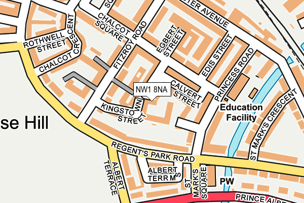
NW1 8NA is located in the Primrose Hill electoral ward, within the London borough of Camden and the English Parliamentary constituency of Holborn and St Pancras. The Sub Integrated Care Board (ICB) Location is NHS North Central London ICB - 93C and the police force is Metropolitan Police. This postcode has been in use since January 1980.


GetTheData
Source: OS OpenMap – Local (Ordnance Survey)
Source: OS VectorMap District (Ordnance Survey)
Licence: Open Government Licence (requires attribution)
| Easting | 528131 |
| Northing | 183873 |
| Latitude | 51.539223 |
| Longitude | -0.153860 |
GetTheData
Source: Open Postcode Geo
Licence: Open Government Licence
| Country | England |
| Postcode District | NW1 |
➜ See where NW1 is on a map ➜ Where is London? | |
GetTheData
Source: Land Registry Price Paid Data
Licence: Open Government Licence
Elevation or altitude of NW1 8NA as distance above sea level:
| Metres | Feet | |
|---|---|---|
| Elevation | 40m | 131ft |
Elevation is measured from the approximate centre of the postcode, to the nearest point on an OS contour line from OS Terrain 50, which has contour spacing of ten vertical metres.
➜ How high above sea level am I? Find the elevation of your current position using your device's GPS.
GetTheData
Source: Open Postcode Elevation
Licence: Open Government Licence
| Ward | Primrose Hill |
| Constituency | Holborn And St Pancras |
GetTheData
Source: ONS Postcode Database
Licence: Open Government Licence
| Regent's Park Road | Primrose Hill | 160m |
| Zsl London Zoo (Albert Terrace) | Primrose Hill | 190m |
| Zsl London Zoo (Prince Albert Road) | Primrose Hill | 207m |
| Regent's Park Road | Primrose Hill | 220m |
| Chalk Farm Morrisons (Camden Goods Yard) | Primrose Hill | 357m |
| Chalk Farm Underground Station | Chalk Farm | 545m |
| Camden Town Underground Station | Camden Town | 771m |
| Mornington Crescent Underground Station | Mornington Crescent | 1,161m |
| Belsize Park Underground Station | Belsize Park | 1,442m |
| St. John's Wood Underground Station | St Johns Wood | 1,489m |
| Kentish Town West Station | 1km |
| Camden Road Station | 1.1km |
| Kentish Town Station | 1.6km |
GetTheData
Source: NaPTAN
Licence: Open Government Licence
GetTheData
Source: ONS Postcode Database
Licence: Open Government Licence


➜ Get more ratings from the Food Standards Agency
GetTheData
Source: Food Standards Agency
Licence: FSA terms & conditions
| Last Collection | |||
|---|---|---|---|
| Location | Mon-Fri | Sat | Distance |
| 9 Princes Road, N. W. 1 | 19:00 | 13:00 | 115m |
| Regents Park Road | 19:00 | 13:00 | 145m |
| Gloucester Avenue | 19:00 | 13:00 | 221m |
GetTheData
Source: Dracos
Licence: Creative Commons Attribution-ShareAlike
The below table lists the International Territorial Level (ITL) codes (formerly Nomenclature of Territorial Units for Statistics (NUTS) codes) and Local Administrative Units (LAU) codes for NW1 8NA:
| ITL 1 Code | Name |
|---|---|
| TLI | London |
| ITL 2 Code | Name |
| TLI3 | Inner London - West |
| ITL 3 Code | Name |
| TLI31 | Camden and City of London |
| LAU 1 Code | Name |
| E09000007 | Camden |
GetTheData
Source: ONS Postcode Directory
Licence: Open Government Licence
The below table lists the Census Output Area (OA), Lower Layer Super Output Area (LSOA), and Middle Layer Super Output Area (MSOA) for NW1 8NA:
| Code | Name | |
|---|---|---|
| OA | E00004239 | |
| LSOA | E01000860 | Camden 018D |
| MSOA | E02000183 | Camden 018 |
GetTheData
Source: ONS Postcode Directory
Licence: Open Government Licence
| NW1 8JP | Kingstown Street | 46m |
| NW1 8TR | Fitzroy Road | 48m |
| NW1 8LT | Manley Street | 52m |
| NW1 8LY | Chalcot Road | 78m |
| NW1 8TP | Fitzroy Road | 81m |
| NW1 7SX | Regents Park Road | 82m |
| NW1 8LS | Chalcot Road | 89m |
| NW1 8JR | Princess Road | 99m |
| NW1 8JN | Princess Road | 101m |
| NW1 8TN | Hopkinsons Place | 111m |
GetTheData
Source: Open Postcode Geo; Land Registry Price Paid Data
Licence: Open Government Licence