NR9 3DU maps, stats, and open data
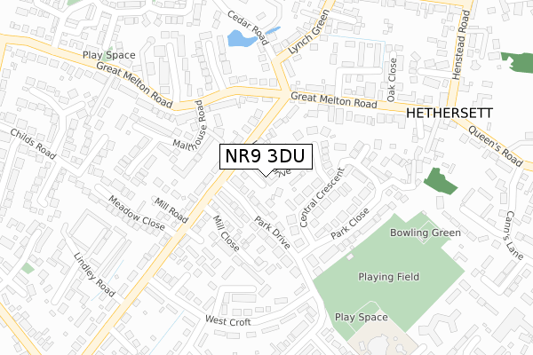
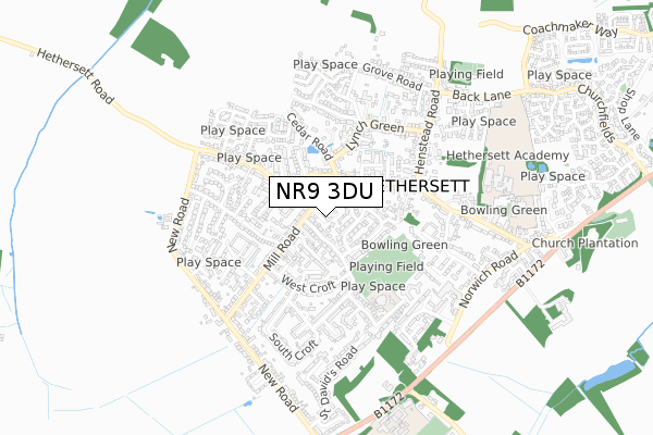
NR9 3DU lies on Alborough Loke in Hethersett, Norwich. NR9 3DU is located in the Hethersett electoral ward, within the local authority district of South Norfolk and the English Parliamentary constituency of South Norfolk. The Sub Integrated Care Board (ICB) Location is NHS Norfolk and Waveney ICB - 26A and the police force is Norfolk. This postcode has been in use since January 1980.
NR9 3DU maps


Licence: Open Government Licence (requires attribution)
Attribution: Contains OS data © Crown copyright and database right 2025
Source: Open Postcode Geo
Licence: Open Government Licence (requires attribution)
Attribution: Contains OS data © Crown copyright and database right 2025; Contains Royal Mail data © Royal Mail copyright and database right 2025; Source: Office for National Statistics licensed under the Open Government Licence v.3.0
NR9 3DU geodata
| Easting | 614946 |
| Northing | 304930 |
| Latitude | 52.599621 |
| Longitude | 1.172491 |
Where is NR9 3DU?
| Street | Alborough Loke |
| Locality | Hethersett |
| Town/City | Norwich |
| Country | England |
| Postcode District | NR9 |
NR9 3DU Elevation
Elevation or altitude of NR9 3DU as distance above sea level:
| Metres | Feet | |
|---|---|---|
| Elevation | 50m | 164ft |
Elevation is measured from the approximate centre of the postcode, to the nearest point on an OS contour line from OS Terrain 50, which has contour spacing of ten vertical metres.
➜ How high above sea level am I? Find the elevation of your current position using your device's GPS.
Politics
| Ward | Hethersett |
|---|---|
| Constituency | South Norfolk |
House Prices
Sales of detached houses in NR9 3DU
1, ALBOROUGH LOKE, HETHERSETT, NORWICH, NR9 3DU 2017 1 FEB £385,000 |
3, ALBOROUGH LOKE, HETHERSETT, NORWICH, NR9 3DU 1997 27 JUN £91,000 |
Licence: Contains HM Land Registry data © Crown copyright and database right 2025. This data is licensed under the Open Government Licence v3.0.
Transport
Nearest bus stops to NR9 3DU
| Meadow Close (Mill Road) | Hethersett | 226m |
| Cromwell Close (Melton Road) | Hethersett | 233m |
| Cromwell Close (Melton Road) | Hethersett | 234m |
| Meadow Close (Mill Road) | Hethersett | 269m |
| Flint House Gardens (Mill Road) | Hethersett | 398m |
Nearest railway stations to NR9 3DU
| Wymondham Station | 5.3km |
Broadband
Broadband access in NR9 3DU (2020 data)
| Percentage of properties with Next Generation Access | 100.0% |
| Percentage of properties with Superfast Broadband | 100.0% |
| Percentage of properties with Ultrafast Broadband | 0.0% |
| Percentage of properties with Full Fibre Broadband | 0.0% |
Superfast Broadband is between 30Mbps and 300Mbps
Ultrafast Broadband is > 300Mbps
Broadband limitations in NR9 3DU (2020 data)
| Percentage of properties unable to receive 2Mbps | 0.0% |
| Percentage of properties unable to receive 5Mbps | 0.0% |
| Percentage of properties unable to receive 10Mbps | 0.0% |
| Percentage of properties unable to receive 30Mbps | 0.0% |
Deprivation
68.2% of English postcodes are less deprived than NR9 3DU:Food Standards Agency
Three nearest food hygiene ratings to NR9 3DU (metres)


➜ Get more ratings from the Food Standards Agency
Nearest post box to NR9 3DU
| Last Collection | |||
|---|---|---|---|
| Location | Mon-Fri | Sat | Distance |
| Gt Melton Road Post Office | 17:15 | 11:15 | 267m |
| Ketts Oak | 17:30 | 08:00 | 1,182m |
| High Green | 17:30 | 11:15 | 1,638m |
NR9 3DU ITL and NR9 3DU LAU
The below table lists the International Territorial Level (ITL) codes (formerly Nomenclature of Territorial Units for Statistics (NUTS) codes) and Local Administrative Units (LAU) codes for NR9 3DU:
| ITL 1 Code | Name |
|---|---|
| TLH | East |
| ITL 2 Code | Name |
| TLH1 | East Anglia |
| ITL 3 Code | Name |
| TLH17 | Breckland and South Norfolk |
| LAU 1 Code | Name |
| E07000149 | South Norfolk |
NR9 3DU census areas
The below table lists the Census Output Area (OA), Lower Layer Super Output Area (LSOA), and Middle Layer Super Output Area (MSOA) for NR9 3DU:
| Code | Name | |
|---|---|---|
| OA | E00136851 | |
| LSOA | E01026905 | South Norfolk 003A |
| MSOA | E02005599 | South Norfolk 003 |
Nearest postcodes to NR9 3DU
| NR9 3DT | Linden Drive | 43m |
| NR9 3EL | Park Drive | 96m |
| NR9 3DR | Mill Road | 108m |
| NR9 3DX | Hubbards Loke | 119m |
| NR9 3EP | Central Crescent | 122m |
| NR9 3ER | Central Close | 128m |
| NR9 3DY | Mill Close | 136m |
| NR9 3DP | Mill Road | 144m |
| NR9 3HA | Great Melton Road | 151m |
| NR9 3EW | Park Close | 174m |