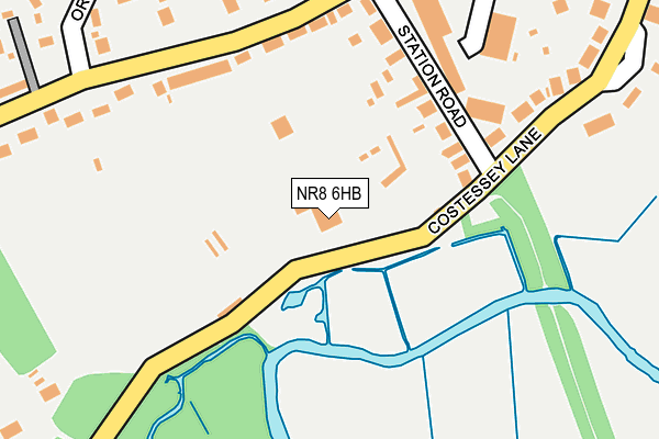
NR8 6HB lies on Costessey Lane in Drayton, Norwich. NR8 6HB is located in the Drayton South electoral ward, within the local authority district of Broadland and the English Parliamentary constituency of Broadland. The Sub Integrated Care Board (ICB) Location is NHS Norfolk and Waveney ICB - 26A and the police force is Norfolk. This postcode has been in use since January 1980.


GetTheData
Source: OS OpenMap – Local (Ordnance Survey)
Source: OS VectorMap District (Ordnance Survey)
Licence: Open Government Licence (requires attribution)
| Easting | 617721 |
| Northing | 313316 |
| Latitude | 52.673787 |
| Longitude | 1.218922 |
GetTheData
Source: Open Postcode Geo
Licence: Open Government Licence
| Street | Costessey Lane |
| Locality | Drayton |
| Town/City | Norwich |
| Country | England |
| Postcode District | NR8 |
➜ See where NR8 is on a map ➜ Where is Drayton? | |
GetTheData
Source: Land Registry Price Paid Data
Licence: Open Government Licence
Elevation or altitude of NR8 6HB as distance above sea level:
| Metres | Feet | |
|---|---|---|
| Elevation | 10m | 33ft |
Elevation is measured from the approximate centre of the postcode, to the nearest point on an OS contour line from OS Terrain 50, which has contour spacing of ten vertical metres.
➜ How high above sea level am I? Find the elevation of your current position using your device's GPS.
GetTheData
Source: Open Postcode Elevation
Licence: Open Government Licence
| Ward | Drayton South |
| Constituency | Broadland |
GetTheData
Source: ONS Postcode Database
Licence: Open Government Licence
BRYNHYFRYDD, COSTESSEY LANE, DRAYTON, NORWICH, NR8 6HB 2013 24 JAN £290,000 |
BRYNHYFRYDD, COSTESSEY LANE, DRAYTON, NORWICH, NR8 6HB 2001 12 APR £137,400 |
MISTYMORN, COSTESSEY LANE, DRAYTON, NORWICH, NR8 6HB 1997 21 JUL £49,000 |
BRYNHYFRYDD, COSTESSEY LANE, DRAYTON, NORWICH, NR8 6HB 1996 23 AUG £92,000 |
GetTheData
Source: HM Land Registry Price Paid Data
Licence: Contains HM Land Registry data © Crown copyright and database right 2025. This data is licensed under the Open Government Licence v3.0.
| Station Road (Taverham Road) | Drayton | 226m |
| Sylvan Way (Orchard Bank) | Taverham | 283m |
| Sylvan Way (Orchard Bank) | Taverham | 290m |
| Budgens (Fakenham Road) | Drayton | 365m |
| Beverley Way (Orchard Bank) | Taverham | 390m |
GetTheData
Source: NaPTAN
Licence: Open Government Licence
| Percentage of properties with Next Generation Access | 100.0% |
| Percentage of properties with Superfast Broadband | 100.0% |
| Percentage of properties with Ultrafast Broadband | 0.0% |
| Percentage of properties with Full Fibre Broadband | 0.0% |
Superfast Broadband is between 30Mbps and 300Mbps
Ultrafast Broadband is > 300Mbps
| Percentage of properties unable to receive 2Mbps | 0.0% |
| Percentage of properties unable to receive 5Mbps | 0.0% |
| Percentage of properties unable to receive 10Mbps | 0.0% |
| Percentage of properties unable to receive 30Mbps | 0.0% |
GetTheData
Source: Ofcom
Licence: Ofcom Terms of Use (requires attribution)
GetTheData
Source: ONS Postcode Database
Licence: Open Government Licence


➜ Get more ratings from the Food Standards Agency
GetTheData
Source: Food Standards Agency
Licence: FSA terms & conditions
| Last Collection | |||
|---|---|---|---|
| Location | Mon-Fri | Sat | Distance |
| Drayton Post Office | 17:30 | 12:30 | 397m |
| Budgens Drayton | 17:15 | 12:45 | 411m |
| Bidewell Close | 15:45 | 09:30 | 1,030m |
GetTheData
Source: Dracos
Licence: Creative Commons Attribution-ShareAlike
The below table lists the International Territorial Level (ITL) codes (formerly Nomenclature of Territorial Units for Statistics (NUTS) codes) and Local Administrative Units (LAU) codes for NR8 6HB:
| ITL 1 Code | Name |
|---|---|
| TLH | East |
| ITL 2 Code | Name |
| TLH1 | East Anglia |
| ITL 3 Code | Name |
| TLH15 | Norwich and East Norfolk |
| LAU 1 Code | Name |
| E07000144 | Broadland |
GetTheData
Source: ONS Postcode Directory
Licence: Open Government Licence
The below table lists the Census Output Area (OA), Lower Layer Super Output Area (LSOA), and Middle Layer Super Output Area (MSOA) for NR8 6HB:
| Code | Name | |
|---|---|---|
| OA | E00134764 | |
| LSOA | E01026521 | Broadland 007D |
| MSOA | E02005526 | Broadland 007 |
GetTheData
Source: ONS Postcode Directory
Licence: Open Government Licence
| NR8 6SA | Station Road | 147m |
| NR8 6RY | Taverham Road | 168m |
| NR8 6RL | Drayton Industrial Estate | 181m |
| NR8 6HA | Costessey Lane | 275m |
| NR8 6RX | Taverham Road | 303m |
| NR8 6RU | Taverham Road | 315m |
| NR8 6RW | Sheridan Close | 325m |
| NR8 6PS | Fakenham Road | 367m |
| NR8 6PN | Fakenham Road | 385m |
| NR8 6PR | Fakenham Road | 390m |
GetTheData
Source: Open Postcode Geo; Land Registry Price Paid Data
Licence: Open Government Licence