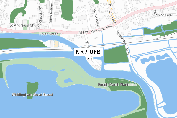
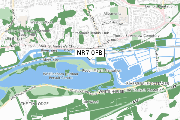
NR7 0FB is located in the Thorpe St Andrew South East electoral ward, within the local authority district of Broadland and the English Parliamentary constituency of Norwich North. The Sub Integrated Care Board (ICB) Location is NHS Norfolk and Waveney ICB - 26A and the police force is Norfolk. This postcode has been in use since September 2019.


GetTheData
Source: OS Open Zoomstack (Ordnance Survey)
Licence: Open Government Licence (requires attribution)
Attribution: Contains OS data © Crown copyright and database right 2024
Source: Open Postcode Geo
Licence: Open Government Licence (requires attribution)
Attribution: Contains OS data © Crown copyright and database right 2024; Contains Royal Mail data © Royal Mail copyright and database right 2024; Source: Office for National Statistics licensed under the Open Government Licence v.3.0
| Easting | 626432 |
| Northing | 308238 |
| Latitude | 52.624673 |
| Longitude | 1.344076 |
GetTheData
Source: Open Postcode Geo
Licence: Open Government Licence
| Country | England |
| Postcode District | NR7 |
| ➜ NR7 open data dashboard ➜ See where NR7 is on a map | |
GetTheData
Source: Land Registry Price Paid Data
Licence: Open Government Licence
| Ward | Thorpe St Andrew South East |
| Constituency | Norwich North |
GetTheData
Source: ONS Postcode Database
Licence: Open Government Licence
| June 2022 | Criminal damage and arson | On or near Barber Place | 239m |
| June 2022 | Drugs | On or near Roxley Close | 359m |
| May 2022 | Violence and sexual offences | On or near Yarmouth Road | 209m |
| ➜ Get more crime data in our Crime section | |||
GetTheData
Source: data.police.uk
Licence: Open Government Licence
| Barber Place (Yarmouth Road) | Thorpe St Andrew | 168m |
| Barber Place (Yarmouth Road) | Thorpe St Andrew | 204m |
| River Green (Yarmouth Road) | Thorpe St Andrew | 240m |
| River Green (Yarmouth Road) | Thorpe St Andrew | 288m |
| School Avenue (Yarmouth Road) | Thorpe St Andrew | 436m |
| Norwich Station | 2.5km |
GetTheData
Source: NaPTAN
Licence: Open Government Licence
GetTheData
Source: ONS Postcode Database
Licence: Open Government Licence


➜ Get more ratings from the Food Standards Agency
GetTheData
Source: Food Standards Agency
Licence: FSA terms & conditions
| Last Collection | |||
|---|---|---|---|
| Location | Mon-Fri | Sat | Distance |
| Thorpe St Andrew Post Office | 18:00 | 11:00 | 271m |
| Yarmouth Road | 18:00 | 11:00 | 271m |
| Hillside Road | 17:30 | 11:00 | 400m |
GetTheData
Source: Dracos
Licence: Creative Commons Attribution-ShareAlike
| Facility | Distance |
|---|---|
| Hillside Avenue Primary School Hillside Avenue, Norwich Grass Pitches | 694m |
| Pinebanks Sports And Leisure (Closed) Yarmouth Road, Norwich Artificial Grass Pitch, Health and Fitness Gym, Sports Hall, Squash Courts, Grass Pitches | 939m |
| Langley Preparatory School (Closed) Yarmouth Road, Norwich Swimming Pool, Sports Hall, Grass Pitches, Studio | 1km |
GetTheData
Source: Active Places
Licence: Open Government Licence
| School | Phase of Education | Distance |
|---|---|---|
| Hillside Avenue Primary and Nursery School, Thorpe Hillside Avenue, Thorpe St Andrew, Norwich, NR7 0QW | Primary | 713m |
| St William's Primary School Williams Loke, Thorpe St Andrew, St. William's Primary School, Norwich, NR7 0AJ | Primary | 1.4km |
| Thorpe St Andrew School and Sixth Form Laundry Lane, Thorpe St Andrew, Norwich, NR7 0XS | Secondary | 1.5km |
GetTheData
Source: Edubase
Licence: Open Government Licence
| Risk of NR7 0FB flooding from rivers and sea | High |
| ➜ NR7 0FB flood map | |
GetTheData
Source: Open Flood Risk by Postcode
Licence: Open Government Licence
The below table lists the International Territorial Level (ITL) codes (formerly Nomenclature of Territorial Units for Statistics (NUTS) codes) and Local Administrative Units (LAU) codes for NR7 0FB:
| ITL 1 Code | Name |
|---|---|
| TLH | East |
| ITL 2 Code | Name |
| TLH1 | East Anglia |
| ITL 3 Code | Name |
| TLH15 | Norwich and East Norfolk |
| LAU 1 Code | Name |
| E07000144 | Broadland |
GetTheData
Source: ONS Postcode Directory
Licence: Open Government Licence
The below table lists the Census Output Area (OA), Lower Layer Super Output Area (LSOA), and Middle Layer Super Output Area (MSOA) for NR7 0FB:
| Code | Name | |
|---|---|---|
| OA | E00135028 | |
| LSOA | E01026577 | Broadland 016D |
| MSOA | E02005535 | Broadland 016 |
GetTheData
Source: ONS Postcode Directory
Licence: Open Government Licence
| NR7 0HE | Yarmouth Road | 152m |
| NR7 0HF | Yarmouth Road | 173m |
| NR7 0QA | Whitlingham Lane | 241m |
| NR7 0HD | Yarmouth Road | 262m |
| NR7 0PY | Old Rectory Close | 288m |
| NR7 0HG | Barber Place | 290m |
| NR7 0EU | River Green Court | 292m |
| NR7 0QE | Yarmouth Road | 297m |
| NR7 0QF | Yarmouth Road | 311m |
| NR7 0AA | Yarmouth Road | 320m |
GetTheData
Source: Open Postcode Geo; Land Registry Price Paid Data
Licence: Open Government Licence