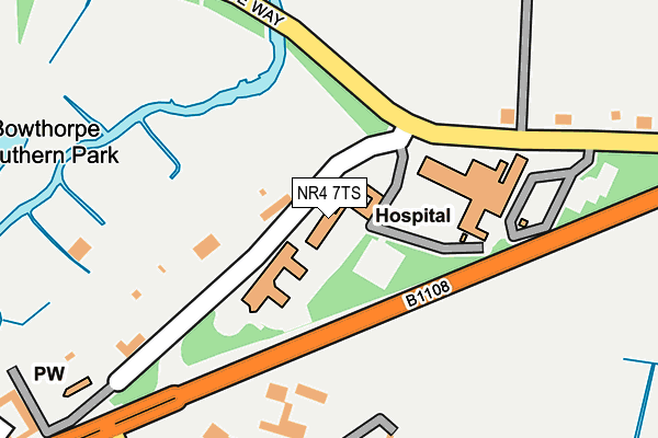
NR4 7TS is located in the Cringleford electoral ward, within the local authority district of South Norfolk and the English Parliamentary constituency of South Norfolk. The Sub Integrated Care Board (ICB) Location is NHS Norfolk and Waveney ICB - 26A and the police force is Norfolk. This postcode has been in use since January 1995.


GetTheData
Source: OS OpenMap – Local (Ordnance Survey)
Source: OS VectorMap District (Ordnance Survey)
Licence: Open Government Licence (requires attribution)
| Easting | 617282 |
| Northing | 306630 |
| Latitude | 52.613976 |
| Longitude | 1.208063 |
GetTheData
Source: Open Postcode Geo
Licence: Open Government Licence
| Country | England |
| Postcode District | NR4 |
➜ See where NR4 is on a map | |
GetTheData
Source: Land Registry Price Paid Data
Licence: Open Government Licence
Elevation or altitude of NR4 7TS as distance above sea level:
| Metres | Feet | |
|---|---|---|
| Elevation | 20m | 66ft |
Elevation is measured from the approximate centre of the postcode, to the nearest point on an OS contour line from OS Terrain 50, which has contour spacing of ten vertical metres.
➜ How high above sea level am I? Find the elevation of your current position using your device's GPS.
GetTheData
Source: Open Postcode Elevation
Licence: Open Government Licence
| Ward | Cringleford |
| Constituency | South Norfolk |
GetTheData
Source: ONS Postcode Database
Licence: Open Government Licence
| Forecourt | Norfolk & Norwich University Hospital | 848m |
| Forecourt | Norfolk & Norwich University Hospital | 903m |
| Braymeadow Lane (School Lane) | Little Melton | 908m |
| School Lane | Little Melton | 929m |
| Colney Lane | Norfolk & Norwich University Hospital | 1,222m |
GetTheData
Source: NaPTAN
Licence: Open Government Licence
GetTheData
Source: ONS Postcode Database
Licence: Open Government Licence


➜ Get more ratings from the Food Standards Agency
GetTheData
Source: Food Standards Agency
Licence: FSA terms & conditions
| Last Collection | |||
|---|---|---|---|
| Location | Mon-Fri | Sat | Distance |
| School Lane Post Office | 17:00 | 11:00 | 854m |
| N&n University Hospital | 17:15 | 11:00 | 854m |
| N&n University Hospital | 17:15 | 11:00 | 965m |
GetTheData
Source: Dracos
Licence: Creative Commons Attribution-ShareAlike
The below table lists the International Territorial Level (ITL) codes (formerly Nomenclature of Territorial Units for Statistics (NUTS) codes) and Local Administrative Units (LAU) codes for NR4 7TS:
| ITL 1 Code | Name |
|---|---|
| TLH | East |
| ITL 2 Code | Name |
| TLH1 | East Anglia |
| ITL 3 Code | Name |
| TLH17 | Breckland and South Norfolk |
| LAU 1 Code | Name |
| E07000149 | South Norfolk |
GetTheData
Source: ONS Postcode Directory
Licence: Open Government Licence
The below table lists the Census Output Area (OA), Lower Layer Super Output Area (LSOA), and Middle Layer Super Output Area (MSOA) for NR4 7TS:
| Code | Name | |
|---|---|---|
| OA | E00136729 | |
| LSOA | E01026883 | South Norfolk 002C |
| MSOA | E02005598 | South Norfolk 002 |
GetTheData
Source: ONS Postcode Directory
Licence: Open Government Licence
| NR9 3NJ | Braymeadow Lane | 477m |
| NR9 3QX | Birch Close | 667m |
| NR9 3QZ | Larch Close | 698m |
| NR9 3QU | Greenacres | 761m |
| NR9 3NH | Braymeadow Lane | 770m |
| NR9 3QY | Elm Close | 774m |
| NR9 3LB | School Lane | 831m |
| NR9 3AE | School Lane | 846m |
| NR9 3LA | School Lane | 876m |
| NR9 3NQ | Braymeadow Lane | 892m |
GetTheData
Source: Open Postcode Geo; Land Registry Price Paid Data
Licence: Open Government Licence