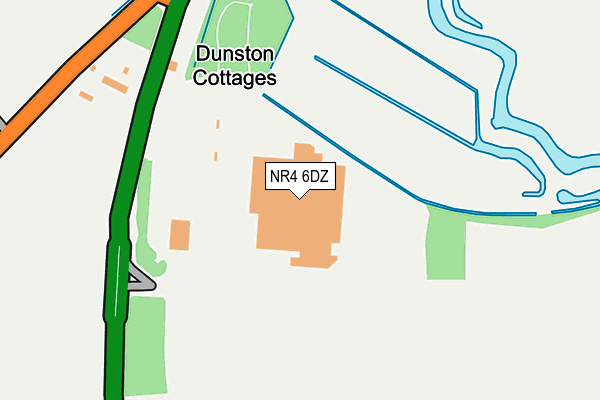
NR4 6DZ is located in the Poringland, Framinghams & Trowse electoral ward, within the local authority district of South Norfolk and the English Parliamentary constituency of South Norfolk. The Sub Integrated Care Board (ICB) Location is NHS Norfolk and Waveney ICB - 26A and the police force is Norfolk. This postcode has been in use since June 1996.


GetTheData
Source: OS OpenMap – Local (Ordnance Survey)
Source: OS VectorMap District (Ordnance Survey)
Licence: Open Government Licence (requires attribution)
| Easting | 622085 |
| Northing | 304751 |
| Latitude | 52.595147 |
| Longitude | 1.277602 |
GetTheData
Source: Open Postcode Geo
Licence: Open Government Licence
| Country | England |
| Postcode District | NR4 |
➜ See where NR4 is on a map | |
GetTheData
Source: Land Registry Price Paid Data
Licence: Open Government Licence
Elevation or altitude of NR4 6DZ as distance above sea level:
| Metres | Feet | |
|---|---|---|
| Elevation | 10m | 33ft |
Elevation is measured from the approximate centre of the postcode, to the nearest point on an OS contour line from OS Terrain 50, which has contour spacing of ten vertical metres.
➜ How high above sea level am I? Find the elevation of your current position using your device's GPS.
GetTheData
Source: Open Postcode Elevation
Licence: Open Government Licence
| Ward | Poringland, Framinghams & Trowse |
| Constituency | South Norfolk |
GetTheData
Source: ONS Postcode Database
Licence: Open Government Licence
| Tesco (Ipswich Road) | South Tuckswood | 174m |
| Tesco (Ipswich Road) | South Tuckswood | 191m |
| Ipswich Road Junction (B1113) | South Tuckswood | 251m |
| Marsh Harrier Inn (Ipswich Road) | South Tuckswood | 415m |
| Marsh Harrier Inn (Ipswich Road) | South Tuckswood | 417m |
| Norwich Station | 4.1km |
GetTheData
Source: NaPTAN
Licence: Open Government Licence
GetTheData
Source: ONS Postcode Database
Licence: Open Government Licence


➜ Get more ratings from the Food Standards Agency
GetTheData
Source: Food Standards Agency
Licence: FSA terms & conditions
| Last Collection | |||
|---|---|---|---|
| Location | Mon-Fri | Sat | Distance |
| Tesco Harford Bridge | 17:45 | 11:00 | 52m |
| Fountains Road | 17:30 | 11:00 | 824m |
| Locksley Road | 17:30 | 11:00 | 1,074m |
GetTheData
Source: Dracos
Licence: Creative Commons Attribution-ShareAlike
The below table lists the International Territorial Level (ITL) codes (formerly Nomenclature of Territorial Units for Statistics (NUTS) codes) and Local Administrative Units (LAU) codes for NR4 6DZ:
| ITL 1 Code | Name |
|---|---|
| TLH | East |
| ITL 2 Code | Name |
| TLH1 | East Anglia |
| ITL 3 Code | Name |
| TLH17 | Breckland and South Norfolk |
| LAU 1 Code | Name |
| E07000149 | South Norfolk |
GetTheData
Source: ONS Postcode Directory
Licence: Open Government Licence
The below table lists the Census Output Area (OA), Lower Layer Super Output Area (LSOA), and Middle Layer Super Output Area (MSOA) for NR4 6DZ:
| Code | Name | |
|---|---|---|
| OA | E00137009 | |
| LSOA | E01026937 | South Norfolk 006G |
| MSOA | E02005602 | South Norfolk 006 |
GetTheData
Source: ONS Postcode Directory
Licence: Open Government Licence
| NR4 6DY | Ipswich Road | 208m |
| NR4 6FF | Yarefield Park | 474m |
| NR4 6EP | Ipswich Road | 675m |
| NR4 6LP | Kirklees | 760m |
| NR4 6LY | Marston Lane | 801m |
| NR4 6LW | Fountains Road | 814m |
| NR4 6LN | Fountains Road | 818m |
| NR4 6LH | Watkin Road | 948m |
| NR4 6LL | Barnesdale Road | 949m |
| NR4 6NQ | Hall Road | 967m |
GetTheData
Source: Open Postcode Geo; Land Registry Price Paid Data
Licence: Open Government Licence