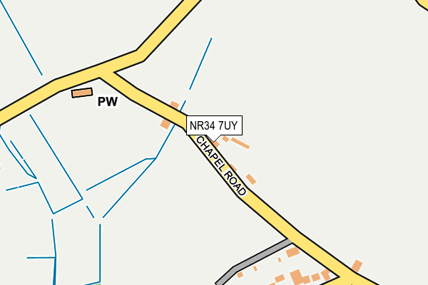
NR34 7UY is in Mutford, Beccles. NR34 7UY is located in the Carlton Colville electoral ward, within the local authority district of East Suffolk and the English Parliamentary constituency of Waveney. The Sub Integrated Care Board (ICB) Location is NHS Norfolk and Waveney ICB - 26A and the police force is Suffolk. This postcode has been in use since January 1980.


GetTheData
Source: OS OpenMap – Local (Ordnance Survey)
Source: OS VectorMap District (Ordnance Survey)
Licence: Open Government Licence (requires attribution)
| Easting | 648868 |
| Northing | 288474 |
| Latitude | 52.437551 |
| Longitude | 1.660071 |
GetTheData
Source: Open Postcode Geo
Licence: Open Government Licence
| Locality | Mutford |
| Town/City | Beccles |
| Country | England |
| Postcode District | NR34 |
➜ See where NR34 is on a map | |
GetTheData
Source: Land Registry Price Paid Data
Licence: Open Government Licence
Elevation or altitude of NR34 7UY as distance above sea level:
| Metres | Feet | |
|---|---|---|
| Elevation | 10m | 33ft |
Elevation is measured from the approximate centre of the postcode, to the nearest point on an OS contour line from OS Terrain 50, which has contour spacing of ten vertical metres.
➜ How high above sea level am I? Find the elevation of your current position using your device's GPS.
GetTheData
Source: Open Postcode Elevation
Licence: Open Government Licence
| Ward | Carlton Colville |
| Constituency | Waveney |
GetTheData
Source: ONS Postcode Database
Licence: Open Government Licence
| Village Hall (Mill Road) | Mutford | 232m |
| Village Hall (Mill Road) | Mutford | 241m |
| Post Office Store (Mill Road) | Mutford | 599m |
| Post Office Store | Mutford | 638m |
| Church (Chapel Road) | Rushmere | 763m |
| Oulton Broad South Station | 4.8km |
| Oulton Broad North Station | 5.9km |
GetTheData
Source: NaPTAN
Licence: Open Government Licence
| Percentage of properties with Next Generation Access | 100.0% |
| Percentage of properties with Superfast Broadband | 50.0% |
| Percentage of properties with Ultrafast Broadband | 0.0% |
| Percentage of properties with Full Fibre Broadband | 0.0% |
Superfast Broadband is between 30Mbps and 300Mbps
Ultrafast Broadband is > 300Mbps
| Percentage of properties unable to receive 2Mbps | 0.0% |
| Percentage of properties unable to receive 5Mbps | 0.0% |
| Percentage of properties unable to receive 10Mbps | 0.0% |
| Percentage of properties unable to receive 30Mbps | 50.0% |
GetTheData
Source: Ofcom
Licence: Ofcom Terms of Use (requires attribution)
GetTheData
Source: ONS Postcode Database
Licence: Open Government Licence


➜ Get more ratings from the Food Standards Agency
GetTheData
Source: Food Standards Agency
Licence: FSA terms & conditions
| Last Collection | |||
|---|---|---|---|
| Location | Mon-Fri | Sat | Distance |
| Rushmere Road | 16:00 | 08:00 | 2,306m |
| Monarch Way | 17:15 | 12:15 | 2,604m |
| Hollowgrove Way | 17:00 | 08:30 | 3,349m |
GetTheData
Source: Dracos
Licence: Creative Commons Attribution-ShareAlike
The below table lists the International Territorial Level (ITL) codes (formerly Nomenclature of Territorial Units for Statistics (NUTS) codes) and Local Administrative Units (LAU) codes for NR34 7UY:
| ITL 1 Code | Name |
|---|---|
| TLH | East |
| ITL 2 Code | Name |
| TLH1 | East Anglia |
| ITL 3 Code | Name |
| TLH14 | Suffolk CC |
| LAU 1 Code | Name |
| E07000244 | East Suffolk |
GetTheData
Source: ONS Postcode Directory
Licence: Open Government Licence
The below table lists the Census Output Area (OA), Lower Layer Super Output Area (LSOA), and Middle Layer Super Output Area (MSOA) for NR34 7UY:
| Code | Name | |
|---|---|---|
| OA | E00154481 | |
| LSOA | E01030286 | Waveney 011B |
| MSOA | E02006312 | Waveney 011 |
GetTheData
Source: ONS Postcode Directory
Licence: Open Government Licence
| NR34 7UR | Mill Road | 210m |
| NR34 7UT | Welch Close | 212m |
| NR34 7UU | Chapel Road | 343m |
| NR34 7UX | Holly Lane | 396m |
| NR34 7UP | Mill Road | 522m |
| NR34 7UZ | Church Road | 547m |
| NR34 7XA | Beccles Road | 672m |
| NR34 7UW | Hulver Road | 886m |
| NR34 7UN | Newson Avenue | 891m |
| NR33 8HE | Mutford Wood | 914m |
GetTheData
Source: Open Postcode Geo; Land Registry Price Paid Data
Licence: Open Government Licence