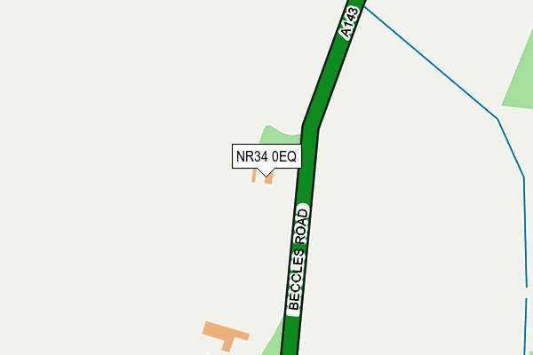
NR34 0EQ is located in the Thurlton electoral ward, within the local authority district of South Norfolk and the English Parliamentary constituency of South Norfolk. The Sub Integrated Care Board (ICB) Location is NHS Norfolk and Waveney ICB - 26A and the police force is Norfolk. This postcode has been in use since January 1980.


GetTheData
Source: OS OpenMap – Local (Ordnance Survey)
Source: OS VectorMap District (Ordnance Survey)
Licence: Open Government Licence (requires attribution)
| Easting | 642639 |
| Northing | 293876 |
| Latitude | 52.488795 |
| Longitude | 1.572521 |
GetTheData
Source: Open Postcode Geo
Licence: Open Government Licence
| Country | England |
| Postcode District | NR34 |
➜ See where NR34 is on a map | |
GetTheData
Source: Land Registry Price Paid Data
Licence: Open Government Licence
Elevation or altitude of NR34 0EQ as distance above sea level:
| Metres | Feet | |
|---|---|---|
| Elevation | 20m | 66ft |
Elevation is measured from the approximate centre of the postcode, to the nearest point on an OS contour line from OS Terrain 50, which has contour spacing of ten vertical metres.
➜ How high above sea level am I? Find the elevation of your current position using your device's GPS.
GetTheData
Source: Open Postcode Elevation
Licence: Open Government Licence
| Ward | Thurlton |
| Constituency | South Norfolk |
GetTheData
Source: ONS Postcode Database
Licence: Open Government Licence
| Elms Road (Beccles Road) | Aldeby | 834m |
| Elms Road (Beccles Road) | Aldeby | 844m |
| Post Office (Beccles Road) | Toft Monks | 883m |
| Post Office (Yarmouth Road) | Toft Monks | 884m |
| The White Lion (Yarmouth Road) | Toft Monks | 1,007m |
| Beccles Station | 3.4km |
| Haddiscoe Station | 5.6km |
GetTheData
Source: NaPTAN
Licence: Open Government Licence
| Percentage of properties with Next Generation Access | 100.0% |
| Percentage of properties with Superfast Broadband | 100.0% |
| Percentage of properties with Ultrafast Broadband | 0.0% |
| Percentage of properties with Full Fibre Broadband | 0.0% |
Superfast Broadband is between 30Mbps and 300Mbps
Ultrafast Broadband is > 300Mbps
| Percentage of properties unable to receive 2Mbps | 0.0% |
| Percentage of properties unable to receive 5Mbps | 0.0% |
| Percentage of properties unable to receive 10Mbps | 0.0% |
| Percentage of properties unable to receive 30Mbps | 0.0% |
GetTheData
Source: Ofcom
Licence: Ofcom Terms of Use (requires attribution)
GetTheData
Source: ONS Postcode Database
Licence: Open Government Licence


➜ Get more ratings from the Food Standards Agency
GetTheData
Source: Food Standards Agency
Licence: FSA terms & conditions
| Last Collection | |||
|---|---|---|---|
| Location | Mon-Fri | Sat | Distance |
| Old Market | 17:30 | 12:00 | 3,339m |
| Dunburgh Hall | 16:45 | 08:00 | 3,365m |
| The Street Post Office | 16:00 | 08:30 | 4,227m |
GetTheData
Source: Dracos
Licence: Creative Commons Attribution-ShareAlike
The below table lists the International Territorial Level (ITL) codes (formerly Nomenclature of Territorial Units for Statistics (NUTS) codes) and Local Administrative Units (LAU) codes for NR34 0EQ:
| ITL 1 Code | Name |
|---|---|
| TLH | East |
| ITL 2 Code | Name |
| TLH1 | East Anglia |
| ITL 3 Code | Name |
| TLH17 | Breckland and South Norfolk |
| LAU 1 Code | Name |
| E07000149 | South Norfolk |
GetTheData
Source: ONS Postcode Directory
Licence: Open Government Licence
The below table lists the Census Output Area (OA), Lower Layer Super Output Area (LSOA), and Middle Layer Super Output Area (MSOA) for NR34 0EQ:
| Code | Name | |
|---|---|---|
| OA | E00137051 | |
| LSOA | E01026943 | South Norfolk 010C |
| MSOA | E02005606 | South Norfolk 010 |
GetTheData
Source: ONS Postcode Directory
Licence: Open Government Licence
| NR34 0EF | Yarmouth Road | 217m |
| NR34 0EG | Waterloo | 469m |
| NR34 0EJ | Elms Road | 690m |
| NR34 0AH | Hollow Way Road | 755m |
| NR34 0HN | St Benedicts Close | 799m |
| NR34 0ER | Mardle Road | 824m |
| NR34 0EA | Beccles Road | 866m |
| NR34 0DN | Fullers Close | 881m |
| NR34 0FR | Bulls Green Lane | 886m |
| NR34 0EH | Post Office Road | 984m |
GetTheData
Source: Open Postcode Geo; Land Registry Price Paid Data
Licence: Open Government Licence