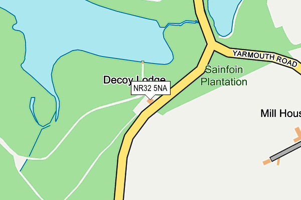
NR32 5NA is located in the Lothingland electoral ward, within the local authority district of East Suffolk and the English Parliamentary constituency of Waveney. The Sub Integrated Care Board (ICB) Location is NHS Norfolk and Waveney ICB - 26A and the police force is Suffolk. This postcode has been in use since January 1980.


GetTheData
Source: OS OpenMap – Local (Ordnance Survey)
Source: OS VectorMap District (Ordnance Survey)
Licence: Open Government Licence (requires attribution)
| Easting | 649644 |
| Northing | 300673 |
| Latitude | 52.546616 |
| Longitude | 1.680572 |
GetTheData
Source: Open Postcode Geo
Licence: Open Government Licence
| Country | England |
| Postcode District | NR32 |
➜ See where NR32 is on a map | |
GetTheData
Source: Land Registry Price Paid Data
Licence: Open Government Licence
Elevation or altitude of NR32 5NA as distance above sea level:
| Metres | Feet | |
|---|---|---|
| Elevation | 0m | 0ft |
Elevation is measured from the approximate centre of the postcode, to the nearest point on an OS contour line from OS Terrain 50, which has contour spacing of ten vertical metres.
➜ How high above sea level am I? Find the elevation of your current position using your device's GPS.
GetTheData
Source: Open Postcode Elevation
Licence: Open Government Licence
| Ward | Lothingland |
| Constituency | Waveney |
GetTheData
Source: ONS Postcode Database
Licence: Open Government Licence
| Telephone Box (Blocka Road) | Ashby | 1,285m |
| Telephone Box (Blocka Road) | Ashby | 1,286m |
| Southview Nurseries (Beccles Road) | Belton | 1,332m |
| Southview Nurseries (Beccles Road) | Belton | 1,332m |
| Lound Road (Beccles Road) | Belton | 1,462m |
| Haddiscoe Station | 4.4km |
| Somerleyton Station | 4.5km |
| Berney Arms Station | 5.9km |
GetTheData
Source: NaPTAN
Licence: Open Government Licence
| Percentage of properties with Next Generation Access | 100.0% |
| Percentage of properties with Superfast Broadband | 100.0% |
| Percentage of properties with Ultrafast Broadband | 0.0% |
| Percentage of properties with Full Fibre Broadband | 0.0% |
Superfast Broadband is between 30Mbps and 300Mbps
Ultrafast Broadband is > 300Mbps
| Percentage of properties unable to receive 2Mbps | 0.0% |
| Percentage of properties unable to receive 5Mbps | 0.0% |
| Percentage of properties unable to receive 10Mbps | 0.0% |
| Percentage of properties unable to receive 30Mbps | 0.0% |
GetTheData
Source: Ofcom
Licence: Ofcom Terms of Use (requires attribution)
GetTheData
Source: ONS Postcode Database
Licence: Open Government Licence


➜ Get more ratings from the Food Standards Agency
GetTheData
Source: Food Standards Agency
Licence: FSA terms & conditions
| Last Collection | |||
|---|---|---|---|
| Location | Mon-Fri | Sat | Distance |
| Crossways | 16:00 | 10:30 | 1,273m |
| Ashby Dell | 16:00 | 08:00 | 1,293m |
| Station Road South | 16:15 | 09:15 | 2,481m |
GetTheData
Source: Dracos
Licence: Creative Commons Attribution-ShareAlike
The below table lists the International Territorial Level (ITL) codes (formerly Nomenclature of Territorial Units for Statistics (NUTS) codes) and Local Administrative Units (LAU) codes for NR32 5NA:
| ITL 1 Code | Name |
|---|---|
| TLH | East |
| ITL 2 Code | Name |
| TLH1 | East Anglia |
| ITL 3 Code | Name |
| TLH14 | Suffolk CC |
| LAU 1 Code | Name |
| E07000244 | East Suffolk |
GetTheData
Source: ONS Postcode Directory
Licence: Open Government Licence
The below table lists the Census Output Area (OA), Lower Layer Super Output Area (LSOA), and Middle Layer Super Output Area (MSOA) for NR32 5NA:
| Code | Name | |
|---|---|---|
| OA | E00154343 | |
| LSOA | E01030259 | Waveney 001D |
| MSOA | E02006302 | Waveney 001 |
GetTheData
Source: ONS Postcode Directory
Licence: Open Government Licence
| NR32 5LZ | Yarmouth Road | 309m |
| NR31 9DP | Browston Lane | 879m |
| NR31 9DS | Lound Road | 1007m |
| NR32 5LU | Yarmouth Road | 1044m |
| NR31 9DW | Browston Green | 1194m |
| NR31 9DN | Cherry Lane | 1236m |
| NR31 9BS | Hobland Road | 1440m |
| NR31 9DL | Browston Lane | 1499m |
| NR32 5LT | The Street | 1502m |
| NR31 9AR | Hobland Road | 1674m |
GetTheData
Source: Open Postcode Geo; Land Registry Price Paid Data
Licence: Open Government Licence