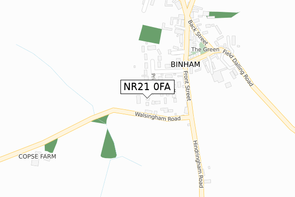
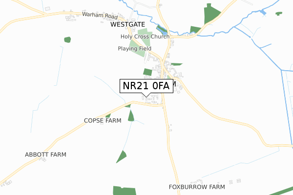
NR21 0FA is located in the Priory electoral ward, within the local authority district of North Norfolk and the English Parliamentary constituency of North Norfolk. The Sub Integrated Care Board (ICB) Location is NHS Norfolk and Waveney ICB - 26A and the police force is Norfolk. This postcode has been in use since September 2019.


GetTheData
Source: OS Open Zoomstack (Ordnance Survey)
Licence: Open Government Licence (requires attribution)
Attribution: Contains OS data © Crown copyright and database right 2024
Source: Open Postcode Geo
Licence: Open Government Licence (requires attribution)
Attribution: Contains OS data © Crown copyright and database right 2024; Contains Royal Mail data © Royal Mail copyright and database right 2024; Source: Office for National Statistics licensed under the Open Government Licence v.3.0
| Easting | 598189 |
| Northing | 339409 |
| Latitude | 52.915555 |
| Longitude | 0.946268 |
GetTheData
Source: Open Postcode Geo
Licence: Open Government Licence
| Country | England |
| Postcode District | NR21 |
| ➜ NR21 open data dashboard ➜ See where NR21 is on a map ➜ Where is Binham? | |
GetTheData
Source: Land Registry Price Paid Data
Licence: Open Government Licence
| Ward | Priory |
| Constituency | North Norfolk |
GetTheData
Source: ONS Postcode Database
Licence: Open Government Licence
17, LEEDERS PIGHTLE, BINHAM, FAKENHAM, NR21 0FA 2021 4 JUN £425,000 |
15, LEEDERS PIGHTLE, BINHAM, FAKENHAM, NR21 0FA 2021 12 MAR £525,000 |
11, LEEDERS PIGHTLE, BINHAM, FAKENHAM, NR21 0FA 2021 29 JAN £540,000 |
13, LEEDERS PIGHTLE, BINHAM, FAKENHAM, NR21 0FA 2021 15 JAN £600,000 |
6, LEEDERS PIGHTLE, BINHAM, FAKENHAM, NR21 0FA 2020 11 DEC £405,000 |
8, LEEDERS PIGHTLE, BINHAM, FAKENHAM, NR21 0FA 2020 10 DEC £405,000 |
3, LEEDERS PIGHTLE, BINHAM, FAKENHAM, NR21 0FA 2020 2 NOV £440,000 |
GetTheData
Source: HM Land Registry Price Paid Data
Licence: Contains HM Land Registry data © Crown copyright and database right 2024. This data is licensed under the Open Government Licence v3.0.
| April 2022 | Other theft | On or near Front Street | 167m |
| April 2022 | Violence and sexual offences | On or near Front Street | 167m |
| December 2021 | Violence and sexual offences | On or near Priory Crescent | 118m |
| ➜ Get more crime data in our Crime section | |||
GetTheData
Source: data.police.uk
Licence: Open Government Licence
| Bus Shelter (Front Street) | Binham | 218m |
| Bus Shelter (Front Street) | Binham | 228m |
| Westgate (Warham Road) | Binham | 800m |
| Westgate (Warham Road) | Binham | 807m |
GetTheData
Source: NaPTAN
Licence: Open Government Licence
GetTheData
Source: ONS Postcode Database
Licence: Open Government Licence

➜ Get more ratings from the Food Standards Agency
GetTheData
Source: Food Standards Agency
Licence: FSA terms & conditions
| Last Collection | |||
|---|---|---|---|
| Location | Mon-Fri | Sat | Distance |
| Front Street Post Office | 15:00 | 10:30 | 216m |
| Westgate | 15:00 | 10:15 | 809m |
| Knoll Corner | 14:30 | 10:30 | 2,623m |
GetTheData
Source: Dracos
Licence: Creative Commons Attribution-ShareAlike
| Facility | Distance |
|---|---|
| Binham Village Hall Warham Road, Binham Grass Pitches | 423m |
| The Playing Field (Closed) Field Dalling, Holt Grass Pitches | 2.6km |
| Hindringham Playing Field Wells Road, Hindringham, Fakenham Grass Pitches | 3.4km |
GetTheData
Source: Active Places
Licence: Open Government Licence
| School | Phase of Education | Distance |
|---|---|---|
| Langham Village School North Street, Langham, Holt, NR25 7DG | Primary | 3.3km |
| Hindringham Church of England Voluntary Controlled Primary School Wells Road, Hindringham, Fakenham, NR21 0PL | Primary | 3.4km |
| Walsingham CE VA Primary School Wells Road, WALSINGHAM, NR22 6DU | Primary | 5.1km |
GetTheData
Source: Edubase
Licence: Open Government Licence
The below table lists the International Territorial Level (ITL) codes (formerly Nomenclature of Territorial Units for Statistics (NUTS) codes) and Local Administrative Units (LAU) codes for NR21 0FA:
| ITL 1 Code | Name |
|---|---|
| TLH | East |
| ITL 2 Code | Name |
| TLH1 | East Anglia |
| ITL 3 Code | Name |
| TLH16 | North and West Norfolk |
| LAU 1 Code | Name |
| E07000147 | North Norfolk |
GetTheData
Source: ONS Postcode Directory
Licence: Open Government Licence
The below table lists the Census Output Area (OA), Lower Layer Super Output Area (LSOA), and Middle Layer Super Output Area (MSOA) for NR21 0FA:
| Code | Name | |
|---|---|---|
| OA | E00136069 | |
| LSOA | E01026765 | North Norfolk 002D |
| MSOA | E02005571 | North Norfolk 002 |
GetTheData
Source: ONS Postcode Directory
Licence: Open Government Licence
| NR21 0AP | Walsingham Road | 76m |
| NR21 0DB | Priory Crescent | 81m |
| NR21 0AN | Front Street | 135m |
| NR21 0AL | Front Street | 224m |
| NR21 0DF | Bunkers Hill | 250m |
| NR21 0DE | Field Dalling Road | 286m |
| NR21 0DD | The Green | 290m |
| NR21 0DL | Hindringham Road | 319m |
| NR21 0DG | Abbey Mews | 336m |
| NR21 0DR | Buttlands Close | 348m |
GetTheData
Source: Open Postcode Geo; Land Registry Price Paid Data
Licence: Open Government Licence