Hindringham Playing Field
Hindringham Playing Field is located in Hindringham, Fakenham (NR21), and offers Grass Pitches.
| Address | THE PAVILION, Wells Road, Hindringham, Fakenham, NR21 0PN |
| Car Park | Yes |
| Car Park Capacity | 50 |
| Management Type | Local Authority (in house) |
| Management Group | Local Authority |
| Owner Type | Local Authority |
| Owner Group | Local Authority |
| Education Phase | Not applicable |
Facilities
| Accessibility | Sports Club / Community Association |
| Management Type | Local Authority (in house) |
| Year Built | 1975 |
| Changing Rooms | Yes |
| Date Record Checked | 28th Nov 2022 |
| Opening Times | Dawn To Dusk |
Facility specifics
Disabled access
| Disabled Access | Yes |
| Finding/Reaching Entrance | Yes |
| Reception Area | Yes |
| Doorways | Yes |
| Activity Areas | Yes |
| Disabled Toilets | Yes |
| Social Areas | Yes |
| Spectator Areas | Yes |
| Emergency Exits | Yes |
| Notes | Defibrillator on site |
| Status Notes | Cricket square also has an Artificial Grass Wicket |
| Accessibility | Sports Club / Community Association |
| Management Type | Local Authority (in house) |
| Year Built | 2005 |
| Changing Rooms | Yes |
| Date Record Checked | 28th Nov 2022 |
| Opening Times | Dawn To Dusk |
Facility specifics
Disabled access
| Disabled Access | Yes |
| Finding/Reaching Entrance | Yes |
| Reception Area | Yes |
| Doorways | Yes |
| Activity Areas | Yes |
| Disabled Toilets | Yes |
| Social Areas | Yes |
| Spectator Areas | Yes |
| Emergency Exits | Yes |
| Notes | derfibilattor |
Contact
| Contact Type | Enquiries |
| Telephone | 0000 000000 |
8192:str_replace(): Passing null to parameter #3 ($subject) of type array|string is deprecated
Disabled access
Disabled access for Hindringham Playing Field
| Disabled Access | Yes |
| Finding/Reaching Entrance | Yes |
| Reception Area | Yes |
| Doorways | Yes |
| Activity Areas | Yes |
| Disabled Toilets | Yes |
| Social Areas | Yes |
| Spectator Areas | Yes |
| Emergency Exits | Yes |
| Notes | Defibrillator on site |
Where is Hindringham Playing Field?
8192:htmlspecialchars(): Passing null to parameter #1 ($string) of type string is deprecated
| Sub Building Name | |
| Building Name | THE PAVILION |
| Building Number | 0 |
8192:htmlspecialchars(): Passing null to parameter #1 ($string) of type string is deprecated
| Dependent Thoroughfare | |
| Thoroughfare Name | WELLS ROAD |
8192:htmlspecialchars(): Passing null to parameter #1 ($string) of type string is deprecated
| Double Dependent Locality | |
| Dependent Locality | HINDRINGHAM |
| PostTown | FAKENHAM |
| Postcode | NR21 0PN |
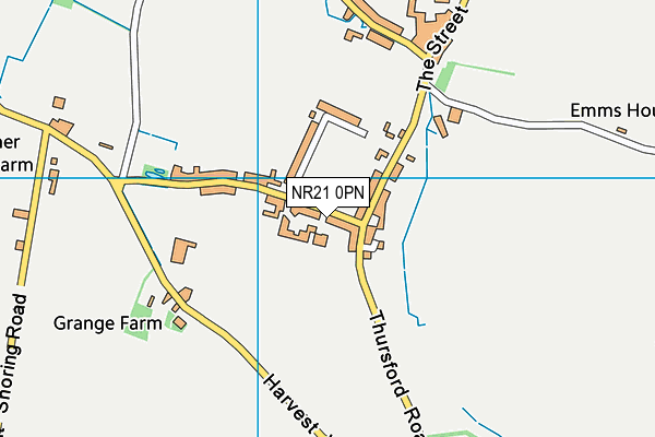
Hindringham Playing Field on a map

Hindringham Playing Field geodata
| Easting | 598125.49 |
| Northing | 335960.04 |
| Latitude | 52.88459 |
| Longitude | 0.943208 |
| Local Authority Name | North Norfolk |
| Local Authority Code | E07000147 |
| Parliamentary Constituency Name | North Norfolk |
| Parliamentary Constituency Code | E14000848 |
| Region Name | Eastern |
| Region Code | E15000006 |
| Ward Name | Priory |
| Ward Code | E05011852 |
| Output Area Code | E00136070 |
About this data
This data is open data sourced from Active Places Power and licenced under the Active Places Open Data Licence.
| Created On | 16th Nov 2006 |
| Audited On | 28th Nov 2022 |
| Checked On | 28th Nov 2022 |
