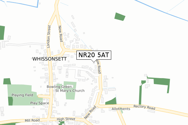
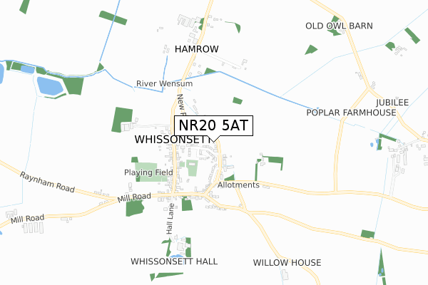
NR20 5AT is located in the Hermitage electoral ward, within the local authority district of Breckland and the English Parliamentary constituency of Mid Norfolk. The Sub Integrated Care Board (ICB) Location is NHS Norfolk and Waveney ICB - 26A and the police force is Norfolk. This postcode has been in use since February 2020.


GetTheData
Source: OS Open Zoomstack (Ordnance Survey)
Licence: Open Government Licence (requires attribution)
Attribution: Contains OS data © Crown copyright and database right 2024
Source: Open Postcode Geo
Licence: Open Government Licence (requires attribution)
Attribution: Contains OS data © Crown copyright and database right 2024; Contains Royal Mail data © Royal Mail copyright and database right 2024; Source: Office for National Statistics licensed under the Open Government Licence v.3.0
| Easting | 592011 |
| Northing | 323473 |
| Latitude | 52.774718 |
| Longitude | 0.845135 |
GetTheData
Source: Open Postcode Geo
Licence: Open Government Licence
| Country | England |
| Postcode District | NR20 |
| ➜ NR20 open data dashboard ➜ See where NR20 is on a map ➜ Where is Whissonsett? | |
GetTheData
Source: Land Registry Price Paid Data
Licence: Open Government Licence
| Ward | Hermitage |
| Constituency | Mid Norfolk |
GetTheData
Source: ONS Postcode Database
Licence: Open Government Licence
1, COPPER BEECH CLOSE, WHISSONSETT, DEREHAM, NR20 5AT 2020 17 NOV £402,000 |
2, COPPER BEECH CLOSE, WHISSONSETT, DEREHAM, NR20 5AT 2020 23 JAN £427,500 |
GetTheData
Source: HM Land Registry Price Paid Data
Licence: Contains HM Land Registry data © Crown copyright and database right 2024. This data is licensed under the Open Government Licence v3.0.
| June 2022 | Anti-social behaviour | On or near Church Close | 83m |
| June 2022 | Criminal damage and arson | On or near Church Close | 83m |
| May 2022 | Public order | On or near Church Close | 83m |
| ➜ Get more crime data in our Crime section | |||
GetTheData
Source: data.police.uk
Licence: Open Government Licence
| Hall Lane (London Street) | Whissonsett | 361m |
| Hall Lane (London Street) | Whissonsett | 378m |
| Colkirk Road | Whissonsett | 660m |
| Colkirk Road | Whissonsett | 661m |
| Whissonsett Road | Whissonsett | 1,356m |
GetTheData
Source: NaPTAN
Licence: Open Government Licence
GetTheData
Source: ONS Postcode Database
Licence: Open Government Licence


➜ Get more ratings from the Food Standards Agency
GetTheData
Source: Food Standards Agency
Licence: FSA terms & conditions
| Last Collection | |||
|---|---|---|---|
| Location | Mon-Fri | Sat | Distance |
| High Street Post Office | 16:45 | 10:30 | 298m |
| Crown Road | 15:30 | 09:15 | 2,780m |
| Hall Lane | 15:30 | 08:15 | 3,160m |
GetTheData
Source: Dracos
Licence: Creative Commons Attribution-ShareAlike
| Facility | Distance |
|---|---|
| Whissonsett Playing Field (Closed) London Street, Whissonsett Grass Pitches | 384m |
| Colkirk Playing Field Whissonsett Road, Colkirk, Fakenham Grass Pitches | 2.5km |
| Mileham Playing Field The Street, Mileham, King's Lynn Grass Pitches | 4km |
GetTheData
Source: Active Places
Licence: Open Government Licence
| School | Phase of Education | Distance |
|---|---|---|
| Brisley Church of England Primary Academy School Road, Brisley, Dereham, NR20 5LH | Primary | 2.8km |
| Colkirk Church of England Primary Academy School Road, Colkirk, Fakenham, NR21 7NW | Primary | 2.9km |
GetTheData
Source: Edubase
Licence: Open Government Licence
The below table lists the International Territorial Level (ITL) codes (formerly Nomenclature of Territorial Units for Statistics (NUTS) codes) and Local Administrative Units (LAU) codes for NR20 5AT:
| ITL 1 Code | Name |
|---|---|
| TLH | East |
| ITL 2 Code | Name |
| TLH1 | East Anglia |
| ITL 3 Code | Name |
| TLH17 | Breckland and South Norfolk |
| LAU 1 Code | Name |
| E07000143 | Breckland |
GetTheData
Source: ONS Postcode Directory
Licence: Open Government Licence
The below table lists the Census Output Area (OA), Lower Layer Super Output Area (LSOA), and Middle Layer Super Output Area (MSOA) for NR20 5AT:
| Code | Name | |
|---|---|---|
| OA | E00134360 | |
| LSOA | E01026442 | Breckland 002A |
| MSOA | E02005504 | Breckland 002 |
GetTheData
Source: ONS Postcode Directory
Licence: Open Government Licence
| NR20 5TB | North View Drive | 38m |
| NR20 5TA | New Road | 56m |
| NR20 5TP | Orchard Close | 134m |
| NR20 5TU | Springwell Road | 166m |
| NR20 5TD | East View Crescent | 189m |
| NR20 5SU | The Terrace | 198m |
| NR20 5ST | London Street | 231m |
| NR20 5TE | School Road | 273m |
| NR20 5TH | Stocks Hill | 288m |
| NR20 5TG | Wash Lane | 288m |
GetTheData
Source: Open Postcode Geo; Land Registry Price Paid Data
Licence: Open Government Licence