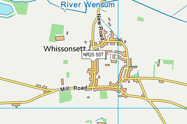
Whissonsett Playing Field (Closed)
Whissonsett Playing Field (Closed) is located in Whissonsett (NR20).
| Address | PLAYING FIELD, London Street, Whissonsett, NR20 5ST |
| Car Park | Yes |
| Car Park Capacity | 10 |
| Management Type | Local Authority (in house) |
| Management Group | Local Authority |
| Owner Type | Local Authority |
| Owner Group | Local Authority |
| Education Phase | Not applicable |
| Closure Date | 28th Oct 2022 |
| Closure Reason | Strategic Review - facility/site not being replaced |
Facilities
| Closure Date | 28th Oct 2022 |
| Closure Reason | Strategic Review - facility/site not being replaced |
| Accessibility | Sports Club / Community Association |
| Management Type | Local Authority (in house) |
| Changing Rooms | Yes |
| Date Record Checked | 28th Oct 2022 |
| Opening Times | Dawn To Dusk |
Facility specifics
Contact
Where is Whissonsett Playing Field (Closed)?
| Sub Building Name | |
| Building Name | PLAYING FIELD |
| Building Number | 0 |
| Dependent Thoroughfare | |
| Thoroughfare Name | LONDON STREET |
| Double Dependent Locality | |
| Dependent Locality | |
| PostTown | WHISSONSETT |
| Postcode | NR20 5ST |
Whissonsett Playing Field (Closed) on a map

Whissonsett Playing Field (Closed) geodata
| Easting | 591662 |
| Northing | 323312 |
| Latitude | 52.773371 |
| Longitude | 0.839855 |
| Local Authority Name | Breckland |
| Local Authority Code | E07000143 |
| Parliamentary Constituency Name | Mid Norfolk |
| Parliamentary Constituency Code | E14000816 |
| Region Name | Eastern |
| Region Code | E15000006 |
| Ward Name | Hermitage |
| Ward Code | E05010248 |
| Output Area Code | E00134359 |
About this data
This data is open data sourced from Active Places Power and licenced under the Active Places Open Data Licence.
| toid | osgb1000002034380233 |
| Created On | 15th Oct 2006 |
| Audited On | 6th Oct 2022 |
| Checked On | 6th Oct 2022 |
