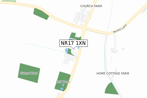
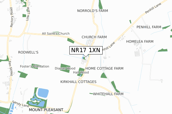
NR17 1XN is in Rockland All Saints, Attleborough. NR17 1XN is located in the All Saints & Wayland electoral ward, within the local authority district of Breckland and the English Parliamentary constituency of Mid Norfolk. The Sub Integrated Care Board (ICB) Location is NHS Norfolk and Waveney ICB - 26A and the police force is Norfolk. This postcode has been in use since January 1980.


GetTheData
Source: OS Open Zoomstack (Ordnance Survey)
Licence: Open Government Licence (requires attribution)
Attribution: Contains OS data © Crown copyright and database right 2025
Source: Open Postcode Geo
Licence: Open Government Licence (requires attribution)
Attribution: Contains OS data © Crown copyright and database right 2025; Contains Royal Mail data © Royal Mail copyright and database right 2025; Source: Office for National Statistics licensed under the Open Government Licence v.3.0
| Easting | 599898 |
| Northing | 295751 |
| Latitude | 52.522974 |
| Longitude | 0.945117 |
GetTheData
Source: Open Postcode Geo
Licence: Open Government Licence
| Locality | Rockland All Saints |
| Town/City | Attleborough |
| Country | England |
| Postcode District | NR17 |
➜ See where NR17 is on a map | |
GetTheData
Source: Land Registry Price Paid Data
Licence: Open Government Licence
Elevation or altitude of NR17 1XN as distance above sea level:
| Metres | Feet | |
|---|---|---|
| Elevation | 40m | 131ft |
Elevation is measured from the approximate centre of the postcode, to the nearest point on an OS contour line from OS Terrain 50, which has contour spacing of ten vertical metres.
➜ How high above sea level am I? Find the elevation of your current position using your device's GPS.
GetTheData
Source: Open Postcode Elevation
Licence: Open Government Licence
| Ward | All Saints & Wayland |
| Constituency | Mid Norfolk |
GetTheData
Source: ONS Postcode Database
Licence: Open Government Licence
| Percentage of properties with Next Generation Access | 100.0% |
| Percentage of properties with Superfast Broadband | 0.0% |
| Percentage of properties with Ultrafast Broadband | 0.0% |
| Percentage of properties with Full Fibre Broadband | 0.0% |
Superfast Broadband is between 30Mbps and 300Mbps
Ultrafast Broadband is > 300Mbps
| Percentage of properties unable to receive 2Mbps | 0.0% |
| Percentage of properties unable to receive 5Mbps | 0.0% |
| Percentage of properties unable to receive 10Mbps | 100.0% |
| Percentage of properties unable to receive 30Mbps | 100.0% |
GetTheData
Source: Ofcom
Licence: Ofcom Terms of Use (requires attribution)
GetTheData
Source: ONS Postcode Database
Licence: Open Government Licence


➜ Get more ratings from the Food Standards Agency
GetTheData
Source: Food Standards Agency
Licence: FSA terms & conditions
| Last Collection | |||
|---|---|---|---|
| Location | Mon-Fri | Sat | Distance |
| Kirke Hall | 09:00 | 08:30 | 84m |
| Fen Street | 09:45 | 09:45 | 1,131m |
| The Street Post Office | 16:30 | 10:15 | 1,233m |
GetTheData
Source: Dracos
Licence: Creative Commons Attribution-ShareAlike
The below table lists the International Territorial Level (ITL) codes (formerly Nomenclature of Territorial Units for Statistics (NUTS) codes) and Local Administrative Units (LAU) codes for NR17 1XN:
| ITL 1 Code | Name |
|---|---|
| TLH | East |
| ITL 2 Code | Name |
| TLH1 | East Anglia |
| ITL 3 Code | Name |
| TLH17 | Breckland and South Norfolk |
| LAU 1 Code | Name |
| E07000143 | Breckland |
GetTheData
Source: ONS Postcode Directory
Licence: Open Government Licence
The below table lists the Census Output Area (OA), Lower Layer Super Output Area (LSOA), and Middle Layer Super Output Area (MSOA) for NR17 1XN:
| Code | Name | |
|---|---|---|
| OA | E00134229 | |
| LSOA | E01026419 | Breckland 010A |
| MSOA | E02005512 | Breckland 010 |
GetTheData
Source: ONS Postcode Directory
Licence: Open Government Licence
| NR17 1XW | 233m | |
| NR17 1HG | Nelsons Loke | 530m |
| NR17 1LS | Penhill Road | 777m |
| NR17 1XR | Mill Lane | 993m |
| NR17 1TU | Low Lane | 1123m |
| NR17 1XQ | Mount Pleasant | 1159m |
| NR17 1TR | The Street | 1186m |
| NR17 1TX | Mill Lane | 1189m |
| NR17 1XE | Fen Street | 1193m |
| NR17 1XA | Rectory Road | 1196m |
GetTheData
Source: Open Postcode Geo; Land Registry Price Paid Data
Licence: Open Government Licence