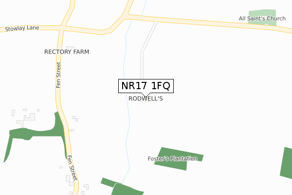
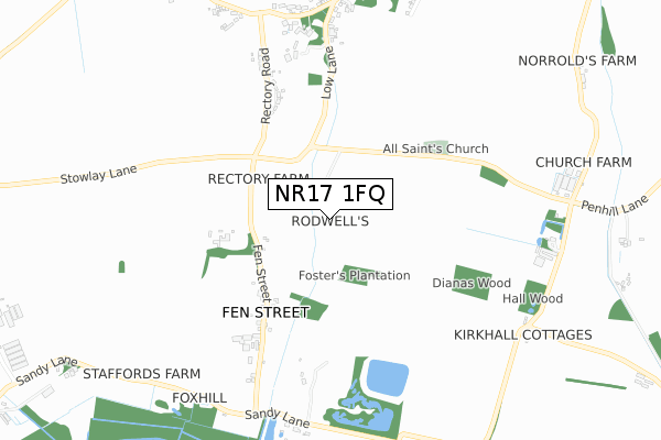
NR17 1FQ is located in the All Saints & Wayland electoral ward, within the local authority district of Breckland and the English Parliamentary constituency of Mid Norfolk. The Sub Integrated Care Board (ICB) Location is NHS Norfolk and Waveney ICB - 26A and the police force is Norfolk. This postcode has been in use since March 2019.


GetTheData
Source: OS Open Zoomstack (Ordnance Survey)
Licence: Open Government Licence (requires attribution)
Attribution: Contains OS data © Crown copyright and database right 2024
Source: Open Postcode Geo
Licence: Open Government Licence (requires attribution)
Attribution: Contains OS data © Crown copyright and database right 2024; Contains Royal Mail data © Royal Mail copyright and database right 2024; Source: Office for National Statistics licensed under the Open Government Licence v.3.0
| Easting | 599041 |
| Northing | 295740 |
| Latitude | 52.523188 |
| Longitude | 0.932496 |
GetTheData
Source: Open Postcode Geo
Licence: Open Government Licence
| Country | England |
| Postcode District | NR17 |
| ➜ NR17 open data dashboard ➜ See where NR17 is on a map | |
GetTheData
Source: Land Registry Price Paid Data
Licence: Open Government Licence
| Ward | All Saints & Wayland |
| Constituency | Mid Norfolk |
GetTheData
Source: ONS Postcode Database
Licence: Open Government Licence
| July 2021 | Anti-social behaviour | On or near Fen Street | 354m |
| ➜ Get more crime data in our Crime section | |||
GetTheData
Source: data.police.uk
Licence: Open Government Licence
GetTheData
Source: ONS Postcode Database
Licence: Open Government Licence


➜ Get more ratings from the Food Standards Agency
GetTheData
Source: Food Standards Agency
Licence: FSA terms & conditions
| Last Collection | |||
|---|---|---|---|
| Location | Mon-Fri | Sat | Distance |
| Fen Street | 09:45 | 09:45 | 363m |
| Kirke Hall | 09:00 | 08:30 | 924m |
| The Street Post Office | 16:30 | 10:15 | 1,010m |
GetTheData
Source: Dracos
Licence: Creative Commons Attribution-ShareAlike
| Facility | Distance |
|---|---|
| Rocklands Playing Field Green Lane, Rockland All Saints, Attleborough Grass Pitches | 1.3km |
| Shropham Playing Field Rocklands Road, Shropham, Attleborough Grass Pitches | 2.6km |
| Amazon Gym Hargham Road, Shropham, Attleborough Health and Fitness Gym | 2.7km |
GetTheData
Source: Active Places
Licence: Open Government Licence
| School | Phase of Education | Distance |
|---|---|---|
| Rocklands Community Primary School 74 The Street, Rockland All Saints, Attleborough, NR17 1TP | Primary | 852m |
| Great Ellingham Primary School Hingham Road, Great Ellingham, Attleborough, NR17 1HX | Primary | 3.2km |
| Caston Church of England Primary Academy The Street, Caston, Attleborough, NR17 1DD | Primary | 4.5km |
GetTheData
Source: Edubase
Licence: Open Government Licence
The below table lists the International Territorial Level (ITL) codes (formerly Nomenclature of Territorial Units for Statistics (NUTS) codes) and Local Administrative Units (LAU) codes for NR17 1FQ:
| ITL 1 Code | Name |
|---|---|
| TLH | East |
| ITL 2 Code | Name |
| TLH1 | East Anglia |
| ITL 3 Code | Name |
| TLH17 | Breckland and South Norfolk |
| LAU 1 Code | Name |
| E07000143 | Breckland |
GetTheData
Source: ONS Postcode Directory
Licence: Open Government Licence
The below table lists the Census Output Area (OA), Lower Layer Super Output Area (LSOA), and Middle Layer Super Output Area (MSOA) for NR17 1FQ:
| Code | Name | |
|---|---|---|
| OA | E00134229 | |
| LSOA | E01026419 | Breckland 010A |
| MSOA | E02005512 | Breckland 010 |
GetTheData
Source: ONS Postcode Directory
Licence: Open Government Licence
| NR17 1XD | Rectory Road | 397m |
| NR17 1XE | Fen Street | 455m |
| NR17 1XA | Rectory Road | 568m |
| NR17 1XB | Rectory Road | 600m |
| NR17 1TU | Low Lane | 735m |
| NR17 1XG | Mount Pleasant | 806m |
| NR17 1UX | The Street | 812m |
| NR17 1XN | 857m | |
| NR17 1XR | Mill Lane | 901m |
| NR17 1UU | Magpie Lane | 915m |
GetTheData
Source: Open Postcode Geo; Land Registry Price Paid Data
Licence: Open Government Licence