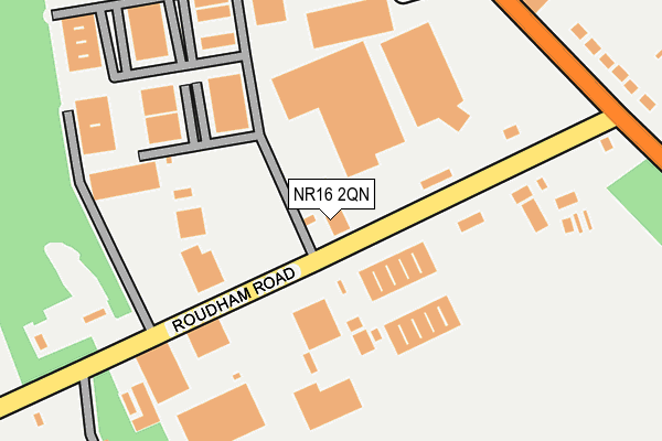
NR16 2QN lies on Roudham Road in Norwich. NR16 2QN is located in the Harling & Heathlands electoral ward, within the local authority district of Breckland and the English Parliamentary constituency of South West Norfolk. The Sub Integrated Care Board (ICB) Location is NHS Norfolk and Waveney ICB - 26A and the police force is Norfolk. This postcode has been in use since January 1980.


GetTheData
Source: OS OpenMap – Local (Ordnance Survey)
Source: OS VectorMap District (Ordnance Survey)
Licence: Open Government Licence (requires attribution)
| Easting | 597740 |
| Northing | 287676 |
| Latitude | 52.451239 |
| Longitude | 0.908539 |
GetTheData
Source: Open Postcode Geo
Licence: Open Government Licence
| Street | Roudham Road |
| Town/City | Norwich |
| Country | England |
| Postcode District | NR16 |
➜ See where NR16 is on a map ➜ Where is Harling Road? | |
GetTheData
Source: Land Registry Price Paid Data
Licence: Open Government Licence
Elevation or altitude of NR16 2QN as distance above sea level:
| Metres | Feet | |
|---|---|---|
| Elevation | 20m | 66ft |
Elevation is measured from the approximate centre of the postcode, to the nearest point on an OS contour line from OS Terrain 50, which has contour spacing of ten vertical metres.
➜ How high above sea level am I? Find the elevation of your current position using your device's GPS.
GetTheData
Source: Open Postcode Elevation
Licence: Open Government Licence
| Ward | Harling & Heathlands |
| Constituency | South West Norfolk |
GetTheData
Source: ONS Postcode Database
Licence: Open Government Licence
| Harling Road Station | 0.3km |
| Eccles Road Station | 4.7km |
GetTheData
Source: NaPTAN
Licence: Open Government Licence
| Percentage of properties with Next Generation Access | 100.0% |
| Percentage of properties with Superfast Broadband | 100.0% |
| Percentage of properties with Ultrafast Broadband | 0.0% |
| Percentage of properties with Full Fibre Broadband | 0.0% |
Superfast Broadband is between 30Mbps and 300Mbps
Ultrafast Broadband is > 300Mbps
| Median download speed | 10.2Mbps |
| Average download speed | 25.0Mbps |
| Maximum download speed | 79.63Mbps |
| Median upload speed | 1.1Mbps |
| Average upload speed | 4.6Mbps |
| Maximum upload speed | 20.00Mbps |
| Percentage of properties unable to receive 2Mbps | 0.0% |
| Percentage of properties unable to receive 5Mbps | 0.0% |
| Percentage of properties unable to receive 10Mbps | 0.0% |
| Percentage of properties unable to receive 30Mbps | 0.0% |
GetTheData
Source: Ofcom
Licence: Ofcom Terms of Use (requires attribution)
GetTheData
Source: ONS Postcode Database
Licence: Open Government Licence


➜ Get more ratings from the Food Standards Agency
GetTheData
Source: Food Standards Agency
Licence: FSA terms & conditions
| Last Collection | |||
|---|---|---|---|
| Location | Mon-Fri | Sat | Distance |
| Harling Station | 16:15 | 08:00 | 300m |
| The Angel P.h. | 16:00 | 09:00 | 1,407m |
| The Croft | 16:10 | 09:00 | 1,489m |
GetTheData
Source: Dracos
Licence: Creative Commons Attribution-ShareAlike
The below table lists the International Territorial Level (ITL) codes (formerly Nomenclature of Territorial Units for Statistics (NUTS) codes) and Local Administrative Units (LAU) codes for NR16 2QN:
| ITL 1 Code | Name |
|---|---|
| TLH | East |
| ITL 2 Code | Name |
| TLH1 | East Anglia |
| ITL 3 Code | Name |
| TLH17 | Breckland and South Norfolk |
| LAU 1 Code | Name |
| E07000143 | Breckland |
GetTheData
Source: ONS Postcode Directory
Licence: Open Government Licence
The below table lists the Census Output Area (OA), Lower Layer Super Output Area (LSOA), and Middle Layer Super Output Area (MSOA) for NR16 2QN:
| Code | Name | |
|---|---|---|
| OA | E00134351 | |
| LSOA | E01026440 | Breckland 014B |
| MSOA | E02005516 | Breckland 014 |
GetTheData
Source: ONS Postcode Directory
Licence: Open Government Licence
| NR16 2TW | Roudham Road | 125m |
| NR16 2SR | Hereward Way Business Park | 212m |
| NR16 2QW | 288m | |
| NR16 2QQ | Maltings Way | 294m |
| NR16 2QR | Dolphin Terrace | 347m |
| NR16 2QP | 360m | |
| NR16 2QS | 859m | |
| NR16 2RN | 1284m | |
| NR16 2RD | Turnpike Cottage | 1378m |
| NR16 2RL | 1621m |
GetTheData
Source: Open Postcode Geo; Land Registry Price Paid Data
Licence: Open Government Licence