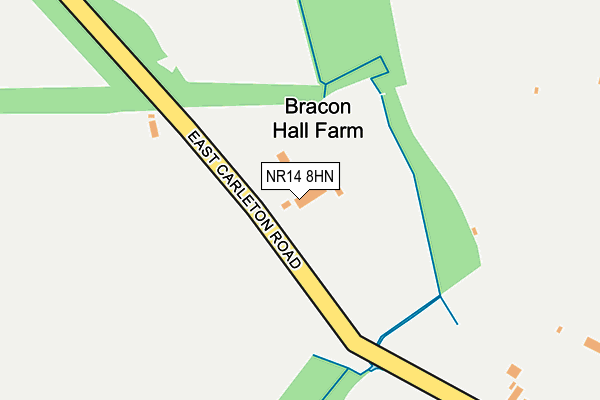
NR14 8HN lies on East Carleton Road in Bracon Ash, Norwich. NR14 8HN is located in the Mulbarton & Stoke Holy Cross electoral ward, within the local authority district of South Norfolk and the English Parliamentary constituency of South Norfolk. The Sub Integrated Care Board (ICB) Location is NHS Norfolk and Waveney ICB - 26A and the police force is Norfolk. This postcode has been in use since January 1980.


GetTheData
Source: OS OpenMap – Local (Ordnance Survey)
Source: OS VectorMap District (Ordnance Survey)
Licence: Open Government Licence (requires attribution)
| Easting | 618677 |
| Northing | 300978 |
| Latitude | 52.562663 |
| Longitude | 1.224882 |
GetTheData
Source: Open Postcode Geo
Licence: Open Government Licence
| Street | East Carleton Road |
| Locality | Bracon Ash |
| Town/City | Norwich |
| Country | England |
| Postcode District | NR14 |
➜ See where NR14 is on a map | |
GetTheData
Source: Land Registry Price Paid Data
Licence: Open Government Licence
Elevation or altitude of NR14 8HN as distance above sea level:
| Metres | Feet | |
|---|---|---|
| Elevation | 40m | 131ft |
Elevation is measured from the approximate centre of the postcode, to the nearest point on an OS contour line from OS Terrain 50, which has contour spacing of ten vertical metres.
➜ How high above sea level am I? Find the elevation of your current position using your device's GPS.
GetTheData
Source: Open Postcode Elevation
Licence: Open Government Licence
| Ward | Mulbarton & Stoke Holy Cross |
| Constituency | South Norfolk |
GetTheData
Source: ONS Postcode Database
Licence: Open Government Licence
| East Carleton Road (Norwich Road) | Mulbarton | 410m |
| Worlds End (Norwich Road) | Mulbarton | 745m |
| Lark Rise (Cuckoofield Lane) | Mulbarton | 756m |
| Lark Rise (Cuckoofield Lane) | Mulbarton | 769m |
| Worlds End (Norwich Road) | Mulbarton | 775m |
GetTheData
Source: NaPTAN
Licence: Open Government Licence
| Percentage of properties with Next Generation Access | 100.0% |
| Percentage of properties with Superfast Broadband | 42.9% |
| Percentage of properties with Ultrafast Broadband | 0.0% |
| Percentage of properties with Full Fibre Broadband | 0.0% |
Superfast Broadband is between 30Mbps and 300Mbps
Ultrafast Broadband is > 300Mbps
| Median download speed | 12.8Mbps |
| Average download speed | 20.1Mbps |
| Maximum download speed | 51.49Mbps |
| Median upload speed | 1.2Mbps |
| Average upload speed | 3.6Mbps |
| Maximum upload speed | 8.91Mbps |
| Percentage of properties unable to receive 2Mbps | 0.0% |
| Percentage of properties unable to receive 5Mbps | 0.0% |
| Percentage of properties unable to receive 10Mbps | 0.0% |
| Percentage of properties unable to receive 30Mbps | 57.1% |
GetTheData
Source: Ofcom
Licence: Ofcom Terms of Use (requires attribution)
GetTheData
Source: ONS Postcode Database
Licence: Open Government Licence


➜ Get more ratings from the Food Standards Agency
GetTheData
Source: Food Standards Agency
Licence: FSA terms & conditions
| Last Collection | |||
|---|---|---|---|
| Location | Mon-Fri | Sat | Distance |
| Birchfield Lane Post Office | 17:15 | 11:45 | 703m |
| Worlds End | 16:35 | 09:15 | 746m |
| Cuckoofield Lane | 16:30 | 09:30 | 929m |
GetTheData
Source: Dracos
Licence: Creative Commons Attribution-ShareAlike
The below table lists the International Territorial Level (ITL) codes (formerly Nomenclature of Territorial Units for Statistics (NUTS) codes) and Local Administrative Units (LAU) codes for NR14 8HN:
| ITL 1 Code | Name |
|---|---|
| TLH | East |
| ITL 2 Code | Name |
| TLH1 | East Anglia |
| ITL 3 Code | Name |
| TLH17 | Breckland and South Norfolk |
| LAU 1 Code | Name |
| E07000149 | South Norfolk |
GetTheData
Source: ONS Postcode Directory
Licence: Open Government Licence
The below table lists the Census Output Area (OA), Lower Layer Super Output Area (LSOA), and Middle Layer Super Output Area (MSOA) for NR14 8HN:
| Code | Name | |
|---|---|---|
| OA | E00136890 | |
| LSOA | E01026913 | South Norfolk 009A |
| MSOA | E02005605 | South Norfolk 009 |
GetTheData
Source: ONS Postcode Directory
Licence: Open Government Licence
| NR14 8HL | East Carleton Road | 323m |
| NR14 8JN | Norwich Road | 420m |
| NR14 8JH | Forge Orchards | 431m |
| NR14 8RL | Partridge Drive | 471m |
| NR14 8EG | Lark Rise | 487m |
| NR14 8JF | Thrush Close | 534m |
| NR14 8JQ | The Common | 534m |
| NR14 8BL | Pheasant Close | 570m |
| NR14 8JE | Owl Drive | 570m |
| NR14 8EE | Lark Rise | 581m |
GetTheData
Source: Open Postcode Geo; Land Registry Price Paid Data
Licence: Open Government Licence