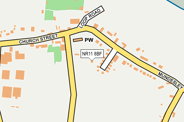
NR11 8BF lies on Church Road in Trimingham, Norwich. NR11 8BF is located in the Poppyland electoral ward, within the local authority district of North Norfolk and the English Parliamentary constituency of North Norfolk. The Sub Integrated Care Board (ICB) Location is NHS Norfolk and Waveney ICB - 26A and the police force is Norfolk. This postcode has been in use since March 2007.


GetTheData
Source: OS OpenMap – Local (Ordnance Survey)
Source: OS VectorMap District (Ordnance Survey)
Licence: Open Government Licence (requires attribution)
| Easting | 627850 |
| Northing | 338697 |
| Latitude | 52.897422 |
| Longitude | 1.386140 |
GetTheData
Source: Open Postcode Geo
Licence: Open Government Licence
| Street | Church Road |
| Locality | Trimingham |
| Town/City | Norwich |
| Country | England |
| Postcode District | NR11 |
➜ See where NR11 is on a map ➜ Where is Trimingham? | |
GetTheData
Source: Land Registry Price Paid Data
Licence: Open Government Licence
Elevation or altitude of NR11 8BF as distance above sea level:
| Metres | Feet | |
|---|---|---|
| Elevation | 60m | 197ft |
Elevation is measured from the approximate centre of the postcode, to the nearest point on an OS contour line from OS Terrain 50, which has contour spacing of ten vertical metres.
➜ How high above sea level am I? Find the elevation of your current position using your device's GPS.
GetTheData
Source: Open Postcode Elevation
Licence: Open Government Licence
| Ward | Poppyland |
| Constituency | North Norfolk |
GetTheData
Source: ONS Postcode Database
Licence: Open Government Licence
THE GARDEN HOUSE, CHURCH ROAD, TRIMINGHAM, NORWICH, NR11 8BF 2019 1 NOV £490,000 |
RYDER LODGE, CHURCH ROAD, TRIMINGHAM, NORWICH, NR11 8BF 2004 8 SEP £80,000 |
GetTheData
Source: HM Land Registry Price Paid Data
Licence: Contains HM Land Registry data © Crown copyright and database right 2025. This data is licensed under the Open Government Licence v3.0.
| Broadwood Close (Church Street) | Trimingham | 228m |
| Broadwood Close (Church Street) | Trimingham | 248m |
| Staden Park (Church Street) | Trimingham | 322m |
| Staden Park (Church Street) | Trimingham | 325m |
| Middle Street (Mundesley Road) | Trimingham | 388m |
| Gunton Station | 4.3km |
GetTheData
Source: NaPTAN
Licence: Open Government Licence
| Percentage of properties with Next Generation Access | 100.0% |
| Percentage of properties with Superfast Broadband | 100.0% |
| Percentage of properties with Ultrafast Broadband | 0.0% |
| Percentage of properties with Full Fibre Broadband | 0.0% |
Superfast Broadband is between 30Mbps and 300Mbps
Ultrafast Broadband is > 300Mbps
| Percentage of properties unable to receive 2Mbps | 0.0% |
| Percentage of properties unable to receive 5Mbps | 0.0% |
| Percentage of properties unable to receive 10Mbps | 0.0% |
| Percentage of properties unable to receive 30Mbps | 0.0% |
GetTheData
Source: Ofcom
Licence: Ofcom Terms of Use (requires attribution)
GetTheData
Source: ONS Postcode Database
Licence: Open Government Licence


➜ Get more ratings from the Food Standards Agency
GetTheData
Source: Food Standards Agency
Licence: FSA terms & conditions
| Last Collection | |||
|---|---|---|---|
| Location | Mon-Fri | Sat | Distance |
| Templewood | 16:00 | 08:30 | 2,505m |
| The Rectory | 16:00 | 08:30 | 2,956m |
| High Street Post Office | 16:30 | 10:00 | 3,081m |
GetTheData
Source: Dracos
Licence: Creative Commons Attribution-ShareAlike
The below table lists the International Territorial Level (ITL) codes (formerly Nomenclature of Territorial Units for Statistics (NUTS) codes) and Local Administrative Units (LAU) codes for NR11 8BF:
| ITL 1 Code | Name |
|---|---|
| TLH | East |
| ITL 2 Code | Name |
| TLH1 | East Anglia |
| ITL 3 Code | Name |
| TLH16 | North and West Norfolk |
| LAU 1 Code | Name |
| E07000147 | North Norfolk |
GetTheData
Source: ONS Postcode Directory
Licence: Open Government Licence
The below table lists the Census Output Area (OA), Lower Layer Super Output Area (LSOA), and Middle Layer Super Output Area (MSOA) for NR11 8BF:
| Code | Name | |
|---|---|---|
| OA | E00136068 | |
| LSOA | E01026762 | North Norfolk 005A |
| MSOA | E02005574 | North Norfolk 005 |
GetTheData
Source: ONS Postcode Directory
Licence: Open Government Licence
| NR11 8AL | Church Street | 91m |
| NR11 8EG | Cromer Road | 111m |
| NR11 8EQ | Loop Road | 152m |
| NR11 8EE | Broadwood Close | 174m |
| NR11 8HT | Cromer Road | 233m |
| NR11 8ED | Mundesley Road | 275m |
| NR11 8HX | Staden Park | 323m |
| NR11 8HU | Cromer Road | 369m |
| NR11 8EB | Middle Street | 418m |
| NR11 8EA | Middle Street | 418m |
GetTheData
Source: Open Postcode Geo; Land Registry Price Paid Data
Licence: Open Government Licence