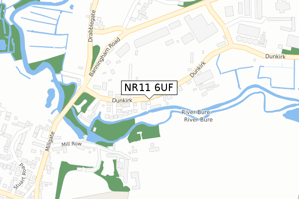
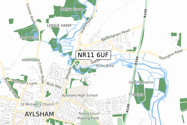
NR11 6UF is located in the Aylsham electoral ward, within the local authority district of Broadland and the English Parliamentary constituency of Broadland. The Sub Integrated Care Board (ICB) Location is NHS Norfolk and Waveney ICB - 26A and the police force is Norfolk. This postcode has been in use since March 2018.


GetTheData
Source: OS Open Zoomstack (Ordnance Survey)
Licence: Open Government Licence (requires attribution)
Attribution: Contains OS data © Crown copyright and database right 2024
Source: Open Postcode Geo
Licence: Open Government Licence (requires attribution)
Attribution: Contains OS data © Crown copyright and database right 2024; Contains Royal Mail data © Royal Mail copyright and database right 2024; Source: Office for National Statistics licensed under the Open Government Licence v.3.0
| Easting | 620008 |
| Northing | 327580 |
| Latitude | 52.800911 |
| Longitude | 1.262264 |
GetTheData
Source: Open Postcode Geo
Licence: Open Government Licence
| Country | England |
| Postcode District | NR11 |
| ➜ NR11 open data dashboard ➜ See where NR11 is on a map ➜ Where is Aylsham? | |
GetTheData
Source: Land Registry Price Paid Data
Licence: Open Government Licence
| Ward | Aylsham |
| Constituency | Broadland |
GetTheData
Source: ONS Postcode Database
Licence: Open Government Licence
| March 2022 | Public order | On or near Dunkirk | 230m |
| October 2021 | Criminal damage and arson | On or near Wherry Loke | 120m |
| July 2021 | Violence and sexual offences | On or near Dunkirk | 230m |
| ➜ Get more crime data in our Crime section | |||
GetTheData
Source: data.police.uk
Licence: Open Government Licence
| Dunkirk (Millgate) | Aylsham | 210m |
| Dunkirk (Millgate) | Aylsham | 237m |
| Mill Row (Millgate) | Aylsham | 415m |
| Mill Row (Millgate) | Aylsham | 427m |
| High School (Sir William's Lane) | Aylsham | 559m |
| Aylsham (Bure Valley Railway) | Aylsham | 1,174m |
GetTheData
Source: NaPTAN
Licence: Open Government Licence
GetTheData
Source: ONS Postcode Database
Licence: Open Government Licence


➜ Get more ratings from the Food Standards Agency
GetTheData
Source: Food Standards Agency
Licence: FSA terms & conditions
| Last Collection | |||
|---|---|---|---|
| Location | Mon-Fri | Sat | Distance |
| Dunkirk | 16:00 | 08:30 | 26m |
| Cromer Road | 17:00 | 09:30 | 750m |
| Tesco Stores | 17:00 | 07:00 | 1,221m |
GetTheData
Source: Dracos
Licence: Creative Commons Attribution-ShareAlike
| Facility | Distance |
|---|---|
| Aylsham High School Sir Williams Lane, Aylsham, Norwich Swimming Pool, Sports Hall, Grass Pitches, Artificial Grass Pitch, Studio | 524m |
| Aylsham Recreation Ground Sir Williams Lane, Aylsham, Norwich Grass Pitches, Outdoor Tennis Courts | 752m |
| Bure Valley Junior School Hungate Street, Aylsham, Norwich Grass Pitches, Sports Hall | 1.5km |
GetTheData
Source: Active Places
Licence: Open Government Licence
| School | Phase of Education | Distance |
|---|---|---|
| Aylsham High School Sir Williams Lane, Aylsham, Norwich, NR11 6AN | Secondary | 524m |
| St Michael's Church of England VA Primary and Nursery School School House Lane, Blickling Road, Aylsham, Norwich, NR11 6EX | Primary | 1km |
| Bure Valley School Hungate Street, Aylsham, Norwich, NR11 6JZ | Primary | 1.5km |
GetTheData
Source: Edubase
Licence: Open Government Licence
| Risk of NR11 6UF flooding from rivers and sea | High |
| ➜ NR11 6UF flood map | |
GetTheData
Source: Open Flood Risk by Postcode
Licence: Open Government Licence
The below table lists the International Territorial Level (ITL) codes (formerly Nomenclature of Territorial Units for Statistics (NUTS) codes) and Local Administrative Units (LAU) codes for NR11 6UF:
| ITL 1 Code | Name |
|---|---|
| TLH | East |
| ITL 2 Code | Name |
| TLH1 | East Anglia |
| ITL 3 Code | Name |
| TLH15 | Norwich and East Norfolk |
| LAU 1 Code | Name |
| E07000144 | Broadland |
GetTheData
Source: ONS Postcode Directory
Licence: Open Government Licence
The below table lists the Census Output Area (OA), Lower Layer Super Output Area (LSOA), and Middle Layer Super Output Area (MSOA) for NR11 6UF:
| Code | Name | |
|---|---|---|
| OA | E00134667 | |
| LSOA | E01026503 | Broadland 001E |
| MSOA | E02005520 | Broadland 001 |
GetTheData
Source: ONS Postcode Directory
Licence: Open Government Licence
| NR11 6SU | Dunkirk | 25m |
| NR11 6SX | Wherry Loke | 128m |
| NR11 6UY | The Staithe | 184m |
| NR11 6HZ | Mill Row | 270m |
| NR11 6ST | Mashs Row | 282m |
| NR11 6LP | Banningham Road | 319m |
| NR11 6GX | The Maltings | 404m |
| NR11 6HX | Millgate | 419m |
| NR11 6HN | Stuart Road | 456m |
| NR11 6HR | New Road | 512m |
GetTheData
Source: Open Postcode Geo; Land Registry Price Paid Data
Licence: Open Government Licence