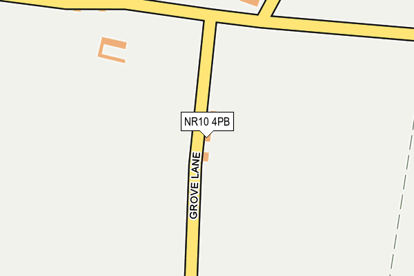
NR10 4PB lies on Grove Lane in Booton, Norwich. NR10 4PB is located in the Great Witchingham electoral ward, within the local authority district of Broadland and the English Parliamentary constituency of Broadland. The Sub Integrated Care Board (ICB) Location is NHS Norfolk and Waveney ICB - 26A and the police force is Norfolk. This postcode has been in use since January 1980.


GetTheData
Source: OS OpenMap – Local (Ordnance Survey)
Source: OS VectorMap District (Ordnance Survey)
Licence: Open Government Licence (requires attribution)
| Easting | 612658 |
| Northing | 322198 |
| Latitude | 52.755520 |
| Longitude | 1.149901 |
GetTheData
Source: Open Postcode Geo
Licence: Open Government Licence
| Street | Grove Lane |
| Locality | Booton |
| Town/City | Norwich |
| Country | England |
| Postcode District | NR10 |
➜ See where NR10 is on a map ➜ Where is The Grove? | |
GetTheData
Source: Land Registry Price Paid Data
Licence: Open Government Licence
Elevation or altitude of NR10 4PB as distance above sea level:
| Metres | Feet | |
|---|---|---|
| Elevation | 40m | 131ft |
Elevation is measured from the approximate centre of the postcode, to the nearest point on an OS contour line from OS Terrain 50, which has contour spacing of ten vertical metres.
➜ How high above sea level am I? Find the elevation of your current position using your device's GPS.
GetTheData
Source: Open Postcode Elevation
Licence: Open Government Licence
| Ward | Great Witchingham |
| Constituency | Broadland |
GetTheData
Source: ONS Postcode Database
Licence: Open Government Licence
| Percentage of properties with Next Generation Access | 100.0% |
| Percentage of properties with Superfast Broadband | 0.0% |
| Percentage of properties with Ultrafast Broadband | 0.0% |
| Percentage of properties with Full Fibre Broadband | 0.0% |
Superfast Broadband is between 30Mbps and 300Mbps
Ultrafast Broadband is > 300Mbps
| Percentage of properties unable to receive 2Mbps | 0.0% |
| Percentage of properties unable to receive 5Mbps | 100.0% |
| Percentage of properties unable to receive 10Mbps | 100.0% |
| Percentage of properties unable to receive 30Mbps | 100.0% |
GetTheData
Source: Ofcom
Licence: Ofcom Terms of Use (requires attribution)
GetTheData
Source: ONS Postcode Database
Licence: Open Government Licence


➜ Get more ratings from the Food Standards Agency
GetTheData
Source: Food Standards Agency
Licence: FSA terms & conditions
| Last Collection | |||
|---|---|---|---|
| Location | Mon-Fri | Sat | Distance |
| Market Place Post Office | 17:00 | 12:00 | 2,681m |
| Station Plain | 16:00 | 10:00 | 2,718m |
| Southgate | 16:15 | 10:15 | 2,726m |
GetTheData
Source: Dracos
Licence: Creative Commons Attribution-ShareAlike
The below table lists the International Territorial Level (ITL) codes (formerly Nomenclature of Territorial Units for Statistics (NUTS) codes) and Local Administrative Units (LAU) codes for NR10 4PB:
| ITL 1 Code | Name |
|---|---|
| TLH | East |
| ITL 2 Code | Name |
| TLH1 | East Anglia |
| ITL 3 Code | Name |
| TLH15 | Norwich and East Norfolk |
| LAU 1 Code | Name |
| E07000144 | Broadland |
GetTheData
Source: ONS Postcode Directory
Licence: Open Government Licence
The below table lists the Census Output Area (OA), Lower Layer Super Output Area (LSOA), and Middle Layer Super Output Area (MSOA) for NR10 4PB:
| Code | Name | |
|---|---|---|
| OA | E00134779 | |
| LSOA | E01026525 | Broadland 002D |
| MSOA | E02005521 | Broadland 002 |
GetTheData
Source: ONS Postcode Directory
Licence: Open Government Licence
| NR10 4PA | Green Lane | 242m |
| NR10 4PD | 364m | |
| NR10 4PE | 537m | |
| NR10 4NZ | Church Road | 654m |
| NR10 4PF | The Common | 754m |
| NR10 4PQ | Cawston Road | 933m |
| NR10 4PJ | 1590m | |
| NR10 4AQ | William Bush Close | 1636m |
| NR10 4AH | Booton Road | 1640m |
| NR10 4NT | The Street | 1654m |
GetTheData
Source: Open Postcode Geo; Land Registry Price Paid Data
Licence: Open Government Licence