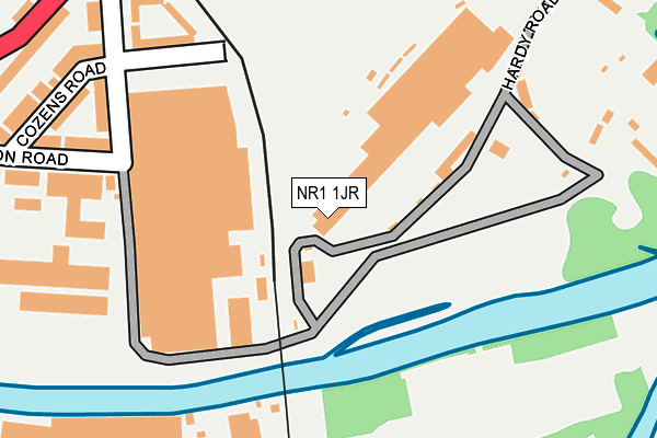
NR1 1JR is located in the Thorpe Hamlet electoral ward, within the local authority district of Norwich and the English Parliamentary constituency of Norwich South. The Sub Integrated Care Board (ICB) Location is NHS Norfolk and Waveney ICB - 26A and the police force is Norfolk. This postcode has been in use since January 1980.


GetTheData
Source: OS OpenMap – Local (Ordnance Survey)
Source: OS VectorMap District (Ordnance Survey)
Licence: Open Government Licence (requires attribution)
| Easting | 624580 |
| Northing | 307773 |
| Latitude | 52.621244 |
| Longitude | 1.316423 |
GetTheData
Source: Open Postcode Geo
Licence: Open Government Licence
| Country | England |
| Postcode District | NR1 |
➜ See where NR1 is on a map ➜ Where is Norwich? | |
GetTheData
Source: Land Registry Price Paid Data
Licence: Open Government Licence
Elevation or altitude of NR1 1JR as distance above sea level:
| Metres | Feet | |
|---|---|---|
| Elevation | 10m | 33ft |
Elevation is measured from the approximate centre of the postcode, to the nearest point on an OS contour line from OS Terrain 50, which has contour spacing of ten vertical metres.
➜ How high above sea level am I? Find the elevation of your current position using your device's GPS.
GetTheData
Source: Open Postcode Elevation
Licence: Open Government Licence
| Ward | Thorpe Hamlet |
| Constituency | Norwich South |
GetTheData
Source: ONS Postcode Database
Licence: Open Government Licence
| Barton Way (Thorpe Road) | Norwich | 323m |
| Cotman Road (Thorpe Road) | Norwich | 400m |
| Football Ground (Carrow Road) | Norwich | 441m |
| Layby (Clarence Road) | Norwich | 447m |
| Football Ground (Carrow Road) | Norwich | 452m |
| Norwich Station | 0.9km |
GetTheData
Source: NaPTAN
Licence: Open Government Licence
GetTheData
Source: ONS Postcode Database
Licence: Open Government Licence


➜ Get more ratings from the Food Standards Agency
GetTheData
Source: Food Standards Agency
Licence: FSA terms & conditions
| Last Collection | |||
|---|---|---|---|
| Location | Mon-Fri | Sat | Distance |
| Carrow Road | 18:30 | 11:00 | 340m |
| Salisbury Road | 18:30 | 11:00 | 543m |
| Cotman Road | 17:45 | 11:00 | 628m |
GetTheData
Source: Dracos
Licence: Creative Commons Attribution-ShareAlike
The below table lists the International Territorial Level (ITL) codes (formerly Nomenclature of Territorial Units for Statistics (NUTS) codes) and Local Administrative Units (LAU) codes for NR1 1JR:
| ITL 1 Code | Name |
|---|---|
| TLH | East |
| ITL 2 Code | Name |
| TLH1 | East Anglia |
| ITL 3 Code | Name |
| TLH15 | Norwich and East Norfolk |
| LAU 1 Code | Name |
| E07000148 | Norwich |
GetTheData
Source: ONS Postcode Directory
Licence: Open Government Licence
The below table lists the Census Output Area (OA), Lower Layer Super Output Area (LSOA), and Middle Layer Super Output Area (MSOA) for NR1 1JR:
| Code | Name | |
|---|---|---|
| OA | E00136543 | |
| LSOA | E01033439 | Norwich 014B |
| MSOA | E02006907 | Norwich 014 |
GetTheData
Source: ONS Postcode Directory
Licence: Open Government Licence
| NR1 1JP | Cozens Road | 223m |
| NR1 1JL | Hardy Road | 228m |
| NR1 1JW | Railway Cottages | 243m |
| NR1 1JA | Kerrison Road | 259m |
| NR1 1JB | Kerrison Road | 271m |
| NR1 1JN | Hardy Road | 281m |
| NR1 1HR | Prospect Terrace | 283m |
| NR1 1JJ | Cozens Road | 284m |
| NR1 1YP | Wilson Road | 291m |
| NR1 1HP | Carrow Road | 311m |
GetTheData
Source: Open Postcode Geo; Land Registry Price Paid Data
Licence: Open Government Licence