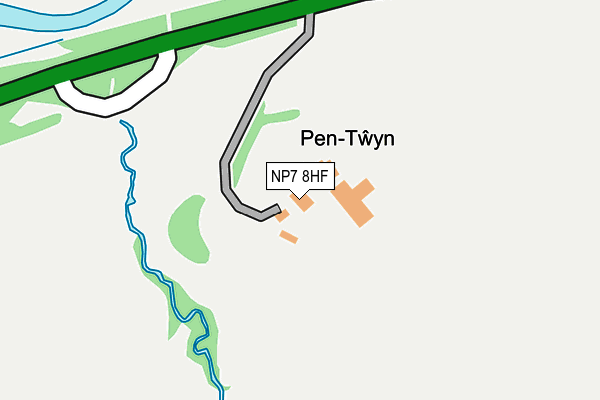
NP7 8HF is located in the Crucorney electoral ward, within the unitary authority of Monmouthshire and the Welsh Parliamentary constituency of Monmouth. The Local Health Board is Aneurin Bevan University and the police force is Gwent. This postcode has been in use since January 1980.


GetTheData
Source: OS OpenMap – Local (Ordnance Survey)
Source: OS VectorMap District (Ordnance Survey)
Licence: Open Government Licence (requires attribution)
| Easting | 337993 |
| Northing | 225013 |
| Latitude | 51.920172 |
| Longitude | -2.903014 |
GetTheData
Source: Open Postcode Geo
Licence: Open Government Licence
| Country | Wales |
| Postcode District | NP7 |
➜ See where NP7 is on a map | |
GetTheData
Source: Land Registry Price Paid Data
Licence: Open Government Licence
Elevation or altitude of NP7 8HF as distance above sea level:
| Metres | Feet | |
|---|---|---|
| Elevation | 110m | 361ft |
Elevation is measured from the approximate centre of the postcode, to the nearest point on an OS contour line from OS Terrain 50, which has contour spacing of ten vertical metres.
➜ How high above sea level am I? Find the elevation of your current position using your device's GPS.
GetTheData
Source: Open Postcode Elevation
Licence: Open Government Licence
| Ward | Crucorney |
| Constituency | Monmouth |
GetTheData
Source: ONS Postcode Database
Licence: Open Government Licence
| Old Forge (Hereford Road) | Llangua | 182m |
| Old Forge (Hereford Road) | Llangua | 220m |
| Malthouse (Hereford Road) | Llangua | 686m |
| Malthouse (Hereford Road) | Llangua | 695m |
| Maerdy Farm (Hereford Road) | Llangua | 832m |
GetTheData
Source: NaPTAN
Licence: Open Government Licence
GetTheData
Source: ONS Postcode Database
Licence: Open Government Licence
| Last Collection | |||
|---|---|---|---|
| Location | Mon-Fri | Sat | Distance |
| Rowlestone | 10:00 | 10:00 | 2,264m |
| Grosmont School | 16:45 | 10:00 | 2,421m |
| Grosmont Post Office | 17:00 | 10:00 | 2,573m |
GetTheData
Source: Dracos
Licence: Creative Commons Attribution-ShareAlike
The below table lists the International Territorial Level (ITL) codes (formerly Nomenclature of Territorial Units for Statistics (NUTS) codes) and Local Administrative Units (LAU) codes for NP7 8HF:
| ITL 1 Code | Name |
|---|---|
| TLL | Wales |
| ITL 2 Code | Name |
| TLL2 | East Wales |
| ITL 3 Code | Name |
| TLL21 | Monmouthshire and Newport |
| LAU 1 Code | Name |
| W06000021 | Monmouthshire |
GetTheData
Source: ONS Postcode Directory
Licence: Open Government Licence
The below table lists the Census Output Area (OA), Lower Layer Super Output Area (LSOA), and Middle Layer Super Output Area (MSOA) for NP7 8HF:
| Code | Name | |
|---|---|---|
| OA | W00008079 | |
| LSOA | W01001548 | Monmouthshire 001B |
| MSOA | W02000336 | Monmouthshire 001 |
GetTheData
Source: ONS Postcode Directory
Licence: Open Government Licence
| NP7 8HE | 741m | |
| NP7 8HG | 897m | |
| HR2 0HF | 1082m | |
| HR2 0DN | 1619m | |
| NP7 8HA | 1646m | |
| NP7 8HD | 1764m | |
| NP7 8EY | 1773m | |
| NP7 8HB | 1920m | |
| NP7 8HS | 2014m | |
| HR2 0DL | 2037m |
GetTheData
Source: Open Postcode Geo; Land Registry Price Paid Data
Licence: Open Government Licence