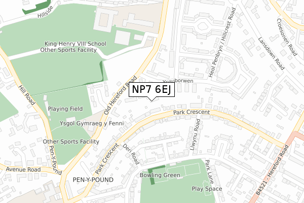
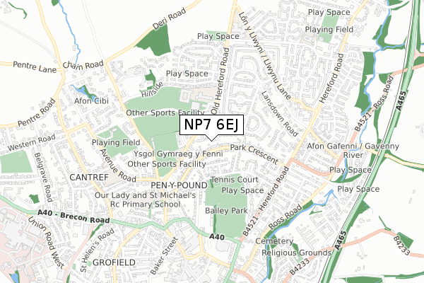
NP7 6EJ is located in the Park electoral ward, within the unitary authority of Monmouthshire and the Welsh Parliamentary constituency of Monmouth. The Local Health Board is Aneurin Bevan University and the police force is Gwent. This postcode has been in use since December 2017.


GetTheData
Source: OS Open Zoomstack (Ordnance Survey)
Licence: Open Government Licence (requires attribution)
Attribution: Contains OS data © Crown copyright and database right 2024
Source: Open Postcode Geo
Licence: Open Government Licence (requires attribution)
Attribution: Contains OS data © Crown copyright and database right 2024; Contains Royal Mail data © Royal Mail copyright and database right 2024; Source: Office for National Statistics licensed under the Open Government Licence v.3.0
| Easting | 330006 |
| Northing | 215018 |
| Latitude | 51.829379 |
| Longitude | -3.017105 |
GetTheData
Source: Open Postcode Geo
Licence: Open Government Licence
| Country | Wales |
| Postcode District | NP7 |
| ➜ NP7 open data dashboard ➜ See where NP7 is on a map ➜ Where is Abergavenny? | |
GetTheData
Source: Land Registry Price Paid Data
Licence: Open Government Licence
| Ward | Park |
| Constituency | Monmouth |
GetTheData
Source: ONS Postcode Database
Licence: Open Government Licence
| January 2024 | Anti-social behaviour | On or near Parking Area | 477m |
| December 2023 | Anti-social behaviour | On or near Parking Area | 477m |
| November 2023 | Violence and sexual offences | On or near Parking Area | 477m |
| ➜ Get more crime data in our Crime section | |||
GetTheData
Source: data.police.uk
Licence: Open Government Licence
| Ysguborwen Hall (Ysguborwen) | Abergavenny | 61m |
| Ysguborwen Hall (Ysguborwen) | Abergavenny | 64m |
| Old Barn Way (Ysguborwen) | Abergavenny | 88m |
| Llwynu Road (Park Crescent) | Mardy | 120m |
| Llwynu Road (Park Crescent) | Mardy | 160m |
| Abergavenny Station | 1.5km |
GetTheData
Source: NaPTAN
Licence: Open Government Licence
| Percentage of properties with Next Generation Access | 100.0% |
| Percentage of properties with Superfast Broadband | 100.0% |
| Percentage of properties with Ultrafast Broadband | 0.0% |
| Percentage of properties with Full Fibre Broadband | 0.0% |
Superfast Broadband is between 30Mbps and 300Mbps
Ultrafast Broadband is > 300Mbps
| Percentage of properties unable to receive 2Mbps | 0.0% |
| Percentage of properties unable to receive 5Mbps | 0.0% |
| Percentage of properties unable to receive 10Mbps | 0.0% |
| Percentage of properties unable to receive 30Mbps | 0.0% |
GetTheData
Source: Ofcom
Licence: Ofcom Terms of Use (requires attribution)
GetTheData
Source: ONS Postcode Database
Licence: Open Government Licence


➜ Get more ratings from the Food Standards Agency
GetTheData
Source: Food Standards Agency
Licence: FSA terms & conditions
| Last Collection | |||
|---|---|---|---|
| Location | Mon-Fri | Sat | Distance |
| Pant Y Goitre | 16:15 | 10:00 | 518m |
| Frogmore Street Post Office | 17:00 | 11:00 | 606m |
| Cross Street | 17:15 | 11:15 | 974m |
GetTheData
Source: Dracos
Licence: Creative Commons Attribution-ShareAlike
| School | Phase of Education | Distance |
|---|---|---|
| Ysgol Gymraeg Y Fenni St David's Road, Abergavenny, NP7 6EL | Not applicable | 209m |
| Our Lady & St Michael's School 14 Pen Y Pound Road, Abergavenny, Monmouthshire, NP7 5UD | Not applicable | 496m |
| Cantref Primary Harold Road, Abergavenny, Monmouthshire, NP7 7DG | Not applicable | 689m |
GetTheData
Source: Edubase
Licence: Open Government Licence
The below table lists the International Territorial Level (ITL) codes (formerly Nomenclature of Territorial Units for Statistics (NUTS) codes) and Local Administrative Units (LAU) codes for NP7 6EJ:
| ITL 1 Code | Name |
|---|---|
| TLL | Wales |
| ITL 2 Code | Name |
| TLL2 | East Wales |
| ITL 3 Code | Name |
| TLL21 | Monmouthshire and Newport |
| LAU 1 Code | Name |
| W06000021 | Monmouthshire |
GetTheData
Source: ONS Postcode Directory
Licence: Open Government Licence
The below table lists the Census Output Area (OA), Lower Layer Super Output Area (LSOA), and Middle Layer Super Output Area (MSOA) for NP7 6EJ:
| Code | Name | |
|---|---|---|
| OA | W00008127 | |
| LSOA | W01001558 | Monmouthshire 002C |
| MSOA | W02000337 | Monmouthshire 002 |
GetTheData
Source: ONS Postcode Directory
Licence: Open Government Licence
| NP7 5TL | Park Crescent | 76m |
| NP7 6EG | Ysguborwen | 83m |
| NP7 6EN | Old Hereford Road | 97m |
| NP7 6EL | Old Hereford Road | 117m |
| NP7 5TA | Blorenge Road | 130m |
| NP7 6EF | Ysguborwen | 142m |
| NP7 6DY | Old Barn Way | 186m |
| NP7 5SY | Deri Road | 188m |
| NP7 6BU | Rholben Road | 191m |
| NP7 5TB | Llwynu Road | 192m |
GetTheData
Source: Open Postcode Geo; Land Registry Price Paid Data
Licence: Open Government Licence