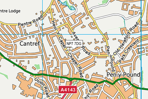
Cantref Primary is located in Abergavenny, Monmouthshire and falls under the local authority of Monmouthshire. The type of establishment is welsh establishment.
| Address | Cantref Primary Harold Road Abergavenny Monmouthshire NP7 7DG |
GetTheData
Source: Get Information About Schools
Licence: Open Government Licence
| Phase of Education | Not applicable |
| Type of Establishment | Welsh establishment |
| Admissions Policy | Not applicable |
| Boarders | Not applicable |
| Official Sixth Form | Not applicable |
| Gender | Mixed |
| Diocese | Not applicable |
| Special Classes | Not applicable |
GetTheData
Source: Get Information About Schools
Licence: Open Government Licence
| Street Address | Harold Road |
| Locality | Abergavenny |
| Town | Monmouthshire |
| Postcode | NP7 7DG |
| ➜ More NP7 7DG open data | |
GetTheData
Source: Get Information About Schools
Licence: Open Government Licence

GetTheData
Source: OS VectorMap District (Ordnance Survey)
Licence: Open Government Licence (requires attribution)
| Ofsted Special Measures | Not applicable |
GetTheData
Source: Get Information About Schools
Licence: Open Government Licence
| Establishment Name | Cantref Primary |
| Establishment Number | 2319 |
| Unique Reference Number | 402092 |
| Local Authority | Monmouthshire |
| Local Authority Code | 679 |
| Previous Local Authority Code | 999 |
| Government Statistical Service Local Authority Code | W06000021 |
| Government Office Region | Wales (pseudo) |
| District | Monmouthshire |
| District Code | W06000021 |
| Ward | Cantref |
| Parliamentary Constituency | Monmouth |
| Urban/Rural Description | (England/Wales) Urban city and town |
| Middle Super Output Area | Monmouthshire 001 |
| Lower Super Output Area | Monmouthshire 001A |
GetTheData
Source: Get Information About Schools
Licence: Open Government Licence
| Establishment Status | Open |
| Last Changed Date | 13th June 2022 |
| Reason Establishment Opened | New Provision |
| Open Date | 1st September 2005 |
| Reason Establishment Closed | Not applicable |
GetTheData
Source: Get Information About Schools
Licence: Open Government Licence
| Teenage Mothers | Not applicable |
| Child Care Facilities | Not applicable |
| Special Educational Needs (SEN) Provision in Primary Care Unit | Not applicable |
| Pupil Referral Unit (PRU) Provides for Educational and Behavioural Difficulties (EBD) | Not applicable |
| Pupil Referral Unit (PRU) Offers Tuition by Another Provider | Not applicable |
GetTheData
Source: Get Information About Schools
Licence: Open Government Licence
| Section 41 Approved | Not approved |
GetTheData
Source: Get Information About Schools
Licence: Open Government Licence
| Trust flag | Not applicable |
| School Sponsor flag | Not applicable |
GetTheData
Source: Get Information About Schools
Licence: Open Government Licence
| Federation flag | Not applicable |
GetTheData
Source: Get Information About Schools
Licence: Open Government Licence
| Further Education Type | Not applicable |
GetTheData
Source: Get Information About Schools
Licence: Open Government Licence
| Easting | 329348 |
| Northing | 214812 |
| Latitude | 51.82744 |
| Longitude | -3.02661 |
GetTheData
Source: Get Information About Schools
Licence: Open Government Licence
| School | Phase of Education | Distance |
|---|---|---|
| Our Lady & St Michael's School 14 Pen Y Pound Road, Abergavenny, Monmouthshire, NP7 5UD | Not applicable | 390m |
| Ysgol Gymraeg Y Fenni St David's Road, Abergavenny, NP7 6EL | Not applicable | 505m |
| Llantilio Pertholey C.V. Primary School Hillgrove Avenue, Mardy Abergavenny, Monmouthshire, NP7 6LZ | Not applicable | 1.8km |
| Gilwern C.P. School Cae Meldon, Gilwern, Abergavenny, Monmouthshire, NP7 0AY | Not applicable | 4.5km |
| Llanfihangel Crucorney C.P. School Pandy, Abergavenny, Monmouthshire, NP7 8DL | Not applicable | 7.6km |
| Crickhowell High School New Road, Crickhowell, NP8 1AW | Not applicable | 8.7km |
| Crickhowell C.P. School Crickhowell, Powys, NP8 1DH | Not applicable | 8.8km |
| Brynmawr Foundation School Rhydw, Intermediate Road, Brymawr, Blaenau Gwent, NP23 4XT | Not applicable | 10km |
| St Mary's C in W Voluntary Aided School Intermediate Road, Brynmawr, Blaenau Gwent, NP23 4SE | Not applicable | 10.2km |
| Ysgol Bryn Onnen Varteg Road, Pontypool, Torfaen, NP4 7RT | Not applicable | 10.4km |
GetTheData
Source: Get Information About Schools
Licence: Open Government Licence