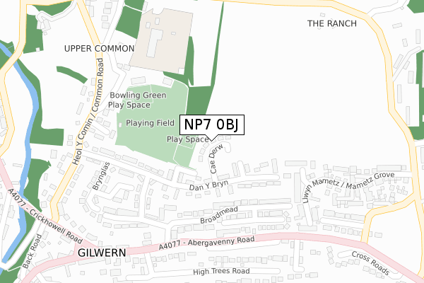
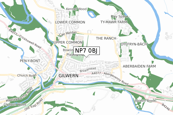
NP7 0BJ lies on Cae Derw in Gilwern, Abergavenny. NP7 0BJ is located in the Llanelly electoral ward, within the unitary authority of Monmouthshire and the Welsh Parliamentary constituency of Monmouth. The Local Health Board is Aneurin Bevan University and the police force is Gwent. This postcode has been in use since June 2000.


GetTheData
Source: OS Open Zoomstack (Ordnance Survey)
Licence: Open Government Licence (requires attribution)
Attribution: Contains OS data © Crown copyright and database right 2025
Source: Open Postcode Geo
Licence: Open Government Licence (requires attribution)
Attribution: Contains OS data © Crown copyright and database right 2025; Contains Royal Mail data © Royal Mail copyright and database right 2025; Source: Office for National Statistics licensed under the Open Government Licence v.3.0
| Easting | 325038 |
| Northing | 214886 |
| Latitude | 51.827541 |
| Longitude | -3.089148 |
GetTheData
Source: Open Postcode Geo
Licence: Open Government Licence
| Street | Cae Derw |
| Locality | Gilwern |
| Town/City | Abergavenny |
| Country | Wales |
| Postcode District | NP7 |
➜ See where NP7 is on a map ➜ Where is Gilwern? | |
GetTheData
Source: Land Registry Price Paid Data
Licence: Open Government Licence
Elevation or altitude of NP7 0BJ as distance above sea level:
| Metres | Feet | |
|---|---|---|
| Elevation | 80m | 262ft |
Elevation is measured from the approximate centre of the postcode, to the nearest point on an OS contour line from OS Terrain 50, which has contour spacing of ten vertical metres.
➜ How high above sea level am I? Find the elevation of your current position using your device's GPS.
GetTheData
Source: Open Postcode Elevation
Licence: Open Government Licence
| Ward | Llanelly |
| Constituency | Monmouth |
GetTheData
Source: ONS Postcode Database
Licence: Open Government Licence
| Rectory (Abergavenny Road) | Gilwern | 243m |
| Rectory (Abergavenny Road) | Gilwern | 298m |
| Primary School (Common Road) | Gilwern | 367m |
| Post Office (Crickhowell Road) | Gilwern | 375m |
| Post Office (Main Road) | Gilwern | 414m |
GetTheData
Source: NaPTAN
Licence: Open Government Licence
| Percentage of properties with Next Generation Access | 100.0% |
| Percentage of properties with Superfast Broadband | 100.0% |
| Percentage of properties with Ultrafast Broadband | 0.0% |
| Percentage of properties with Full Fibre Broadband | 0.0% |
Superfast Broadband is between 30Mbps and 300Mbps
Ultrafast Broadband is > 300Mbps
| Median download speed | 35.0Mbps |
| Average download speed | 32.8Mbps |
| Maximum download speed | 41.42Mbps |
| Median upload speed | 5.8Mbps |
| Average upload speed | 5.0Mbps |
| Maximum upload speed | 7.25Mbps |
| Percentage of properties unable to receive 2Mbps | 0.0% |
| Percentage of properties unable to receive 5Mbps | 0.0% |
| Percentage of properties unable to receive 10Mbps | 0.0% |
| Percentage of properties unable to receive 30Mbps | 0.0% |
GetTheData
Source: Ofcom
Licence: Ofcom Terms of Use (requires attribution)
Estimated total energy consumption in NP7 0BJ by fuel type, 2015.
| Consumption (kWh) | 109,229 |
|---|---|
| Meter count | 12 |
| Mean (kWh/meter) | 9,102 |
| Median (kWh/meter) | 8,648 |
| Consumption (kWh) | 54,363 |
|---|---|
| Meter count | 12 |
| Mean (kWh/meter) | 4,530 |
| Median (kWh/meter) | 4,006 |
GetTheData
Source: Postcode level gas estimates: 2015 (experimental)
Source: Postcode level electricity estimates: 2015 (experimental)
Licence: Open Government Licence
GetTheData
Source: ONS Postcode Database
Licence: Open Government Licence


➜ Get more ratings from the Food Standards Agency
GetTheData
Source: Food Standards Agency
Licence: FSA terms & conditions
| Last Collection | |||
|---|---|---|---|
| Location | Mon-Fri | Sat | Distance |
| Llangattock Lingoed | 16:00 | 09:00 | 1,854m |
| Llangenny | 17:00 | 08:00 | 3,292m |
| Llangenny Lane | 17:00 | 11:00 | 4,416m |
GetTheData
Source: Dracos
Licence: Creative Commons Attribution-ShareAlike
The below table lists the International Territorial Level (ITL) codes (formerly Nomenclature of Territorial Units for Statistics (NUTS) codes) and Local Administrative Units (LAU) codes for NP7 0BJ:
| ITL 1 Code | Name |
|---|---|
| TLL | Wales |
| ITL 2 Code | Name |
| TLL2 | East Wales |
| ITL 3 Code | Name |
| TLL21 | Monmouthshire and Newport |
| LAU 1 Code | Name |
| W06000021 | Monmouthshire |
GetTheData
Source: ONS Postcode Directory
Licence: Open Government Licence
The below table lists the Census Output Area (OA), Lower Layer Super Output Area (LSOA), and Middle Layer Super Output Area (MSOA) for NP7 0BJ:
| Code | Name | |
|---|---|---|
| OA | W00008145 | |
| LSOA | W01001563 | Monmouthshire 003C |
| MSOA | W02000338 | Monmouthshire 003 |
GetTheData
Source: ONS Postcode Directory
Licence: Open Government Licence
| NP7 0BL | Dan Y Bryn | 88m |
| NP7 0AN | Broadmead | 153m |
| NP7 0AL | Llanwenarth View | 186m |
| NP7 0BP | Brynglas | 187m |
| NP7 0AW | Basildene Close | 235m |
| NP7 0BW | Brynglas | 245m |
| NP7 0DT | Glanmoor | 248m |
| NP7 0DS | Common Road | 269m |
| NP7 0BS | Brynglas | 271m |
| NP7 0AD | Abergavenny Road | 288m |
GetTheData
Source: Open Postcode Geo; Land Registry Price Paid Data
Licence: Open Government Licence