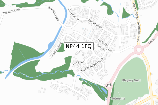
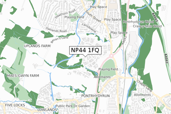
NP44 1FQ is located in the Pontnewydd electoral ward, within the unitary authority of Torfaen and the Welsh Parliamentary constituency of Torfaen. The Local Health Board is Aneurin Bevan University and the police force is Gwent. This postcode has been in use since February 2020.


GetTheData
Source: OS Open Zoomstack (Ordnance Survey)
Licence: Open Government Licence (requires attribution)
Attribution: Contains OS data © Crown copyright and database right 2024
Source: Open Postcode Geo
Licence: Open Government Licence (requires attribution)
Attribution: Contains OS data © Crown copyright and database right 2024; Contains Royal Mail data © Royal Mail copyright and database right 2024; Source: Office for National Statistics licensed under the Open Government Licence v.3.0
| Easting | 329226 |
| Northing | 197548 |
| Latitude | 51.672229 |
| Longitude | -3.024861 |
GetTheData
Source: Open Postcode Geo
Licence: Open Government Licence
| Country | Wales |
| Postcode District | NP44 |
| ➜ NP44 open data dashboard ➜ See where NP44 is on a map ➜ Where is Pontypool? | |
GetTheData
Source: Land Registry Price Paid Data
Licence: Open Government Licence
| Ward | Pontnewydd |
| Constituency | Torfaen |
GetTheData
Source: ONS Postcode Database
Licence: Open Government Licence
4, WRENS NEST CLOSE, PONTRHYDYRUN, CWMBRAN, NP44 1FQ 2022 13 APR £520,000 |
3, WRENS NEST CLOSE, PONTRHYDYRUN, CWMBRAN, NP44 1FQ 2021 9 JUN £468,000 |
2020 21 OCT £295,000 |
GetTheData
Source: HM Land Registry Price Paid Data
Licence: Contains HM Land Registry data © Crown copyright and database right 2024. This data is licensed under the Open Government Licence v3.0.
| November 2023 | Violence and sexual offences | On or near Berkeley Crescent | 369m |
| November 2023 | Anti-social behaviour | On or near Berkeley Crescent | 369m |
| June 2022 | Violence and sexual offences | On or near Berkeley Crescent | 369m |
| ➜ Get more crime data in our Crime section | |||
GetTheData
Source: data.police.uk
Licence: Open Government Licence
| Post Office (Pontrhydyrun Road) | Pontrhydyrun | 495m |
| Parc Panteg (Avondale Road) | Pontrhydyrun | 500m |
| Parc Panteg (Avondale Road) | Pontrhydyrun | 500m |
| Ashbridge (Avondale Road) | Pontrhydyrun | 504m |
| Post Office (Pontrhydyrun Road) | Pontrhydyrun | 508m |
| Cwmbran Station | 1.8km |
| Pontypool & New Inn Station | 3km |
GetTheData
Source: NaPTAN
Licence: Open Government Licence
GetTheData
Source: ONS Postcode Database
Licence: Open Government Licence


➜ Get more ratings from the Food Standards Agency
GetTheData
Source: Food Standards Agency
Licence: FSA terms & conditions
| Last Collection | |||
|---|---|---|---|
| Location | Mon-Fri | Sat | Distance |
| Hawthorn Road | 16:15 | 11:45 | 442m |
| Five Locks Close | 17:30 | 11:00 | 963m |
| Edlogan Square Post Office | 17:00 | 12:00 | 1,356m |
GetTheData
Source: Dracos
Licence: Creative Commons Attribution-ShareAlike
| School | Phase of Education | Distance |
|---|---|---|
| St David's R.C. Jnr. & Inf. School Caldicot Way, Pontrhydyrun, Cwmbran, Torfaen, NP44 1UF | Not applicable | 1km |
| Griffithstown Primary Florence Place, Griffithstown, Pontypool, NP4 5DN | Not applicable | 1.2km |
| Pontnewydd Primary School Bryncelyn Road, Pontnewydd, Cwmbran, Torfaen, NP44 1JW | Not applicable | 1.4km |
GetTheData
Source: Edubase
Licence: Open Government Licence
The below table lists the International Territorial Level (ITL) codes (formerly Nomenclature of Territorial Units for Statistics (NUTS) codes) and Local Administrative Units (LAU) codes for NP44 1FQ:
| ITL 1 Code | Name |
|---|---|
| TLL | Wales |
| ITL 2 Code | Name |
| TLL1 | West Wales and The Valleys |
| ITL 3 Code | Name |
| TLL16 | Gwent Valleys |
| LAU 1 Code | Name |
| W06000020 | Torfaen |
GetTheData
Source: ONS Postcode Directory
Licence: Open Government Licence
The below table lists the Census Output Area (OA), Lower Layer Super Output Area (LSOA), and Middle Layer Super Output Area (MSOA) for NP44 1FQ:
| Code | Name | |
|---|---|---|
| OA | W00007947 | |
| LSOA | W01001520 | Torfaen 007B |
| MSOA | W02000329 | Torfaen 007 |
GetTheData
Source: ONS Postcode Directory
Licence: Open Government Licence
| NP44 1BU | 320m | |
| NP4 5EQ | Berkley Crescent | 387m |
| NP4 5EG | Meadow Close | 414m |
| NP4 5EF | Lansdowne | 432m |
| NP44 1SG | Brook Street | 432m |
| NP4 5EL | Avondale Road | 444m |
| NP4 5EE | Lansdowne | 465m |
| NP4 5EJ | Railway Terrace | 470m |
| NP4 5ED | Richmond Road | 473m |
| NP44 1SB | Pontrhydyrun Road | 474m |
GetTheData
Source: Open Postcode Geo; Land Registry Price Paid Data
Licence: Open Government Licence