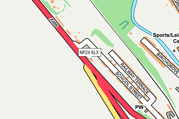
NP24 6LX lies on Graig Houses in Tirphil, New Tredegar. NP24 6LX is located in the New Tredegar electoral ward, within the unitary authority of Caerphilly and the Welsh Parliamentary constituency of Merthyr Tydfil and Rhymney. The Local Health Board is Aneurin Bevan University and the police force is Gwent. This postcode has been in use since June 1999.


GetTheData
Source: OS OpenMap – Local (Ordnance Survey)
Source: OS VectorMap District (Ordnance Survey)
Licence: Open Government Licence (requires attribution)
| Easting | 313687 |
| Northing | 203497 |
| Latitude | 51.723526 |
| Longitude | -3.250984 |
GetTheData
Source: Open Postcode Geo
Licence: Open Government Licence
| Street | Graig Houses |
| Locality | Tirphil |
| Town/City | New Tredegar |
| Country | Wales |
| Postcode District | NP24 |
➜ See where NP24 is on a map ➜ Where is New Tredegar? | |
GetTheData
Source: Land Registry Price Paid Data
Licence: Open Government Licence
Elevation or altitude of NP24 6LX as distance above sea level:
| Metres | Feet | |
|---|---|---|
| Elevation | 250m | 820ft |
Elevation is measured from the approximate centre of the postcode, to the nearest point on an OS contour line from OS Terrain 50, which has contour spacing of ten vertical metres.
➜ How high above sea level am I? Find the elevation of your current position using your device's GPS.
GetTheData
Source: Open Postcode Elevation
Licence: Open Government Licence
| Ward | New Tredegar |
| Constituency | Merthyr Tydfil And Rhymney |
GetTheData
Source: ONS Postcode Database
Licence: Open Government Licence
| Craig Rhymney (A469) | Tir-phil | 39m |
| Craig Rhymney (A469) | Tir-phil | 45m |
| Rising Sun (A469) | Tir-phil | 368m |
| Rising Sun (A469) | Tir-phil | 376m |
| Dynevor Arms (The Square) | Tir-phil | 406m |
| Tir-phil Station | 0.4km |
| Brithdir Station | 2.1km |
| Pontlottyn Station | 3.2km |
GetTheData
Source: NaPTAN
Licence: Open Government Licence
| Percentage of properties with Next Generation Access | 100.0% |
| Percentage of properties with Superfast Broadband | 100.0% |
| Percentage of properties with Ultrafast Broadband | 0.0% |
| Percentage of properties with Full Fibre Broadband | 0.0% |
Superfast Broadband is between 30Mbps and 300Mbps
Ultrafast Broadband is > 300Mbps
| Percentage of properties unable to receive 2Mbps | 0.0% |
| Percentage of properties unable to receive 5Mbps | 0.0% |
| Percentage of properties unable to receive 10Mbps | 0.0% |
| Percentage of properties unable to receive 30Mbps | 0.0% |
GetTheData
Source: Ofcom
Licence: Ofcom Terms of Use (requires attribution)
GetTheData
Source: ONS Postcode Database
Licence: Open Government Licence


➜ Get more ratings from the Food Standards Agency
GetTheData
Source: Food Standards Agency
Licence: FSA terms & conditions
| Last Collection | |||
|---|---|---|---|
| Location | Mon-Fri | Sat | Distance |
| Bargoed Post Office | 17:15 | 11:45 | 4,150m |
| Argoed Post Office | 17:00 | 12:00 | 4,689m |
| Marine Street | 16:30 | 11:00 | 5,119m |
GetTheData
Source: Dracos
Licence: Creative Commons Attribution-ShareAlike
The below table lists the International Territorial Level (ITL) codes (formerly Nomenclature of Territorial Units for Statistics (NUTS) codes) and Local Administrative Units (LAU) codes for NP24 6LX:
| ITL 1 Code | Name |
|---|---|
| TLL | Wales |
| ITL 2 Code | Name |
| TLL1 | West Wales and The Valleys |
| ITL 3 Code | Name |
| TLL16 | Gwent Valleys |
| LAU 1 Code | Name |
| W06000018 | Caerphilly |
GetTheData
Source: ONS Postcode Directory
Licence: Open Government Licence
The below table lists the Census Output Area (OA), Lower Layer Super Output Area (LSOA), and Middle Layer Super Output Area (MSOA) for NP24 6LX:
| Code | Name | |
|---|---|---|
| OA | W00007263 | |
| LSOA | W01001386 | Caerphilly 002E |
| MSOA | W02000291 | Caerphilly 002 |
GetTheData
Source: ONS Postcode Directory
Licence: Open Government Licence
| NP24 6EX | Upper Cross Street | 87m |
| NP24 6HA | Lower Cross Street | 158m |
| NP24 6LZ | Graig Rhymney | 160m |
| NP24 6EY | Railway Terrace | 209m |
| NP24 6AH | Birchgrove | 251m |
| NP24 6ET | School Street | 275m |
| NP24 6HB | Taylors Row | 324m |
| NP24 6LH | Greenfield Street | 340m |
| NP24 6LQ | Greenfield Street | 362m |
| NP24 6EP | Sunnybank | 371m |
GetTheData
Source: Open Postcode Geo; Land Registry Price Paid Data
Licence: Open Government Licence