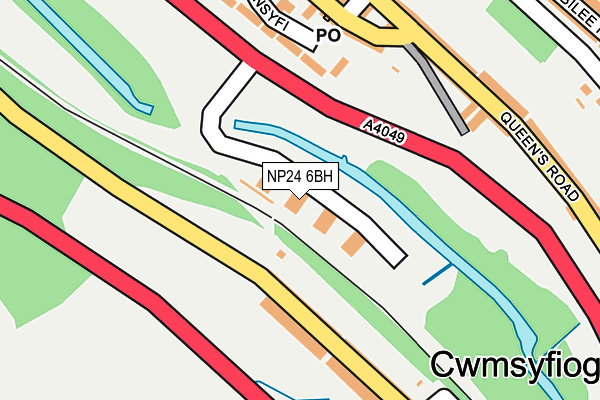
NP24 6BH is located in the New Tredegar electoral ward, within the unitary authority of Caerphilly and the Welsh Parliamentary constituency of Merthyr Tydfil and Rhymney. The Local Health Board is Aneurin Bevan University and the police force is Gwent. This postcode has been in use since July 2006.


GetTheData
Source: OS OpenMap – Local (Ordnance Survey)
Source: OS VectorMap District (Ordnance Survey)
Licence: Open Government Licence (requires attribution)
| Easting | 314906 |
| Northing | 202448 |
| Latitude | 51.714287 |
| Longitude | -3.233094 |
GetTheData
Source: Open Postcode Geo
Licence: Open Government Licence
| Country | Wales |
| Postcode District | NP24 |
➜ See where NP24 is on a map ➜ Where is New Tredegar? | |
GetTheData
Source: Land Registry Price Paid Data
Licence: Open Government Licence
Elevation or altitude of NP24 6BH as distance above sea level:
| Metres | Feet | |
|---|---|---|
| Elevation | 200m | 656ft |
Elevation is measured from the approximate centre of the postcode, to the nearest point on an OS contour line from OS Terrain 50, which has contour spacing of ten vertical metres.
➜ How high above sea level am I? Find the elevation of your current position using your device's GPS.
GetTheData
Source: Open Postcode Elevation
Licence: Open Government Licence
| Ward | New Tredegar |
| Constituency | Merthyr Tydfil And Rhymney |
GetTheData
Source: ONS Postcode Database
Licence: Open Government Licence
| Nelson Terrace (Bristol Terrace) | Brithdir | 84m |
| Milton Terrace (Bristol Terrace) | Brithdir | 92m |
| Tanlan Square (Queen`s Road) | Elliotstown | 185m |
| Tanlan Square (Queen`s Road) | Elliotstown | 201m |
| Glyn Syfi (Elliot Street) | Elliotstown | 276m |
| Brithdir Station | 0.5km |
| Tir-phil Station | 1.2km |
| Bargoed Station | 2.5km |
GetTheData
Source: NaPTAN
Licence: Open Government Licence
| Median download speed | 2.7Mbps |
| Average download speed | 11.7Mbps |
| Maximum download speed | 34.12Mbps |
| Median upload speed | 0.5Mbps |
| Average upload speed | 2.7Mbps |
| Maximum upload speed | 7.18Mbps |
GetTheData
Source: Ofcom
Licence: Ofcom Terms of Use (requires attribution)
GetTheData
Source: ONS Postcode Database
Licence: Open Government Licence


➜ Get more ratings from the Food Standards Agency
GetTheData
Source: Food Standards Agency
Licence: FSA terms & conditions
| Last Collection | |||
|---|---|---|---|
| Location | Mon-Fri | Sat | Distance |
| Bargoed Post Office | 17:15 | 11:45 | 2,854m |
| Argoed Post Office | 17:00 | 12:00 | 3,306m |
| Marine Street | 16:30 | 11:00 | 4,433m |
GetTheData
Source: Dracos
Licence: Creative Commons Attribution-ShareAlike
The below table lists the International Territorial Level (ITL) codes (formerly Nomenclature of Territorial Units for Statistics (NUTS) codes) and Local Administrative Units (LAU) codes for NP24 6BH:
| ITL 1 Code | Name |
|---|---|
| TLL | Wales |
| ITL 2 Code | Name |
| TLL1 | West Wales and The Valleys |
| ITL 3 Code | Name |
| TLL16 | Gwent Valleys |
| LAU 1 Code | Name |
| W06000018 | Caerphilly |
GetTheData
Source: ONS Postcode Directory
Licence: Open Government Licence
The below table lists the Census Output Area (OA), Lower Layer Super Output Area (LSOA), and Middle Layer Super Output Area (MSOA) for NP24 6BH:
| Code | Name | |
|---|---|---|
| OA | W00007258 | |
| LSOA | W01001385 | Caerphilly 002D |
| MSOA | W02000291 | Caerphilly 002 |
GetTheData
Source: ONS Postcode Directory
Licence: Open Government Licence
| NP24 6HT | Nelson Terrace | 90m |
| NP24 6HU | Milton Terrace | 115m |
| NP24 6HX | Wellington Terrace | 169m |
| NP24 6HY | Tennyson Terrace | 171m |
| NP24 6DR | Elliot Street | 179m |
| NP24 6DZ | Queens Road | 189m |
| NP24 6DP | Elliot Street | 190m |
| NP24 6DT | Phillips Street | 216m |
| NP24 6DY | Queens Road | 236m |
| NP24 6DU | Queens Road | 243m |
GetTheData
Source: Open Postcode Geo; Land Registry Price Paid Data
Licence: Open Government Licence