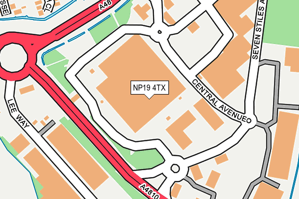
NP19 4TX is located in the Lliswerry electoral ward, within the unitary authority of Newport and the Welsh Parliamentary constituency of Newport East. The Local Health Board is Aneurin Bevan University and the police force is Gwent. This postcode has been in use since August 2006.


GetTheData
Source: OS OpenMap – Local (Ordnance Survey)
Source: OS VectorMap District (Ordnance Survey)
Licence: Open Government Licence (requires attribution)
| Easting | 334548 |
| Northing | 186830 |
| Latitude | 51.576519 |
| Longitude | -2.945904 |
GetTheData
Source: Open Postcode Geo
Licence: Open Government Licence
| Country | Wales |
| Postcode District | NP19 |
➜ See where NP19 is on a map ➜ Where is Newport? | |
GetTheData
Source: Land Registry Price Paid Data
Licence: Open Government Licence
Elevation or altitude of NP19 4TX as distance above sea level:
| Metres | Feet | |
|---|---|---|
| Elevation | 10m | 33ft |
Elevation is measured from the approximate centre of the postcode, to the nearest point on an OS contour line from OS Terrain 50, which has contour spacing of ten vertical metres.
➜ How high above sea level am I? Find the elevation of your current position using your device's GPS.
GetTheData
Source: Open Postcode Elevation
Licence: Open Government Licence
| Ward | Lliswerry |
| Constituency | Newport East |
GetTheData
Source: ONS Postcode Database
Licence: Open Government Licence
| Newport Retail Park (Central Avenue) | Liswerry | 27m |
| Spytty Retail Park (Central Avenue) | Liswerry | 88m |
| Newport Retail Park (Central Avenue) | Liswerry | 113m |
| Spytty Tesco (Spytty Road) | Liswerry | 137m |
| Spytty Tesco (Spytty Road) | Liswerry | 175m |
| Newport (S Wales) Station | 4km |
GetTheData
Source: NaPTAN
Licence: Open Government Licence
GetTheData
Source: ONS Postcode Database
Licence: Open Government Licence


➜ Get more ratings from the Food Standards Agency
GetTheData
Source: Food Standards Agency
Licence: FSA terms & conditions
| Last Collection | |||
|---|---|---|---|
| Location | Mon-Fri | Sat | Distance |
| Aberthaw Circle | 17:30 | 11:15 | 1,096m |
| Nelson Drive | 17:30 | 11:45 | 1,823m |
| Barnardstown | 17:30 | 12:00 | 2,386m |
GetTheData
Source: Dracos
Licence: Creative Commons Attribution-ShareAlike
The below table lists the International Territorial Level (ITL) codes (formerly Nomenclature of Territorial Units for Statistics (NUTS) codes) and Local Administrative Units (LAU) codes for NP19 4TX:
| ITL 1 Code | Name |
|---|---|
| TLL | Wales |
| ITL 2 Code | Name |
| TLL2 | East Wales |
| ITL 3 Code | Name |
| TLL21 | Monmouthshire and Newport |
| LAU 1 Code | Name |
| W06000022 | Newport |
GetTheData
Source: ONS Postcode Directory
Licence: Open Government Licence
The below table lists the Census Output Area (OA), Lower Layer Super Output Area (LSOA), and Middle Layer Super Output Area (MSOA) for NP19 4TX:
| Code | Name | |
|---|---|---|
| OA | W00009886 | |
| LSOA | W01001646 | Newport 015E |
| MSOA | W02000361 | Newport 015 |
GetTheData
Source: ONS Postcode Directory
Licence: Open Government Licence
| NP19 4TA | Heath Close | 231m |
| NP19 4PA | Fosse Road | 263m |
| NP19 4PB | Broadcommon Close | 294m |
| NP19 4TH | Fosse Close | 304m |
| NP19 4NZ | Westmoor Close | 349m |
| NP19 4TB | Fosse Road | 382m |
| NP19 4NW | Pontfaen Road | 400m |
| NP19 4PE | Broad Mead Park | 403m |
| NP19 4TD | Fallowfield Drive | 424m |
| NP19 4BB | Spencer Way | 449m |
GetTheData
Source: Open Postcode Geo; Land Registry Price Paid Data
Licence: Open Government Licence