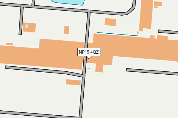
NP19 4QZ is located in the Bishton and Langstone electoral ward, within the unitary authority of Newport and the Welsh Parliamentary constituency of Newport East. The Local Health Board is Aneurin Bevan University and the police force is Gwent. This postcode has been in use since June 1999.


GetTheData
Source: OS OpenMap – Local (Ordnance Survey)
Source: OS VectorMap District (Ordnance Survey)
Licence: Open Government Licence (requires attribution)
| Easting | 338447 |
| Northing | 186682 |
| Latitude | 51.575628 |
| Longitude | -2.889621 |
GetTheData
Source: Open Postcode Geo
Licence: Open Government Licence
| Country | Wales |
| Postcode District | NP19 |
➜ See where NP19 is on a map ➜ Where is Newport? | |
GetTheData
Source: Land Registry Price Paid Data
Licence: Open Government Licence
Elevation or altitude of NP19 4QZ as distance above sea level:
| Metres | Feet | |
|---|---|---|
| Elevation | 10m | 33ft |
Elevation is measured from the approximate centre of the postcode, to the nearest point on an OS contour line from OS Terrain 50, which has contour spacing of ten vertical metres.
➜ How high above sea level am I? Find the elevation of your current position using your device's GPS.
GetTheData
Source: Open Postcode Elevation
Licence: Open Government Licence
| Ward | Bishton And Langstone |
| Constituency | Newport East |
GetTheData
Source: ONS Postcode Database
Licence: Open Government Licence
| Corus Bus Park (Grounds) | Llanwern | 426m |
| Corus (Grounds) | Llanwern | 584m |
| Bishton Village (Bishton Crossing Lane) | Bishton | 997m |
| Bishton Village (Bishton Crossing Lane) | Bishton | 1,008m |
| Queen`s Way | Llanwern | 1,544m |
GetTheData
Source: NaPTAN
Licence: Open Government Licence
GetTheData
Source: ONS Postcode Database
Licence: Open Government Licence

➜ Get more ratings from the Food Standards Agency
GetTheData
Source: Food Standards Agency
Licence: FSA terms & conditions
| Last Collection | |||
|---|---|---|---|
| Location | Mon-Fri | Sat | Distance |
| Magor Post Office | 18:00 | 12:00 | 2,244m |
| Nelson Drive | 17:30 | 11:45 | 3,407m |
| The Priory Langstone | 16:00 | 11:00 | 3,457m |
GetTheData
Source: Dracos
Licence: Creative Commons Attribution-ShareAlike
The below table lists the International Territorial Level (ITL) codes (formerly Nomenclature of Territorial Units for Statistics (NUTS) codes) and Local Administrative Units (LAU) codes for NP19 4QZ:
| ITL 1 Code | Name |
|---|---|
| TLL | Wales |
| ITL 2 Code | Name |
| TLL2 | East Wales |
| ITL 3 Code | Name |
| TLL21 | Monmouthshire and Newport |
| LAU 1 Code | Name |
| W06000022 | Newport |
GetTheData
Source: ONS Postcode Directory
Licence: Open Government Licence
The below table lists the Census Output Area (OA), Lower Layer Super Output Area (LSOA), and Middle Layer Super Output Area (MSOA) for NP19 4QZ:
| Code | Name | |
|---|---|---|
| OA | W00008564 | |
| LSOA | W01001649 | Newport 004D |
| MSOA | W02000350 | Newport 004 |
GetTheData
Source: ONS Postcode Directory
Licence: Open Government Licence
| NP18 2EA | Moor View | 790m |
| NP18 2DZ | 1166m | |
| NP18 2EX | Willow Drive | 2029m |
| NP18 2DN | Bishton Road | 2061m |
| NP18 2HB | Waltwood Road | 2087m |
| NP18 2DX | Dockwell Terrace | 2097m |
| NP18 2HT | Elm Close | 2119m |
| NP18 2DW | Station Road | 2140m |
| NP18 2HA | Waltwood Road | 2147m |
| NP18 2HR | Ashgrove | 2171m |
GetTheData
Source: Open Postcode Geo; Land Registry Price Paid Data
Licence: Open Government Licence