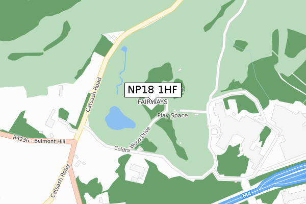
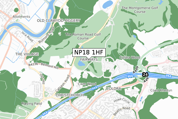
NP18 1HF is located in the Caerleon electoral ward, within the unitary authority of Newport and the Welsh Parliamentary constituency of Newport West. The Local Health Board is Aneurin Bevan University and the police force is Gwent. This postcode has been in use since June 1999.


GetTheData
Source: OS Open Zoomstack (Ordnance Survey)
Licence: Open Government Licence (requires attribution)
Attribution: Contains OS data © Crown copyright and database right 2025
Source: Open Postcode Geo
Licence: Open Government Licence (requires attribution)
Attribution: Contains OS data © Crown copyright and database right 2025; Contains Royal Mail data © Royal Mail copyright and database right 2025; Source: Office for National Statistics licensed under the Open Government Licence v.3.0
| Easting | 335273 |
| Northing | 189844 |
| Latitude | 51.603697 |
| Longitude | -2.935995 |
GetTheData
Source: Open Postcode Geo
Licence: Open Government Licence
| Country | Wales |
| Postcode District | NP18 |
➜ See where NP18 is on a map | |
GetTheData
Source: Land Registry Price Paid Data
Licence: Open Government Licence
Elevation or altitude of NP18 1HF as distance above sea level:
| Metres | Feet | |
|---|---|---|
| Elevation | 90m | 295ft |
Elevation is measured from the approximate centre of the postcode, to the nearest point on an OS contour line from OS Terrain 50, which has contour spacing of ten vertical metres.
➜ How high above sea level am I? Find the elevation of your current position using your device's GPS.
GetTheData
Source: Open Postcode Elevation
Licence: Open Government Licence
| Ward | Caerleon |
| Constituency | Newport West |
GetTheData
Source: ONS Postcode Database
Licence: Open Government Licence
| Celtic Manor (The Coldra) | Coldra | 504m |
| Celtic Manor (The Coldra) | Coldra | 522m |
| Royal Oak Hill | Lawrence Hill | 692m |
| Royal Oak (Chepstow Road) | Royal Oak | 710m |
| Royal Oak Hill | Lawrence Hill | 720m |
| Newport (S Wales) Station | 4.8km |
GetTheData
Source: NaPTAN
Licence: Open Government Licence
| Percentage of properties with Next Generation Access | 100.0% |
| Percentage of properties with Superfast Broadband | 0.0% |
| Percentage of properties with Ultrafast Broadband | 0.0% |
| Percentage of properties with Full Fibre Broadband | 0.0% |
Superfast Broadband is between 30Mbps and 300Mbps
Ultrafast Broadband is > 300Mbps
| Percentage of properties unable to receive 2Mbps | 0.0% |
| Percentage of properties unable to receive 5Mbps | 0.0% |
| Percentage of properties unable to receive 10Mbps | 0.0% |
| Percentage of properties unable to receive 30Mbps | 100.0% |
GetTheData
Source: Ofcom
Licence: Ofcom Terms of Use (requires attribution)
GetTheData
Source: ONS Postcode Database
Licence: Open Government Licence


➜ Get more ratings from the Food Standards Agency
GetTheData
Source: Food Standards Agency
Licence: FSA terms & conditions
| Last Collection | |||
|---|---|---|---|
| Location | Mon-Fri | Sat | Distance |
| Caerleon Post Office | 17:00 | 12:00 | 1,395m |
| Nelson Drive | 17:30 | 11:45 | 1,475m |
| The Museum Caerleon | 17:15 | 11:00 | 1,554m |
GetTheData
Source: Dracos
Licence: Creative Commons Attribution-ShareAlike
The below table lists the International Territorial Level (ITL) codes (formerly Nomenclature of Territorial Units for Statistics (NUTS) codes) and Local Administrative Units (LAU) codes for NP18 1HF:
| ITL 1 Code | Name |
|---|---|
| TLL | Wales |
| ITL 2 Code | Name |
| TLL2 | East Wales |
| ITL 3 Code | Name |
| TLL21 | Monmouthshire and Newport |
| LAU 1 Code | Name |
| W06000022 | Newport |
GetTheData
Source: ONS Postcode Directory
Licence: Open Government Licence
The below table lists the Census Output Area (OA), Lower Layer Super Output Area (LSOA), and Middle Layer Super Output Area (MSOA) for NP18 1HF:
| Code | Name | |
|---|---|---|
| OA | W00008443 | |
| LSOA | W01001625 | Newport 001C |
| MSOA | W02000347 | Newport 001 |
GetTheData
Source: ONS Postcode Directory
Licence: Open Government Licence
| NP18 1LB | Catsash Road | 245m |
| NP18 1JF | Royal Oak Hill | 407m |
| NP18 2LR | The Coldra | 510m |
| NP18 2LS | The Coldra | 543m |
| NP18 1JE | Royal Oak Drive | 585m |
| NP18 2LP | The Coldra | 613m |
| NP19 9GQ | Fisher Close | 638m |
| NP19 9GP | Howe Circle | 640m |
| NP19 9GN | Anson Green | 658m |
| NP18 1JD | Royal Oak Drive | 679m |
GetTheData
Source: Open Postcode Geo; Land Registry Price Paid Data
Licence: Open Government Licence