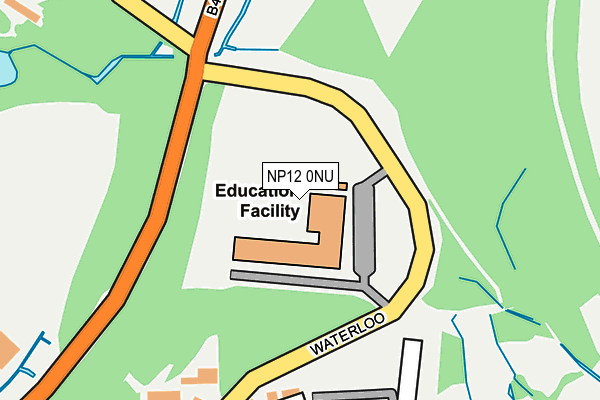
NP12 0NU is located in the Penmaen electoral ward, within the unitary authority of Caerphilly and the Welsh Parliamentary constituency of Islwyn. The Local Health Board is Aneurin Bevan University and the police force is Gwent. This postcode has been in use since August 2015.


GetTheData
Source: OS OpenMap – Local (Ordnance Survey)
Source: OS VectorMap District (Ordnance Survey)
Licence: Open Government Licence (requires attribution)
| Easting | 318704 |
| Northing | 199083 |
| Latitude | 51.684601 |
| Longitude | -3.177346 |
GetTheData
Source: Open Postcode Geo
Licence: Open Government Licence
| Country | Wales |
| Postcode District | NP12 |
➜ See where NP12 is on a map | |
GetTheData
Source: Land Registry Price Paid Data
Licence: Open Government Licence
Elevation or altitude of NP12 0NU as distance above sea level:
| Metres | Feet | |
|---|---|---|
| Elevation | 170m | 558ft |
Elevation is measured from the approximate centre of the postcode, to the nearest point on an OS contour line from OS Terrain 50, which has contour spacing of ten vertical metres.
➜ How high above sea level am I? Find the elevation of your current position using your device's GPS.
GetTheData
Source: Open Postcode Elevation
Licence: Open Government Licence
| Ward | Penmaen |
| Constituency | Islwyn |
GetTheData
Source: ONS Postcode Database
Licence: Open Government Licence
| Presbyterian Church (Penmaen Avenue) | Oakdale | 458m |
| Presbyterian Church (Penmaen Avenue) | Oakdale | 464m |
| Rock Villas (A4048) | Rock | 599m |
| Blacksmith Close (Bryn-howard Terrace) | Oakdale | 610m |
| Rock Villas (A4048) | Rock | 614m |
| Newbridge Station | 3.2km |
| Llanhilleth Station | 3.4km |
| Gilfach Fargoed Station | 3.4km |
GetTheData
Source: NaPTAN
Licence: Open Government Licence
GetTheData
Source: ONS Postcode Database
Licence: Open Government Licence


➜ Get more ratings from the Food Standards Agency
GetTheData
Source: Food Standards Agency
Licence: FSA terms & conditions
| Last Collection | |||
|---|---|---|---|
| Location | Mon-Fri | Sat | Distance |
| Bloomfield Road Post Office | 16:00 | 11:45 | 2,259m |
| Blackwood Post Office | 18:00 | 12:30 | 2,437m |
| Cefn Fforest Post Office | 17:00 | 12:00 | 2,785m |
GetTheData
Source: Dracos
Licence: Creative Commons Attribution-ShareAlike
The below table lists the International Territorial Level (ITL) codes (formerly Nomenclature of Territorial Units for Statistics (NUTS) codes) and Local Administrative Units (LAU) codes for NP12 0NU:
| ITL 1 Code | Name |
|---|---|
| TLL | Wales |
| ITL 2 Code | Name |
| TLL1 | West Wales and The Valleys |
| ITL 3 Code | Name |
| TLL16 | Gwent Valleys |
| LAU 1 Code | Name |
| W06000018 | Caerphilly |
GetTheData
Source: ONS Postcode Directory
Licence: Open Government Licence
The below table lists the Census Output Area (OA), Lower Layer Super Output Area (LSOA), and Middle Layer Super Output Area (MSOA) for NP12 0NU:
| Code | Name | |
|---|---|---|
| OA | W00007280 | |
| LSOA | W01001390 | Caerphilly 006E |
| MSOA | W02000295 | Caerphilly 006 |
GetTheData
Source: ONS Postcode Directory
Licence: Open Government Licence
| NP12 0GY | Nant Gau | 229m |
| NP12 0GZ | Tir Berllan | 300m |
| NP12 0GX | Bronwydd | 318m |
| NP12 0LA | Syr Dafydd Avenue | 389m |
| NP12 0EZ | Cefn Y Fferm | 392m |
| NP12 0BP | Blacksmith Close | 405m |
| NP12 0HX | 426m | |
| NP12 0LB | 436m | |
| NP12 0JZ | Penmaen Avenue | 479m |
| NP12 0EX | Maes Bengi | 495m |
GetTheData
Source: Open Postcode Geo; Land Registry Price Paid Data
Licence: Open Government Licence