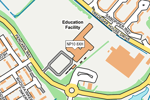
NP10 8XH is located in the Tredegar Park and Marshfield electoral ward, within the unitary authority of Newport and the Welsh Parliamentary constituency of Newport West. The Local Health Board is Aneurin Bevan University and the police force is Gwent. This postcode has been in use since May 2004.


GetTheData
Source: OS OpenMap – Local (Ordnance Survey)
Source: OS VectorMap District (Ordnance Survey)
Licence: Open Government Licence (requires attribution)
| Easting | 329115 |
| Northing | 184744 |
| Latitude | 51.557106 |
| Longitude | -3.023865 |
GetTheData
Source: Open Postcode Geo
Licence: Open Government Licence
| Country | Wales |
| Postcode District | NP10 |
➜ See where NP10 is on a map ➜ Where is Newport? | |
GetTheData
Source: Land Registry Price Paid Data
Licence: Open Government Licence
Elevation or altitude of NP10 8XH as distance above sea level:
| Metres | Feet | |
|---|---|---|
| Elevation | 10m | 33ft |
Elevation is measured from the approximate centre of the postcode, to the nearest point on an OS contour line from OS Terrain 50, which has contour spacing of ten vertical metres.
➜ How high above sea level am I? Find the elevation of your current position using your device's GPS.
GetTheData
Source: Open Postcode Elevation
Licence: Open Government Licence
| Ward | Tredegar Park And Marshfield |
| Constituency | Newport West |
GetTheData
Source: ONS Postcode Database
Licence: Open Government Licence
| St Joseph`s Rc High School (Grounds) | Duffryn | 34m |
| Morgraig Avenue (Pencarn Way) | Duffryn | 166m |
| Asda (Tredegar House Drive) | Duffryn | 183m |
| Pencarn Way | Duffryn | 188m |
| Panasonic (Pencarn Way) | Duffryn | 200m |
| Newport (S Wales) Station | 3.9km |
| Rogerstone Station | 5.2km |
GetTheData
Source: NaPTAN
Licence: Open Government Licence
GetTheData
Source: ONS Postcode Database
Licence: Open Government Licence


➜ Get more ratings from the Food Standards Agency
GetTheData
Source: Food Standards Agency
Licence: FSA terms & conditions
| Last Collection | |||
|---|---|---|---|
| Location | Mon-Fri | Sat | Distance |
| Morgraig Avenue | 16:45 | 12:00 | 263m |
| Cleppa Park | 18:30 | 1,283m | |
| Lamb Close | 17:30 | 12:00 | 1,740m |
GetTheData
Source: Dracos
Licence: Creative Commons Attribution-ShareAlike
The below table lists the International Territorial Level (ITL) codes (formerly Nomenclature of Territorial Units for Statistics (NUTS) codes) and Local Administrative Units (LAU) codes for NP10 8XH:
| ITL 1 Code | Name |
|---|---|
| TLL | Wales |
| ITL 2 Code | Name |
| TLL2 | East Wales |
| ITL 3 Code | Name |
| TLL21 | Monmouthshire and Newport |
| LAU 1 Code | Name |
| W06000022 | Newport |
GetTheData
Source: ONS Postcode Directory
Licence: Open Government Licence
The below table lists the Census Output Area (OA), Lower Layer Super Output Area (LSOA), and Middle Layer Super Output Area (MSOA) for NP10 8XH:
| Code | Name | |
|---|---|---|
| OA | W00008757 | |
| LSOA | W01001689 | Newport 019D |
| MSOA | W02000365 | Newport 019 |
GetTheData
Source: ONS Postcode Directory
Licence: Open Government Licence
| NP10 8WY | Sandpiper Way | 263m |
| NP10 8BG | Steeplechase Road | 267m |
| NP10 8WX | Sandpiper Way | 273m |
| NP10 8AW | Cedar Gardens | 306m |
| NP10 8SY | Goodrich Grove | 320m |
| NP10 8AZ | Edmundsbury Road | 332m |
| NP10 8AU | Sir Briggs Avenue | 335m |
| NP10 8HA | Penhow Mews | 344m |
| NP10 8UB | Raglan Mews | 346m |
| NP10 8AY | Edmundsbury Road | 364m |
GetTheData
Source: Open Postcode Geo; Land Registry Price Paid Data
Licence: Open Government Licence