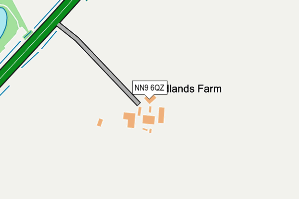
NN9 6QZ is located in the Raunds electoral ward, within the unitary authority of North Northamptonshire and the English Parliamentary constituency of Corby. The Sub Integrated Care Board (ICB) Location is NHS Northamptonshire ICB - 78H and the police force is Northamptonshire. This postcode has been in use since January 1980.


GetTheData
Source: OS OpenMap – Local (Ordnance Survey)
Source: OS VectorMap District (Ordnance Survey)
Licence: Open Government Licence (requires attribution)
| Easting | 496660 |
| Northing | 270377 |
| Latitude | 52.323004 |
| Longitude | -0.583182 |
GetTheData
Source: Open Postcode Geo
Licence: Open Government Licence
| Country | England |
| Postcode District | NN9 |
➜ See where NN9 is on a map | |
GetTheData
Source: Land Registry Price Paid Data
Licence: Open Government Licence
Elevation or altitude of NN9 6QZ as distance above sea level:
| Metres | Feet | |
|---|---|---|
| Elevation | 50m | 164ft |
Elevation is measured from the approximate centre of the postcode, to the nearest point on an OS contour line from OS Terrain 50, which has contour spacing of ten vertical metres.
➜ How high above sea level am I? Find the elevation of your current position using your device's GPS.
GetTheData
Source: Open Postcode Elevation
Licence: Open Government Licence
| Ward | Raunds |
| Constituency | Corby |
GetTheData
Source: ONS Postcode Database
Licence: Open Government Licence
| A45 Roundabout (Station Road) | Higham Ferrers | 905m |
| A45 Roundabout (Station Road) | Higham Ferrers | 916m |
| 40 Elizabeth Way (Elizabeth Way) | Higham Ferrers | 996m |
| Andrew Close (Elizabeth Way) | Higham Ferrers | 1,007m |
| Swans Way (Stanwick Road) | Higham Ferrers | 1,014m |
GetTheData
Source: NaPTAN
Licence: Open Government Licence
GetTheData
Source: ONS Postcode Database
Licence: Open Government Licence


➜ Get more ratings from the Food Standards Agency
GetTheData
Source: Food Standards Agency
Licence: FSA terms & conditions
| Last Collection | |||
|---|---|---|---|
| Location | Mon-Fri | Sat | Distance |
| North End | 17:15 | 11:15 | 1,261m |
| Irthlingborough Tso | 17:00 | 10:30 | 2,008m |
| Wharf Road Tso | 17:15 | 11:15 | 2,060m |
GetTheData
Source: Dracos
Licence: Creative Commons Attribution-ShareAlike
The below table lists the International Territorial Level (ITL) codes (formerly Nomenclature of Territorial Units for Statistics (NUTS) codes) and Local Administrative Units (LAU) codes for NN9 6QZ:
| ITL 1 Code | Name |
|---|---|
| TLF | East Midlands (England) |
| ITL 2 Code | Name |
| TLF2 | Leicestershire, Rutland and Northamptonshire |
| ITL 3 Code | Name |
| TLF25 | North Northamptonshire |
| LAU 1 Code | Name |
| E07000152 | East Northamptonshire |
GetTheData
Source: ONS Postcode Directory
Licence: Open Government Licence
The below table lists the Census Output Area (OA), Lower Layer Super Output Area (LSOA), and Middle Layer Super Output Area (MSOA) for NN9 6QZ:
| Code | Name | |
|---|---|---|
| OA | E00137722 | |
| LSOA | E01027074 | East Northamptonshire 004B |
| MSOA | E02005632 | East Northamptonshire 004 |
GetTheData
Source: ONS Postcode Directory
Licence: Open Government Licence
| NN9 6QG | Higham Road | 650m |
| NN10 8LR | Kestrel Drive | 785m |
| NN10 8LL | Dove Close | 804m |
| NN10 8LN | Heron Close | 836m |
| NN10 8PR | Nightingale Way | 865m |
| NN10 8NE | Teal Close | 900m |
| NN10 8JQ | Mallard Close | 905m |
| NN9 6QF | Higham Road | 939m |
| NN10 8NF | Swans Way | 959m |
| NN10 8LE | Stanwick Road | 976m |
GetTheData
Source: Open Postcode Geo; Land Registry Price Paid Data
Licence: Open Government Licence