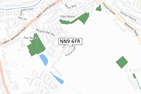
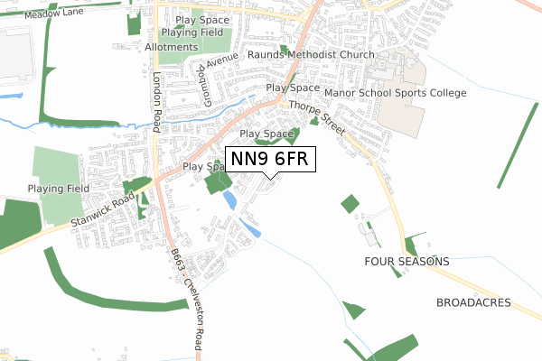
NN9 6FR is located in the Raunds electoral ward, within the unitary authority of North Northamptonshire and the English Parliamentary constituency of Corby. The Sub Integrated Care Board (ICB) Location is NHS Northamptonshire ICB - 78H and the police force is Northamptonshire. This postcode has been in use since April 2019.


GetTheData
Source: OS Open Zoomstack (Ordnance Survey)
Licence: Open Government Licence (requires attribution)
Attribution: Contains OS data © Crown copyright and database right 2024
Source: Open Postcode Geo
Licence: Open Government Licence (requires attribution)
Attribution: Contains OS data © Crown copyright and database right 2024; Contains Royal Mail data © Royal Mail copyright and database right 2024; Source: Office for National Statistics licensed under the Open Government Licence v.3.0
| Easting | 499611 |
| Northing | 272081 |
| Latitude | 52.337792 |
| Longitude | -0.539394 |
GetTheData
Source: Open Postcode Geo
Licence: Open Government Licence
| Country | England |
| Postcode District | NN9 |
| ➜ NN9 open data dashboard ➜ See where NN9 is on a map ➜ Where is Raunds? | |
GetTheData
Source: Land Registry Price Paid Data
Licence: Open Government Licence
| Ward | Raunds |
| Constituency | Corby |
GetTheData
Source: ONS Postcode Database
Licence: Open Government Licence
2022 18 JUL £290,000 |
5, ACACIA CRESCENT, RAUNDS, WELLINGBOROUGH, NN9 6FR 2020 19 JUN £245,000 |
9, ACACIA CRESCENT, RAUNDS, WELLINGBOROUGH, NN9 6FR 2020 20 MAR £265,752 |
7, ACACIA CRESCENT, RAUNDS, WELLINGBOROUGH, NN9 6FR 2020 9 MAR £305,000 |
11, ACACIA CRESCENT, RAUNDS, WELLINGBOROUGH, NN9 6FR 2020 28 FEB £355,000 |
17, ACACIA CRESCENT, RAUNDS, WELLINGBOROUGH, NN9 6FR 2020 14 FEB £305,000 |
15, ACACIA CRESCENT, RAUNDS, WELLINGBOROUGH, NN9 6FR 2020 8 JAN £355,000 |
18, ACACIA CRESCENT, RAUNDS, WELLINGBOROUGH, NN9 6FR 2019 20 DEC £310,000 |
2019 12 DEC £255,000 |
GetTheData
Source: HM Land Registry Price Paid Data
Licence: Contains HM Land Registry data © Crown copyright and database right 2024. This data is licensed under the Open Government Licence v3.0.
| October 2023 | Violence and sexual offences | On or near Petrol Station | 368m |
| October 2023 | Violence and sexual offences | On or near Petrol Station | 368m |
| June 2023 | Anti-social behaviour | On or near Petrol Station | 368m |
| ➜ Get more crime data in our Crime section | |||
GetTheData
Source: data.police.uk
Licence: Open Government Licence
| Cole Court (Grove Street) | Raunds | 319m |
| Cole Court (Grove Street) | Raunds | 336m |
| Co-op Store (Grove Street) | Raunds | 383m |
| Thorpe Street | Raunds | 392m |
| Co-op Store (Brook Street) | Raunds | 425m |
GetTheData
Source: NaPTAN
Licence: Open Government Licence
| Percentage of properties with Next Generation Access | 100.0% |
| Percentage of properties with Superfast Broadband | 100.0% |
| Percentage of properties with Ultrafast Broadband | 0.0% |
| Percentage of properties with Full Fibre Broadband | 0.0% |
Superfast Broadband is between 30Mbps and 300Mbps
Ultrafast Broadband is > 300Mbps
| Percentage of properties unable to receive 2Mbps | 0.0% |
| Percentage of properties unable to receive 5Mbps | 0.0% |
| Percentage of properties unable to receive 10Mbps | 0.0% |
| Percentage of properties unable to receive 30Mbps | 0.0% |
GetTheData
Source: Ofcom
Licence: Ofcom Terms of Use (requires attribution)
GetTheData
Source: ONS Postcode Database
Licence: Open Government Licence


➜ Get more ratings from the Food Standards Agency
GetTheData
Source: Food Standards Agency
Licence: FSA terms & conditions
| Last Collection | |||
|---|---|---|---|
| Location | Mon-Fri | Sat | Distance |
| Marshalls Road | 16:15 | 08:00 | 910m |
| Mallows Drive | 16:45 | 08:30 | 1,423m |
| Chelveston Tso | 16:15 | 10:45 | 2,549m |
GetTheData
Source: Dracos
Licence: Creative Commons Attribution-ShareAlike
| Facility | Distance |
|---|---|
| Manor Sport And Leisure Ltd Mountbatten Way, Raunds, Wellingborough Sports Hall, Health and Fitness Gym, Artificial Grass Pitch, Grass Pitches, Studio, Outdoor Tennis Courts | 738m |
| Raunds Cricket Club Marshalls Road, Raunds, Wellingborough Grass Pitches | 780m |
| Windmill Primary School Windmill Lane, Raunds, Wellingborough Grass Pitches, Sports Hall | 948m |
GetTheData
Source: Active Places
Licence: Open Government Licence
| School | Phase of Education | Distance |
|---|---|---|
| Raunds Park Infant School Park Street, Raunds, Wellingborough, NN9 6NB | Primary | 747m |
| Manor School Mountbatten Way, Raunds, Wellingborough, NN9 6PA | Secondary | 807m |
| St Peter's Church of England Academy Mountbatten Way, Raunds, Wellingborough, NN9 6PA | Primary | 862m |
GetTheData
Source: Edubase
Licence: Open Government Licence
The below table lists the International Territorial Level (ITL) codes (formerly Nomenclature of Territorial Units for Statistics (NUTS) codes) and Local Administrative Units (LAU) codes for NN9 6FR:
| ITL 1 Code | Name |
|---|---|
| TLF | East Midlands (England) |
| ITL 2 Code | Name |
| TLF2 | Leicestershire, Rutland and Northamptonshire |
| ITL 3 Code | Name |
| TLF25 | North Northamptonshire |
| LAU 1 Code | Name |
| E07000152 | East Northamptonshire |
GetTheData
Source: ONS Postcode Directory
Licence: Open Government Licence
The below table lists the Census Output Area (OA), Lower Layer Super Output Area (LSOA), and Middle Layer Super Output Area (MSOA) for NN9 6FR:
| Code | Name | |
|---|---|---|
| OA | E00137604 | |
| LSOA | E01027051 | East Northamptonshire 005A |
| MSOA | E02005633 | East Northamptonshire 005 |
GetTheData
Source: ONS Postcode Directory
Licence: Open Government Licence
| NN9 6TW | Whitney Close | 202m |
| NN9 6TU | Glovers Lane | 203m |
| NN9 6TT | Weighbridge Way | 225m |
| NN9 6UL | Centenary Way | 243m |
| NN9 6TX | Rushmere Close | 253m |
| NN9 6DR | Streather Court | 265m |
| NN9 6DS | Grove Street | 297m |
| NN9 6DU | Grove Place | 297m |
| NN9 6UJ | Willow Way | 301m |
| NN9 6JH | Warwick Close | 343m |
GetTheData
Source: Open Postcode Geo; Land Registry Price Paid Data
Licence: Open Government Licence