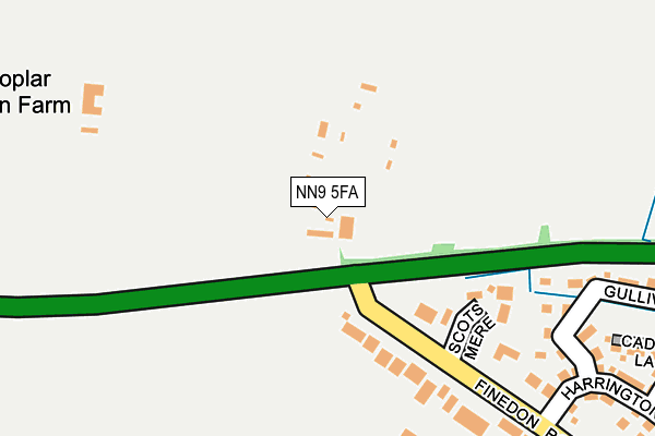
NN9 5FA is located in the Irthlingborough electoral ward, within the unitary authority of North Northamptonshire and the English Parliamentary constituency of Corby. The Sub Integrated Care Board (ICB) Location is NHS Northamptonshire ICB - 78H and the police force is Northamptonshire. This postcode has been in use since March 2015.


GetTheData
Source: OS OpenMap – Local (Ordnance Survey)
Source: OS VectorMap District (Ordnance Survey)
Licence: Open Government Licence (requires attribution)
| Easting | 493829 |
| Northing | 271430 |
| Latitude | 52.332944 |
| Longitude | -0.624429 |
GetTheData
Source: Open Postcode Geo
Licence: Open Government Licence
| Country | England |
| Postcode District | NN9 |
➜ See where NN9 is on a map | |
GetTheData
Source: Land Registry Price Paid Data
Licence: Open Government Licence
Elevation or altitude of NN9 5FA as distance above sea level:
| Metres | Feet | |
|---|---|---|
| Elevation | 80m | 262ft |
Elevation is measured from the approximate centre of the postcode, to the nearest point on an OS contour line from OS Terrain 50, which has contour spacing of ten vertical metres.
➜ How high above sea level am I? Find the elevation of your current position using your device's GPS.
GetTheData
Source: Open Postcode Elevation
Licence: Open Government Licence
| Ward | Irthlingborough |
| Constituency | Corby |
GetTheData
Source: ONS Postcode Database
Licence: Open Government Licence
| Huxlow School (Finedon Road) | Irthlingborough | 364m |
| Huxlow School (Finedon Road) | Irthlingborough | 435m |
| Holbush Way (Finedon Road) | Irthlingborough | 789m |
| Holbush Way (Finedon Road) | Irthlingborough | 789m |
| Scarborough Street (College Street) | Irthlingborough | 1,003m |
| Wellingborough Station | 4.8km |
GetTheData
Source: NaPTAN
Licence: Open Government Licence
GetTheData
Source: ONS Postcode Database
Licence: Open Government Licence


➜ Get more ratings from the Food Standards Agency
GetTheData
Source: Food Standards Agency
Licence: FSA terms & conditions
| Last Collection | |||
|---|---|---|---|
| Location | Mon-Fri | Sat | Distance |
| Irthlingborough Tso | 17:00 | 10:30 | 1,101m |
| Wellingborough Road | 16:00 | 08:00 | 1,213m |
| Thomas Flawn Road | 16:00 | 08:30 | 1,440m |
GetTheData
Source: Dracos
Licence: Creative Commons Attribution-ShareAlike
The below table lists the International Territorial Level (ITL) codes (formerly Nomenclature of Territorial Units for Statistics (NUTS) codes) and Local Administrative Units (LAU) codes for NN9 5FA:
| ITL 1 Code | Name |
|---|---|
| TLF | East Midlands (England) |
| ITL 2 Code | Name |
| TLF2 | Leicestershire, Rutland and Northamptonshire |
| ITL 3 Code | Name |
| TLF25 | North Northamptonshire |
| LAU 1 Code | Name |
| E07000152 | East Northamptonshire |
GetTheData
Source: ONS Postcode Directory
Licence: Open Government Licence
The below table lists the Census Output Area (OA), Lower Layer Super Output Area (LSOA), and Middle Layer Super Output Area (MSOA) for NN9 5FA:
| Code | Name | |
|---|---|---|
| OA | E00137550 | |
| LSOA | E01027038 | East Northamptonshire 006A |
| MSOA | E02005634 | East Northamptonshire 006 |
GetTheData
Source: ONS Postcode Directory
Licence: Open Government Licence
| NN9 5YE | Scotsmere | 149m |
| NN9 5GR | Gulliver Road | 319m |
| NN9 5GS | Cadnams Lane | 333m |
| NN9 5GP | Harrington Road | 375m |
| NN9 5GT | Wardens Lane | 437m |
| NN9 5UB | Finedon Road | 476m |
| NN9 5GE | Wyckley Close | 476m |
| NN9 5TF | Merefields | 523m |
| NN9 5GD | Ringwell Close | 527m |
| NN9 5GB | Turnbrook Close | 552m |
GetTheData
Source: Open Postcode Geo; Land Registry Price Paid Data
Licence: Open Government Licence