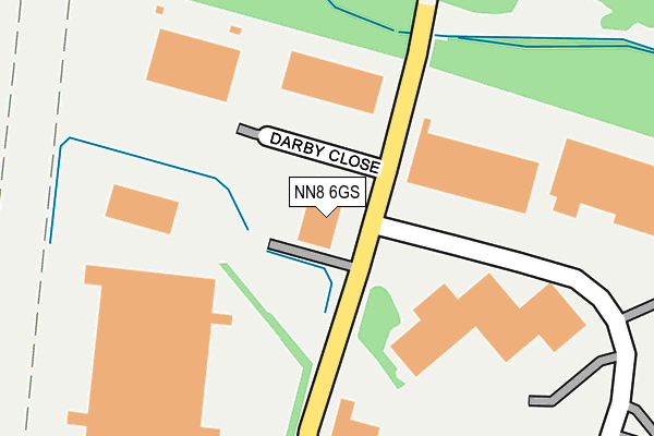
NN8 6GS is located in the Brickhill and Queensway electoral ward, within the unitary authority of North Northamptonshire and the English Parliamentary constituency of Wellingborough. The Sub Integrated Care Board (ICB) Location is NHS Northamptonshire ICB - 78H and the police force is Northamptonshire. This postcode has been in use since September 1991.


GetTheData
Source: OS OpenMap – Local (Ordnance Survey)
Source: OS VectorMap District (Ordnance Survey)
Licence: Open Government Licence (requires attribution)
| Easting | 486058 |
| Northing | 268313 |
| Latitude | 52.306215 |
| Longitude | -0.739220 |
GetTheData
Source: Open Postcode Geo
Licence: Open Government Licence
| Country | England |
| Postcode District | NN8 |
➜ See where NN8 is on a map ➜ Where is Wellingborough? | |
GetTheData
Source: Land Registry Price Paid Data
Licence: Open Government Licence
Elevation or altitude of NN8 6GS as distance above sea level:
| Metres | Feet | |
|---|---|---|
| Elevation | 110m | 361ft |
Elevation is measured from the approximate centre of the postcode, to the nearest point on an OS contour line from OS Terrain 50, which has contour spacing of ten vertical metres.
➜ How high above sea level am I? Find the elevation of your current position using your device's GPS.
GetTheData
Source: Open Postcode Elevation
Licence: Open Government Licence
| Ward | Brickhill And Queensway |
| Constituency | Wellingborough |
GetTheData
Source: ONS Postcode Database
Licence: Open Government Licence
| Homebase (Rutherford Drive) | Wellingborough | 280m |
| Homebase (Rutherford Drive) | Wellingborough | 280m |
| Kwik Save (Rutherford Drive) | Wellingborough | 435m |
| Kwik Save (Rutherford Drive) | Wellingborough | 472m |
| Shaw Close (Sywell Road) | Wellingborough | 522m |
| Wellingborough Station | 4.3km |
GetTheData
Source: NaPTAN
Licence: Open Government Licence
GetTheData
Source: ONS Postcode Database
Licence: Open Government Licence


➜ Get more ratings from the Food Standards Agency
GetTheData
Source: Food Standards Agency
Licence: FSA terms & conditions
| Last Collection | |||
|---|---|---|---|
| Location | Mon-Fri | Sat | Distance |
| Hatton Street | 17:15 | 11:00 | 2,568m |
| Croyland Road | 16:00 | 11:00 | 2,744m |
| Fallowfield | 17:00 | 11:00 | 2,798m |
GetTheData
Source: Dracos
Licence: Creative Commons Attribution-ShareAlike
The below table lists the International Territorial Level (ITL) codes (formerly Nomenclature of Territorial Units for Statistics (NUTS) codes) and Local Administrative Units (LAU) codes for NN8 6GS:
| ITL 1 Code | Name |
|---|---|
| TLF | East Midlands (England) |
| ITL 2 Code | Name |
| TLF2 | Leicestershire, Rutland and Northamptonshire |
| ITL 3 Code | Name |
| TLF25 | North Northamptonshire |
| LAU 1 Code | Name |
| E07000156 | Wellingborough |
GetTheData
Source: ONS Postcode Directory
Licence: Open Government Licence
The below table lists the Census Output Area (OA), Lower Layer Super Output Area (LSOA), and Middle Layer Super Output Area (MSOA) for NN8 6GS:
| Code | Name | |
|---|---|---|
| OA | E00139087 | |
| LSOA | E01027339 | Wellingborough 005A |
| MSOA | E02005696 | Wellingborough 005 |
GetTheData
Source: ONS Postcode Directory
Licence: Open Government Licence
| NN8 6XF | Morris Close | 583m |
| NN8 6AB | Huxley Close | 585m |
| NN8 6GR | Booth Drive | 662m |
| NN8 3SX | Warnham | 768m |
| NN8 3SU | Trelawney | 770m |
| NN8 6AG | Wallis Close | 783m |
| NN8 3EW | Shelley Road | 798m |
| NN8 3ST | Keswick | 820m |
| NN8 3SY | Alastor | 846m |
| NN8 3LJ | Brooke Close | 848m |
GetTheData
Source: Open Postcode Geo; Land Registry Price Paid Data
Licence: Open Government Licence