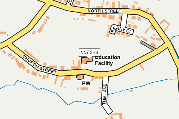
NN7 3HS is located in the Bugbrooke electoral ward, within the unitary authority of West Northamptonshire and the English Parliamentary constituency of Daventry. The Sub Integrated Care Board (ICB) Location is NHS Northamptonshire ICB - 78H and the police force is Northamptonshire. This postcode has been in use since July 1995.


GetTheData
Source: OS OpenMap – Local (Ordnance Survey)
Source: OS VectorMap District (Ordnance Survey)
Licence: Open Government Licence (requires attribution)
| Easting | 471455 |
| Northing | 256706 |
| Latitude | 52.203974 |
| Longitude | -0.955810 |
GetTheData
Source: Open Postcode Geo
Licence: Open Government Licence
| Country | England |
| Postcode District | NN7 |
➜ See where NN7 is on a map ➜ Where is Rothersthorpe? | |
GetTheData
Source: Land Registry Price Paid Data
Licence: Open Government Licence
Elevation or altitude of NN7 3HS as distance above sea level:
| Metres | Feet | |
|---|---|---|
| Elevation | 80m | 262ft |
Elevation is measured from the approximate centre of the postcode, to the nearest point on an OS contour line from OS Terrain 50, which has contour spacing of ten vertical metres.
➜ How high above sea level am I? Find the elevation of your current position using your device's GPS.
GetTheData
Source: Open Postcode Elevation
Licence: Open Government Licence
| Ward | Bugbrooke |
| Constituency | Daventry |
GetTheData
Source: ONS Postcode Database
Licence: Open Government Licence
| Kislingbury Road (Banbury Lane) | Rothersthorpe | 239m |
| Kislingbury Road (Banbury Lane) | Rothersthorpe | 252m |
| Carlsberg (Tithe Barn Way) | Swan Valley | 1,274m |
| The Barn Way (Swan Valley Way) | Swan Valley | 1,330m |
| Cygnet Drive (Swan Valley Way) | Swan Valley | 1,338m |
| Northampton Station | 5km |
GetTheData
Source: NaPTAN
Licence: Open Government Licence
GetTheData
Source: ONS Postcode Database
Licence: Open Government Licence


➜ Get more ratings from the Food Standards Agency
GetTheData
Source: Food Standards Agency
Licence: FSA terms & conditions
| Last Collection | |||
|---|---|---|---|
| Location | Mon-Fri | Sat | Distance |
| Banbury Lane | 16:00 | 10:30 | 301m |
| Rothersthorpe M1 Service | 17:30 | 11:15 | 1,001m |
| Rothersthorpe M1 Services | 17:30 | 11:15 | 1,072m |
GetTheData
Source: Dracos
Licence: Creative Commons Attribution-ShareAlike
The below table lists the International Territorial Level (ITL) codes (formerly Nomenclature of Territorial Units for Statistics (NUTS) codes) and Local Administrative Units (LAU) codes for NN7 3HS:
| ITL 1 Code | Name |
|---|---|
| TLF | East Midlands (England) |
| ITL 2 Code | Name |
| TLF2 | Leicestershire, Rutland and Northamptonshire |
| ITL 3 Code | Name |
| TLF24 | West Northamptonshire |
| LAU 1 Code | Name |
| E07000155 | South Northamptonshire |
GetTheData
Source: ONS Postcode Directory
Licence: Open Government Licence
The below table lists the Census Output Area (OA), Lower Layer Super Output Area (LSOA), and Middle Layer Super Output Area (MSOA) for NN7 3HS:
| Code | Name | |
|---|---|---|
| OA | E00138806 | |
| LSOA | E01027285 | South Northamptonshire 001C |
| MSOA | E02005681 | South Northamptonshire 001 |
GetTheData
Source: ONS Postcode Directory
Licence: Open Government Licence
| NN7 3JD | Church Street | 94m |
| NN7 3JE | The Lane | 114m |
| NN7 3JQ | Berry Close | 154m |
| NN7 3JB | North Street | 198m |
| NN7 3BH | St Johns Close | 234m |
| NN7 3HY | Banbury Lane | 285m |
| NN7 3HZ | Kislingbury Road | 333m |
| NN7 3JH | Mumford Drive | 382m |
| NN7 3JJ | Ardens Grove | 400m |
| NN7 3JL | Grafton Way | 471m |
GetTheData
Source: Open Postcode Geo; Land Registry Price Paid Data
Licence: Open Government Licence