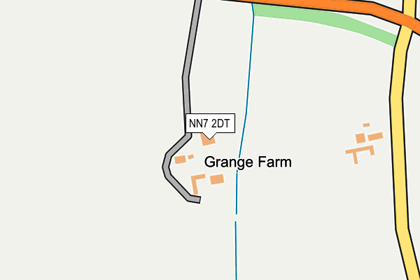
NN7 2DT is in Preston Deanery, Northampton. NN7 2DT is located in the Hackleton and Grange Park electoral ward, within the unitary authority of West Northamptonshire and the English Parliamentary constituency of South Northamptonshire. The Sub Integrated Care Board (ICB) Location is NHS Northamptonshire ICB - 78H and the police force is Northamptonshire. This postcode has been in use since January 1980.


GetTheData
Source: OS OpenMap – Local (Ordnance Survey)
Source: OS VectorMap District (Ordnance Survey)
Licence: Open Government Licence (requires attribution)
| Easting | 478478 |
| Northing | 256216 |
| Latitude | 52.198601 |
| Longitude | -0.853193 |
GetTheData
Source: Open Postcode Geo
Licence: Open Government Licence
| Locality | Preston Deanery |
| Town/City | Northampton |
| Country | England |
| Postcode District | NN7 |
➜ See where NN7 is on a map | |
GetTheData
Source: Land Registry Price Paid Data
Licence: Open Government Licence
Elevation or altitude of NN7 2DT as distance above sea level:
| Metres | Feet | |
|---|---|---|
| Elevation | 90m | 295ft |
Elevation is measured from the approximate centre of the postcode, to the nearest point on an OS contour line from OS Terrain 50, which has contour spacing of ten vertical metres.
➜ How high above sea level am I? Find the elevation of your current position using your device's GPS.
GetTheData
Source: Open Postcode Elevation
Licence: Open Government Licence
| Ward | Hackleton And Grange Park |
| Constituency | South Northamptonshire |
GetTheData
Source: ONS Postcode Database
Licence: Open Government Licence
| Preston Deanery Turn (Newport Pagnell Road) | Preston Deanery | 321m |
| Preston Deanery Turn (Newport Pagnell Road) | Preston Deanery | 338m |
| Middle Greeve (Lady Hollows Drive) | Wootton Fields | 1,141m |
| Lady Hollows Drive North End (Newport Pagnell Road) | Wootton Fields | 1,145m |
| Middle Greeve (Lady Hollows Drive) | Wootton Fields | 1,169m |
| Northampton Station | 5.7km |
GetTheData
Source: NaPTAN
Licence: Open Government Licence
| Percentage of properties with Next Generation Access | 0.0% |
| Percentage of properties with Superfast Broadband | 0.0% |
| Percentage of properties with Ultrafast Broadband | 0.0% |
| Percentage of properties with Full Fibre Broadband | 0.0% |
Superfast Broadband is between 30Mbps and 300Mbps
Ultrafast Broadband is > 300Mbps
| Median download speed | 9.8Mbps |
| Average download speed | 10.1Mbps |
| Maximum download speed | 12.20Mbps |
| Median upload speed | 1.1Mbps |
| Average upload speed | 1.1Mbps |
| Maximum upload speed | 1.22Mbps |
| Percentage of properties unable to receive 2Mbps | 0.0% |
| Percentage of properties unable to receive 5Mbps | 0.0% |
| Percentage of properties unable to receive 10Mbps | 40.0% |
| Percentage of properties unable to receive 30Mbps | 100.0% |
GetTheData
Source: Ofcom
Licence: Ofcom Terms of Use (requires attribution)
GetTheData
Source: ONS Postcode Database
Licence: Open Government Licence


➜ Get more ratings from the Food Standards Agency
GetTheData
Source: Food Standards Agency
Licence: FSA terms & conditions
| Last Collection | |||
|---|---|---|---|
| Location | Mon-Fri | Sat | Distance |
| Preston Deanery | 16:00 | 10:30 | 659m |
| Poppyridge | 17:30 | 11:30 | 1,156m |
| Hope Drive | 17:30 | 11:45 | 1,683m |
GetTheData
Source: Dracos
Licence: Creative Commons Attribution-ShareAlike
The below table lists the International Territorial Level (ITL) codes (formerly Nomenclature of Territorial Units for Statistics (NUTS) codes) and Local Administrative Units (LAU) codes for NN7 2DT:
| ITL 1 Code | Name |
|---|---|
| TLF | East Midlands (England) |
| ITL 2 Code | Name |
| TLF2 | Leicestershire, Rutland and Northamptonshire |
| ITL 3 Code | Name |
| TLF24 | West Northamptonshire |
| LAU 1 Code | Name |
| E07000155 | South Northamptonshire |
GetTheData
Source: ONS Postcode Directory
Licence: Open Government Licence
The below table lists the Census Output Area (OA), Lower Layer Super Output Area (LSOA), and Middle Layer Super Output Area (MSOA) for NN7 2DT:
| Code | Name | |
|---|---|---|
| OA | E00138739 | |
| LSOA | E01027273 | South Northamptonshire 002A |
| MSOA | E02005682 | South Northamptonshire 002 |
GetTheData
Source: ONS Postcode Directory
Licence: Open Government Licence
| NN7 2DX | 648m | |
| NN7 2DS | Hereford Court | 813m |
| NN4 6NF | Cowslip Close | 846m |
| NN4 6ND | Poppyfield Road | 849m |
| NN4 6NE | Poppyfield Road | 949m |
| NN4 6NG | Cornflower Close | 956m |
| NN4 6AQ | The Ashes | 1026m |
| NN4 6AP | The Choakles | 1030m |
| NN4 6AT | Milton Bridge | 1052m |
| NN4 6AN | Long Meadow | 1088m |
GetTheData
Source: Open Postcode Geo; Land Registry Price Paid Data
Licence: Open Government Licence