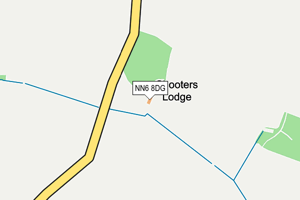
NN6 8DG is in Holdenby, Northampton. NN6 8DG is located in the Long Buckby electoral ward, within the unitary authority of West Northamptonshire and the English Parliamentary constituency of Daventry. The Sub Integrated Care Board (ICB) Location is NHS Northamptonshire ICB - 78H and the police force is Northamptonshire. This postcode has been in use since December 1996.


GetTheData
Source: OS OpenMap – Local (Ordnance Survey)
Source: OS VectorMap District (Ordnance Survey)
Licence: Open Government Licence (requires attribution)
| Easting | 470059 |
| Northing | 268478 |
| Latitude | 52.309955 |
| Longitude | -0.973810 |
GetTheData
Source: Open Postcode Geo
Licence: Open Government Licence
| Locality | Holdenby |
| Town/City | Northampton |
| Country | England |
| Postcode District | NN6 |
➜ See where NN6 is on a map | |
GetTheData
Source: Land Registry Price Paid Data
Licence: Open Government Licence
Elevation or altitude of NN6 8DG as distance above sea level:
| Metres | Feet | |
|---|---|---|
| Elevation | 100m | 328ft |
Elevation is measured from the approximate centre of the postcode, to the nearest point on an OS contour line from OS Terrain 50, which has contour spacing of ten vertical metres.
➜ How high above sea level am I? Find the elevation of your current position using your device's GPS.
GetTheData
Source: Open Postcode Elevation
Licence: Open Government Licence
| Ward | Long Buckby |
| Constituency | Daventry |
GetTheData
Source: ONS Postcode Database
Licence: Open Government Licence
| Village Lane End (Church Brampton Road) | Holdenby | 645m |
| Demand Responsive Area | Holdenby | 654m |
| Village Lane End (Church Brampton Road) | Holdenby | 663m |
| Glebe Farm (Holdenby Road) | Church Brampton | 1,684m |
| Glebe Farm (Holdenby Road) | Church Brampton | 1,717m |
GetTheData
Source: NaPTAN
Licence: Open Government Licence
| Percentage of properties with Next Generation Access | 100.0% |
| Percentage of properties with Superfast Broadband | 100.0% |
| Percentage of properties with Ultrafast Broadband | 100.0% |
| Percentage of properties with Full Fibre Broadband | 100.0% |
Superfast Broadband is between 30Mbps and 300Mbps
Ultrafast Broadband is > 300Mbps
| Percentage of properties unable to receive 2Mbps | 0.0% |
| Percentage of properties unable to receive 5Mbps | 0.0% |
| Percentage of properties unable to receive 10Mbps | 0.0% |
| Percentage of properties unable to receive 30Mbps | 0.0% |
GetTheData
Source: Ofcom
Licence: Ofcom Terms of Use (requires attribution)
GetTheData
Source: ONS Postcode Database
Licence: Open Government Licence

➜ Get more ratings from the Food Standards Agency
GetTheData
Source: Food Standards Agency
Licence: FSA terms & conditions
| Last Collection | |||
|---|---|---|---|
| Location | Mon-Fri | Sat | Distance |
| Holdenby | 17:00 | 10:30 | 807m |
| Teeton | 16:45 | 10:30 | 1,947m |
| Spratton Tso | 16:45 | 10:30 | 2,465m |
GetTheData
Source: Dracos
Licence: Creative Commons Attribution-ShareAlike
The below table lists the International Territorial Level (ITL) codes (formerly Nomenclature of Territorial Units for Statistics (NUTS) codes) and Local Administrative Units (LAU) codes for NN6 8DG:
| ITL 1 Code | Name |
|---|---|
| TLF | East Midlands (England) |
| ITL 2 Code | Name |
| TLF2 | Leicestershire, Rutland and Northamptonshire |
| ITL 3 Code | Name |
| TLF24 | West Northamptonshire |
| LAU 1 Code | Name |
| E07000151 | Daventry |
GetTheData
Source: ONS Postcode Directory
Licence: Open Government Licence
The below table lists the Census Output Area (OA), Lower Layer Super Output Area (LSOA), and Middle Layer Super Output Area (MSOA) for NN6 8DG:
| Code | Name | |
|---|---|---|
| OA | E00137425 | |
| LSOA | E01027021 | Daventry 004D |
| MSOA | E02005622 | Daventry 004 |
GetTheData
Source: ONS Postcode Directory
Licence: Open Government Licence
| NN6 8EE | Home Farm Court | 745m |
| NN6 8DJ | 805m | |
| NN6 8LQ | 1208m | |
| NN6 8LA | Welford Road | 1581m |
| NN6 8LB | Holdenby Road | 1877m |
| NN6 8DW | Holdenby Road | 1879m |
| NN6 8LJ | 1914m | |
| NN6 8JH | Willow Close | 2037m |
| NN6 8JN | The Brambles | 2051m |
| NN6 8JJ | Blackthorn Close | 2055m |
GetTheData
Source: Open Postcode Geo; Land Registry Price Paid Data
Licence: Open Government Licence