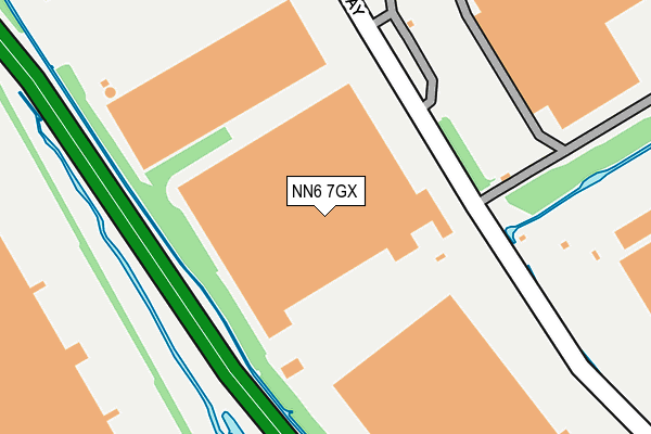
NN6 7GX is located in the Braunston and Crick electoral ward, within the unitary authority of West Northamptonshire and the English Parliamentary constituency of Daventry. The Sub Integrated Care Board (ICB) Location is NHS Northamptonshire ICB - 78H and the police force is Northamptonshire. This postcode has been in use since June 2000.


GetTheData
Source: OS OpenMap – Local (Ordnance Survey)
Source: OS VectorMap District (Ordnance Survey)
Licence: Open Government Licence (requires attribution)
| Easting | 456885 |
| Northing | 273723 |
| Latitude | 52.358640 |
| Longitude | -1.166119 |
GetTheData
Source: Open Postcode Geo
Licence: Open Government Licence
| Country | England |
| Postcode District | NN6 |
➜ See where NN6 is on a map | |
GetTheData
Source: Land Registry Price Paid Data
Licence: Open Government Licence
Elevation or altitude of NN6 7GX as distance above sea level:
| Metres | Feet | |
|---|---|---|
| Elevation | 110m | 361ft |
Elevation is measured from the approximate centre of the postcode, to the nearest point on an OS contour line from OS Terrain 50, which has contour spacing of ten vertical metres.
➜ How high above sea level am I? Find the elevation of your current position using your device's GPS.
GetTheData
Source: Open Postcode Elevation
Licence: Open Government Licence
| Ward | Braunston And Crick |
| Constituency | Daventry |
GetTheData
Source: ONS Postcode Database
Licence: Open Government Licence
| Stobarts (Danes Way) | Dirft | 99m |
| Stobarts (Danes Way) | Dirft | 106m |
| Danes Way Roundabout (Private Road Off A5) | Dirft | 407m |
| Ingrams (Danes Way) | Dirft | 557m |
| Ingrams (Danes Way) | Dirft | 557m |
GetTheData
Source: NaPTAN
Licence: Open Government Licence
GetTheData
Source: ONS Postcode Database
Licence: Open Government Licence


➜ Get more ratings from the Food Standards Agency
GetTheData
Source: Food Standards Agency
Licence: FSA terms & conditions
| Last Collection | |||
|---|---|---|---|
| Location | Mon-Fri | Sat | Distance |
| Yelvertoft Road | 16:30 | 10:30 | 2,262m |
| Lennon Close | 16:45 | 11:30 | 2,417m |
| Crick Tso | 16:30 | 10:30 | 2,596m |
GetTheData
Source: Dracos
Licence: Creative Commons Attribution-ShareAlike
The below table lists the International Territorial Level (ITL) codes (formerly Nomenclature of Territorial Units for Statistics (NUTS) codes) and Local Administrative Units (LAU) codes for NN6 7GX:
| ITL 1 Code | Name |
|---|---|
| TLF | East Midlands (England) |
| ITL 2 Code | Name |
| TLF2 | Leicestershire, Rutland and Northamptonshire |
| ITL 3 Code | Name |
| TLF24 | West Northamptonshire |
| LAU 1 Code | Name |
| E07000151 | Daventry |
GetTheData
Source: ONS Postcode Directory
Licence: Open Government Licence
The below table lists the Census Output Area (OA), Lower Layer Super Output Area (LSOA), and Middle Layer Super Output Area (MSOA) for NN6 7GX:
| Code | Name | |
|---|---|---|
| OA | E00137350 | |
| LSOA | E01027006 | Daventry 003E |
| MSOA | E02005621 | Daventry 003 |
GetTheData
Source: ONS Postcode Directory
Licence: Open Government Licence
| NN6 7XR | 1430m | |
| NN6 7SL | Eldon Way | 1608m |
| NN6 7WN | Centenary Drive | 1791m |
| NN6 7TY | Cowley Meadow Way | 1871m |
| CV23 0AB | Crick Road | 1877m |
| NN6 7GS | Swainson Close | 1989m |
| NN6 7UA | Barley Croft | 2036m |
| NN6 7ST | King Style Close | 2069m |
| NN6 7TR | Yelvertoft Road | 2100m |
| NN6 7SR | Drayson Lane | 2130m |
GetTheData
Source: Open Postcode Geo; Land Registry Price Paid Data
Licence: Open Government Licence