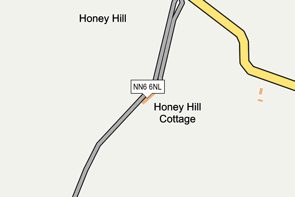
NN6 6NL is in Elkington, Northampton. NN6 6NL is located in the Brixworth electoral ward, within the unitary authority of West Northamptonshire and the English Parliamentary constituency of Daventry. The Sub Integrated Care Board (ICB) Location is NHS Northamptonshire ICB - 78H and the police force is Northamptonshire. This postcode has been in use since August 1993.


GetTheData
Source: OS OpenMap – Local (Ordnance Survey)
Source: OS VectorMap District (Ordnance Survey)
Licence: Open Government Licence (requires attribution)
| Easting | 463890 |
| Northing | 276742 |
| Latitude | 52.385007 |
| Longitude | -1.062699 |
GetTheData
Source: Open Postcode Geo
Licence: Open Government Licence
| Locality | Elkington |
| Town/City | Northampton |
| Country | England |
| Postcode District | NN6 |
➜ See where NN6 is on a map | |
GetTheData
Source: Land Registry Price Paid Data
Licence: Open Government Licence
Elevation or altitude of NN6 6NL as distance above sea level:
| Metres | Feet | |
|---|---|---|
| Elevation | 210m | 689ft |
Elevation is measured from the approximate centre of the postcode, to the nearest point on an OS contour line from OS Terrain 50, which has contour spacing of ten vertical metres.
➜ How high above sea level am I? Find the elevation of your current position using your device's GPS.
GetTheData
Source: Open Postcode Elevation
Licence: Open Government Licence
| Ward | Brixworth |
| Constituency | Daventry |
GetTheData
Source: ONS Postcode Database
Licence: Open Government Licence
| Honey Hill (Stanford Road) | Elkington | 235m |
| Honey Hill (Stanford Road) | Elkington | 241m |
| Cold Ashby Lodge (Stanford Road) | Cold Ashby | 356m |
| Cold Ashby Lodge (Stanford Road) | Cold Ashby | 358m |
| Demand Responsive Area | Elkington | 1,362m |
GetTheData
Source: NaPTAN
Licence: Open Government Licence
| Percentage of properties with Next Generation Access | 0.0% |
| Percentage of properties with Superfast Broadband | 0.0% |
| Percentage of properties with Ultrafast Broadband | 0.0% |
| Percentage of properties with Full Fibre Broadband | 0.0% |
Superfast Broadband is between 30Mbps and 300Mbps
Ultrafast Broadband is > 300Mbps
| Percentage of properties unable to receive 2Mbps | 0.0% |
| Percentage of properties unable to receive 5Mbps | 0.0% |
| Percentage of properties unable to receive 10Mbps | 100.0% |
| Percentage of properties unable to receive 30Mbps | 100.0% |
GetTheData
Source: Ofcom
Licence: Ofcom Terms of Use (requires attribution)
GetTheData
Source: ONS Postcode Database
Licence: Open Government Licence


➜ Get more ratings from the Food Standards Agency
GetTheData
Source: Food Standards Agency
Licence: FSA terms & conditions
| Last Collection | |||
|---|---|---|---|
| Location | Mon-Fri | Sat | Distance |
| Cold Ashby | 16:00 | 10:30 | 1,628m |
| West End | 16:00 | 10:30 | 3,382m |
| High Street | 16:30 | 10:30 | 3,727m |
GetTheData
Source: Dracos
Licence: Creative Commons Attribution-ShareAlike
The below table lists the International Territorial Level (ITL) codes (formerly Nomenclature of Territorial Units for Statistics (NUTS) codes) and Local Administrative Units (LAU) codes for NN6 6NL:
| ITL 1 Code | Name |
|---|---|
| TLF | East Midlands (England) |
| ITL 2 Code | Name |
| TLF2 | Leicestershire, Rutland and Northamptonshire |
| ITL 3 Code | Name |
| TLF24 | West Northamptonshire |
| LAU 1 Code | Name |
| E07000151 | Daventry |
GetTheData
Source: ONS Postcode Directory
Licence: Open Government Licence
The below table lists the Census Output Area (OA), Lower Layer Super Output Area (LSOA), and Middle Layer Super Output Area (MSOA) for NN6 6NL:
| Code | Name | |
|---|---|---|
| OA | E00137481 | |
| LSOA | E01027030 | Daventry 001C |
| MSOA | E02005619 | Daventry 001 |
GetTheData
Source: ONS Postcode Directory
Licence: Open Government Licence
| NN6 6EP | Stanford Road | 545m |
| NN6 6NJ | 1143m | |
| NN6 6NH | 1344m | |
| NN6 6EW | Stanford Close | 1451m |
| NN6 6EE | West Haddon Road | 1493m |
| NN6 6EU | Stanford Road | 1534m |
| NN6 6ER | Park Spinney Close | 1623m |
| NN6 6EH | Bridle Lane | 1634m |
| NN6 6EJ | William Lee Close | 1672m |
| NN6 6EF | Crabtree Lane | 1693m |
GetTheData
Source: Open Postcode Geo; Land Registry Price Paid Data
Licence: Open Government Licence