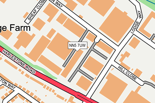
NN5 7UW is located in the Dallington Spencer electoral ward, within the unitary authority of West Northamptonshire and the English Parliamentary constituency of Northampton South. The Sub Integrated Care Board (ICB) Location is NHS Northamptonshire ICB - 78H and the police force is Northamptonshire. This postcode has been in use since January 1980.


GetTheData
Source: OS OpenMap – Local (Ordnance Survey)
Source: OS VectorMap District (Ordnance Survey)
Licence: Open Government Licence (requires attribution)
| Easting | 472139 |
| Northing | 262750 |
| Latitude | 52.258214 |
| Longitude | -0.944516 |
GetTheData
Source: Open Postcode Geo
Licence: Open Government Licence
| Country | England |
| Postcode District | NN5 |
➜ See where NN5 is on a map ➜ Where is Northampton? | |
GetTheData
Source: Land Registry Price Paid Data
Licence: Open Government Licence
Elevation or altitude of NN5 7UW as distance above sea level:
| Metres | Feet | |
|---|---|---|
| Elevation | 90m | 295ft |
Elevation is measured from the approximate centre of the postcode, to the nearest point on an OS contour line from OS Terrain 50, which has contour spacing of ten vertical metres.
➜ How high above sea level am I? Find the elevation of your current position using your device's GPS.
GetTheData
Source: Open Postcode Elevation
Licence: Open Government Licence
| Ward | Dallington Spencer |
| Constituency | Northampton South |
GetTheData
Source: ONS Postcode Database
Licence: Open Government Licence
| The Io Centre (Barn Way) | Lodge Farm | 122m |
| The Io Centre (Barn Way) | Lodge Farm | 130m |
| Firsview Drive (Harlestone Road) | New Duston | 152m |
| Harlestone Road | New Duston | 167m |
| Harlestone Road | New Duston | 237m |
| Northampton Station | 3.5km |
GetTheData
Source: NaPTAN
Licence: Open Government Licence
| Median download speed | 40.0Mbps |
| Average download speed | 44.8Mbps |
| Maximum download speed | 80.00Mbps |
| Median upload speed | 10.0Mbps |
| Average upload speed | 11.3Mbps |
| Maximum upload speed | 20.00Mbps |
GetTheData
Source: Ofcom
Licence: Ofcom Terms of Use (requires attribution)
Estimated total energy consumption in NN5 7UW by fuel type, 2015.
| Consumption (kWh) | 420,729 |
|---|---|
| Meter count | 19 |
| Mean (kWh/meter) | 22,144 |
| Median (kWh/meter) | 16,449 |
GetTheData
Source: Postcode level gas estimates: 2015 (experimental)
Source: Postcode level electricity estimates: 2015 (experimental)
Licence: Open Government Licence
GetTheData
Source: ONS Postcode Database
Licence: Open Government Licence


➜ Get more ratings from the Food Standards Agency
GetTheData
Source: Food Standards Agency
Licence: FSA terms & conditions
| Last Collection | |||
|---|---|---|---|
| Location | Mon-Fri | Sat | Distance |
| Lodge Farm | 18:45 | 11:30 | 173m |
| Lodge Farm | 18:45 | 175m | |
| Firsview Drive | 17:30 | 11:30 | 303m |
GetTheData
Source: Dracos
Licence: Creative Commons Attribution-ShareAlike
The below table lists the International Territorial Level (ITL) codes (formerly Nomenclature of Territorial Units for Statistics (NUTS) codes) and Local Administrative Units (LAU) codes for NN5 7UW:
| ITL 1 Code | Name |
|---|---|
| TLF | East Midlands (England) |
| ITL 2 Code | Name |
| TLF2 | Leicestershire, Rutland and Northamptonshire |
| ITL 3 Code | Name |
| TLF24 | West Northamptonshire |
| LAU 1 Code | Name |
| E07000154 | Northampton |
GetTheData
Source: ONS Postcode Directory
Licence: Open Government Licence
The below table lists the Census Output Area (OA), Lower Layer Super Output Area (LSOA), and Middle Layer Super Output Area (MSOA) for NN5 7UW:
| Code | Name | |
|---|---|---|
| OA | E00138579 | |
| LSOA | E01027240 | Northampton 018D |
| MSOA | E02005667 | Northampton 018 |
GetTheData
Source: ONS Postcode Directory
Licence: Open Government Licence
| NN5 6NY | Harlestone Road | 171m |
| NN5 6PB | Harlestone Road | 263m |
| NN5 6NG | Grafton Way | 301m |
| NN5 6NH | Woodland Close | 317m |
| NN5 6NQ | Grafton Way | 338m |
| NN5 7EU | Ryehill Court | 367m |
| NN5 6RN | Pytchley Way | 376m |
| NN5 6NX | Harlestone Road | 383m |
| NN5 6RW | Cottesmore Close | 389m |
| NN5 6RG | Firsview Drive | 406m |
GetTheData
Source: Open Postcode Geo; Land Registry Price Paid Data
Licence: Open Government Licence