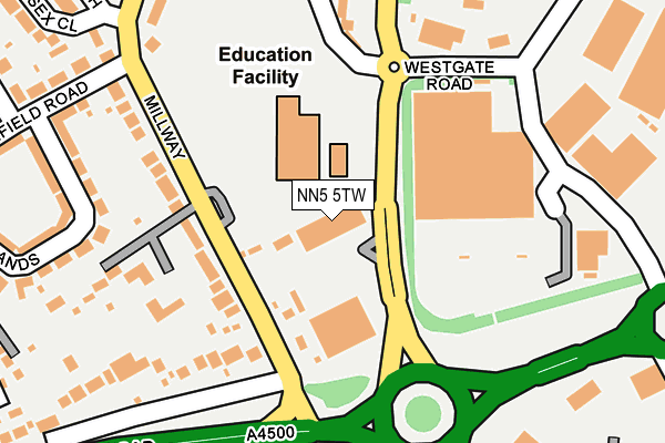
NN5 5TW lies on Tollgate Way in Northampton. NN5 5TW is located in the Duston East electoral ward, within the unitary authority of West Northamptonshire and the English Parliamentary constituency of Northampton South. The Sub Integrated Care Board (ICB) Location is NHS Northamptonshire ICB - 78H and the police force is Northamptonshire. This postcode has been in use since December 1998.


GetTheData
Source: OS OpenMap – Local (Ordnance Survey)
Source: OS VectorMap District (Ordnance Survey)
Licence: Open Government Licence (requires attribution)
| Easting | 472547 |
| Northing | 260606 |
| Latitude | 52.238873 |
| Longitude | -0.939014 |
GetTheData
Source: Open Postcode Geo
Licence: Open Government Licence
| Street | Tollgate Way |
| Town/City | Northampton |
| Country | England |
| Postcode District | NN5 |
➜ See where NN5 is on a map ➜ Where is Northampton? | |
GetTheData
Source: Land Registry Price Paid Data
Licence: Open Government Licence
Elevation or altitude of NN5 5TW as distance above sea level:
| Metres | Feet | |
|---|---|---|
| Elevation | 90m | 295ft |
Elevation is measured from the approximate centre of the postcode, to the nearest point on an OS contour line from OS Terrain 50, which has contour spacing of ten vertical metres.
➜ How high above sea level am I? Find the elevation of your current position using your device's GPS.
GetTheData
Source: Open Postcode Elevation
Licence: Open Government Licence
| Ward | Duston East |
| Constituency | Northampton South |
GetTheData
Source: ONS Postcode Database
Licence: Open Government Licence
| Sainsburys (Gambrel Road) | Sixfields | 195m |
| Millway (Weedon Road) | Sixfields | 205m |
| Millway (Weedon Road) | Sixfields | 211m |
| Sainsburys (Gambrel Road) | Sixfields | 284m |
| Kent Road (Weedon Road) | Upton | 377m |
| Northampton Station | 2.2km |
GetTheData
Source: NaPTAN
Licence: Open Government Licence
GetTheData
Source: ONS Postcode Database
Licence: Open Government Licence


➜ Get more ratings from the Food Standards Agency
GetTheData
Source: Food Standards Agency
Licence: FSA terms & conditions
| Last Collection | |||
|---|---|---|---|
| Location | Mon-Fri | Sat | Distance |
| Millway | 17:30 | 11:30 | 148m |
| Sainsburys Weedon Road | 17:30 | 11:30 | 167m |
| Southfield Road | 17:30 | 11:30 | 396m |
GetTheData
Source: Dracos
Licence: Creative Commons Attribution-ShareAlike
The below table lists the International Territorial Level (ITL) codes (formerly Nomenclature of Territorial Units for Statistics (NUTS) codes) and Local Administrative Units (LAU) codes for NN5 5TW:
| ITL 1 Code | Name |
|---|---|
| TLF | East Midlands (England) |
| ITL 2 Code | Name |
| TLF2 | Leicestershire, Rutland and Northamptonshire |
| ITL 3 Code | Name |
| TLF24 | West Northamptonshire |
| LAU 1 Code | Name |
| E07000154 | Northampton |
GetTheData
Source: ONS Postcode Directory
Licence: Open Government Licence
The below table lists the Census Output Area (OA), Lower Layer Super Output Area (LSOA), and Middle Layer Super Output Area (MSOA) for NN5 5TW:
| Code | Name | |
|---|---|---|
| OA | E00138435 | |
| LSOA | E01027217 | Northampton 019D |
| MSOA | E02005668 | Northampton 019 |
GetTheData
Source: ONS Postcode Directory
Licence: Open Government Licence
| NN5 6ES | Millway | 156m |
| NN5 4EX | Weedon Road | 213m |
| NN5 6EY | The Scarplands | 264m |
| NN5 6FA | Somerset Drive | 280m |
| NN5 4AH | Da Vinci Close | 305m |
| NN5 4AJ | Brunel Drive | 307m |
| NN5 6EZ | Stanfield Road | 331m |
| NN5 6EU | Hall Close | 349m |
| NN5 6ER | Millway | 352m |
| NN5 6ET | Sussex Close | 361m |
GetTheData
Source: Open Postcode Geo; Land Registry Price Paid Data
Licence: Open Government Licence