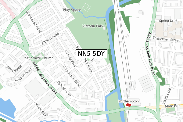
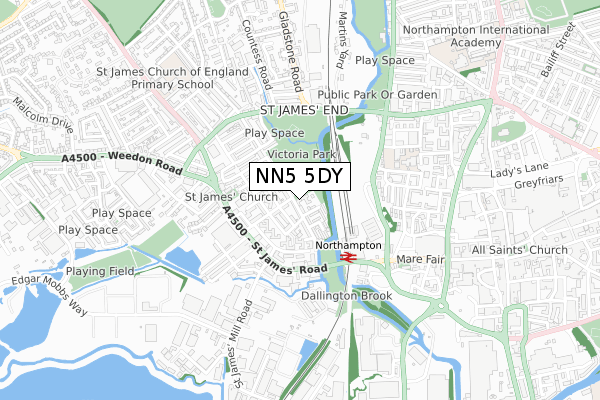
NN5 5DY is located in the Dallington Spencer electoral ward, within the unitary authority of West Northamptonshire and the English Parliamentary constituency of Northampton South. The Sub Integrated Care Board (ICB) Location is NHS Northamptonshire ICB - 78H and the police force is Northamptonshire. This postcode has been in use since August 2018.


GetTheData
Source: OS Open Zoomstack (Ordnance Survey)
Licence: Open Government Licence (requires attribution)
Attribution: Contains OS data © Crown copyright and database right 2024
Source: Open Postcode Geo
Licence: Open Government Licence (requires attribution)
Attribution: Contains OS data © Crown copyright and database right 2024; Contains Royal Mail data © Royal Mail copyright and database right 2024; Source: Office for National Statistics licensed under the Open Government Licence v.3.0
| Easting | 474538 |
| Northing | 260659 |
| Latitude | 52.239099 |
| Longitude | -0.909836 |
GetTheData
Source: Open Postcode Geo
Licence: Open Government Licence
| Country | England |
| Postcode District | NN5 |
| ➜ NN5 open data dashboard ➜ See where NN5 is on a map ➜ Where is Northampton? | |
GetTheData
Source: Land Registry Price Paid Data
Licence: Open Government Licence
| Ward | Dallington Spencer |
| Constituency | Northampton South |
GetTheData
Source: ONS Postcode Database
Licence: Open Government Licence
| January 2024 | Anti-social behaviour | On or near Byfield Road | 224m |
| January 2024 | Public order | On or near Stenson Street | 227m |
| January 2024 | Shoplifting | On or near Stenson Street | 227m |
| ➜ Get more crime data in our Crime section | |||
GetTheData
Source: data.police.uk
Licence: Open Government Licence
| Bus Depot (St James Road) | St James End | 254m |
| Byfield Road (St James Road) | St James End | 276m |
| Byfield Road (St James Road) | St James End | 292m |
| Bus Depot (St James Road) | St James End | 297m |
| Railway Station Forecourt (Station Forecourt) | Northampton | 307m |
| Northampton Station | 0.3km |
GetTheData
Source: NaPTAN
Licence: Open Government Licence
| Percentage of properties with Next Generation Access | 100.0% |
| Percentage of properties with Superfast Broadband | 100.0% |
| Percentage of properties with Ultrafast Broadband | 100.0% |
| Percentage of properties with Full Fibre Broadband | 100.0% |
Superfast Broadband is between 30Mbps and 300Mbps
Ultrafast Broadband is > 300Mbps
| Percentage of properties unable to receive 2Mbps | 0.0% |
| Percentage of properties unable to receive 5Mbps | 0.0% |
| Percentage of properties unable to receive 10Mbps | 0.0% |
| Percentage of properties unable to receive 30Mbps | 0.0% |
GetTheData
Source: Ofcom
Licence: Ofcom Terms of Use (requires attribution)
GetTheData
Source: ONS Postcode Database
Licence: Open Government Licence


➜ Get more ratings from the Food Standards Agency
GetTheData
Source: Food Standards Agency
Licence: FSA terms & conditions
| Last Collection | |||
|---|---|---|---|
| Location | Mon-Fri | Sat | Distance |
| Stanley Road | 17:45 | 11:30 | 96m |
| Castle Station | 18:30 | 11:30 | 294m |
| St James End Tso | 17:30 | 12:00 | 377m |
GetTheData
Source: Dracos
Licence: Creative Commons Attribution-ShareAlike
| Facility | Distance |
|---|---|
| Victoria Park (Northampton) Spencer Bridge Road, Northampton Grass Pitches | 191m |
| Spring Lane Primary School Spring Lane, Northampton Grass Pitches | 496m |
| Fitness4less (Northampton) Marefair, Northampton Swimming Pool, Health and Fitness Gym, Studio | 577m |
GetTheData
Source: Active Places
Licence: Open Government Licence
| School | Phase of Education | Distance |
|---|---|---|
| Spring Lane Primary School Spring Lane, Northampton, NN1 2JW | Primary | 497m |
| St James Church of England Primary School Harlestone Road, St James, Northampton, NN5 7AG | Primary | 555m |
| New Horizons School 59-77 Sheep Street, Northampton, NN1 2NE | Not applicable | 826m |
GetTheData
Source: Edubase
Licence: Open Government Licence
| Risk of NN5 5DY flooding from rivers and sea | Low |
| ➜ NN5 5DY flood map | |
GetTheData
Source: Open Flood Risk by Postcode
Licence: Open Government Licence
The below table lists the International Territorial Level (ITL) codes (formerly Nomenclature of Territorial Units for Statistics (NUTS) codes) and Local Administrative Units (LAU) codes for NN5 5DY:
| ITL 1 Code | Name |
|---|---|
| TLF | East Midlands (England) |
| ITL 2 Code | Name |
| TLF2 | Leicestershire, Rutland and Northamptonshire |
| ITL 3 Code | Name |
| TLF24 | West Northamptonshire |
| LAU 1 Code | Name |
| E07000154 | Northampton |
GetTheData
Source: ONS Postcode Directory
Licence: Open Government Licence
The below table lists the Census Output Area (OA), Lower Layer Super Output Area (LSOA), and Middle Layer Super Output Area (MSOA) for NN5 5DY:
| Code | Name | |
|---|---|---|
| OA | E00138153 | |
| LSOA | E01027151 | Northampton 024A |
| MSOA | E02005673 | Northampton 024 |
GetTheData
Source: ONS Postcode Directory
Licence: Open Government Licence
| NN5 5DR | St James Park Road | 47m |
| NN5 5DS | Marlborough Road | 76m |
| NN5 5DP | Richmond Terrace | 90m |
| NN5 5DT | Stanley Road | 99m |
| NN5 5DU | Ambush Street | 118m |
| NN5 5EA | Greenwood Road | 120m |
| NN5 5EL | St James Park Road | 127m |
| NN5 5DN | St James Park Road | 130m |
| NN5 5DX | Ambush Street | 131m |
| NN5 5EG | Greenwood Road | 136m |
GetTheData
Source: Open Postcode Geo; Land Registry Price Paid Data
Licence: Open Government Licence