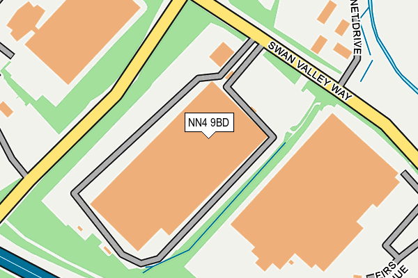
NN4 9BD is located in the Sixfields electoral ward, within the unitary authority of West Northamptonshire and the English Parliamentary constituency of South Northamptonshire. The Sub Integrated Care Board (ICB) Location is NHS Northamptonshire ICB - 78H and the police force is Northamptonshire. This postcode has been in use since December 2000.


GetTheData
Source: OS OpenMap – Local (Ordnance Survey)
Source: OS VectorMap District (Ordnance Survey)
Licence: Open Government Licence (requires attribution)
| Easting | 472528 |
| Northing | 257566 |
| Latitude | 52.211564 |
| Longitude | -0.939928 |
GetTheData
Source: Open Postcode Geo
Licence: Open Government Licence
| Country | England |
| Postcode District | NN4 |
➜ See where NN4 is on a map ➜ Where is Swan Valley? | |
GetTheData
Source: Land Registry Price Paid Data
Licence: Open Government Licence
Elevation or altitude of NN4 9BD as distance above sea level:
| Metres | Feet | |
|---|---|---|
| Elevation | 70m | 230ft |
Elevation is measured from the approximate centre of the postcode, to the nearest point on an OS contour line from OS Terrain 50, which has contour spacing of ten vertical metres.
➜ How high above sea level am I? Find the elevation of your current position using your device's GPS.
GetTheData
Source: Open Postcode Elevation
Licence: Open Government Licence
| Ward | Sixfields |
| Constituency | South Northamptonshire |
GetTheData
Source: ONS Postcode Database
Licence: Open Government Licence
| The Barn Way (Swan Valley Way) | Swan Valley | 211m |
| The Barn Way (Swan Valley Way) | Swan Valley | 216m |
| Cygnet Drive (Swan Valley Way) | Swan Valley | 451m |
| Cygnet Drive (Swan Valley Way) | Swan Valley | 454m |
| Teal Close (Ladybridge Drive) | Shelfleys | 548m |
| Northampton Station | 3.7km |
GetTheData
Source: NaPTAN
Licence: Open Government Licence
GetTheData
Source: ONS Postcode Database
Licence: Open Government Licence


➜ Get more ratings from the Food Standards Agency
GetTheData
Source: Food Standards Agency
Licence: FSA terms & conditions
| Last Collection | |||
|---|---|---|---|
| Location | Mon-Fri | Sat | Distance |
| Rothersthorpe M1 Services | 17:30 | 11:15 | 303m |
| Rothersthorpe M1 Service | 17:30 | 11:15 | 389m |
| Tansy Close | 17:30 | 11:30 | 624m |
GetTheData
Source: Dracos
Licence: Creative Commons Attribution-ShareAlike
The below table lists the International Territorial Level (ITL) codes (formerly Nomenclature of Territorial Units for Statistics (NUTS) codes) and Local Administrative Units (LAU) codes for NN4 9BD:
| ITL 1 Code | Name |
|---|---|
| TLF | East Midlands (England) |
| ITL 2 Code | Name |
| TLF2 | Leicestershire, Rutland and Northamptonshire |
| ITL 3 Code | Name |
| TLF24 | West Northamptonshire |
| LAU 1 Code | Name |
| E07000154 | Northampton |
GetTheData
Source: ONS Postcode Directory
Licence: Open Government Licence
The below table lists the Census Output Area (OA), Lower Layer Super Output Area (LSOA), and Middle Layer Super Output Area (MSOA) for NN4 9BD:
| Code | Name | |
|---|---|---|
| OA | E00138631 | |
| LSOA | E01027254 | Northampton 029D |
| MSOA | E02005678 | Northampton 029 |
GetTheData
Source: ONS Postcode Directory
Licence: Open Government Licence
| NN4 9DT | Windlass Close | 307m |
| NN4 9DS | Narrowboat Lane | 321m |
| NN4 9DF | Canal Way | 440m |
| NN4 9DW | Towpath Avenue | 444m |
| NN4 9DG | Lockgate Road | 459m |
| NN4 9DP | Lockgate Road | 484m |
| NN4 9XF | Teal Close | 494m |
| NN4 9DB | Narrowboat Lane | 522m |
| NN4 9XA | Whitegates | 525m |
| NN4 9DE | Tiller Way | 554m |
GetTheData
Source: Open Postcode Geo; Land Registry Price Paid Data
Licence: Open Government Licence