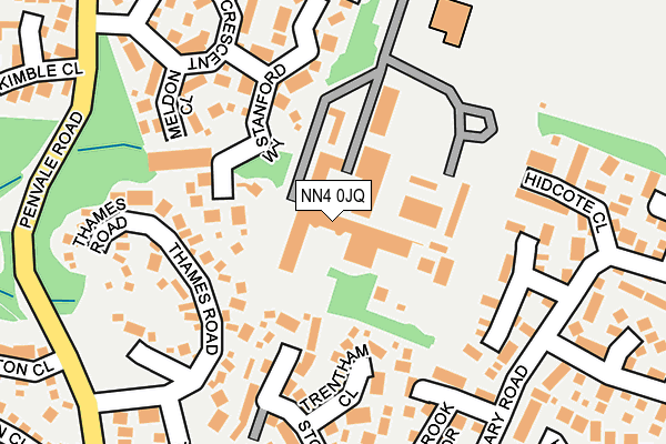
NN4 0JQ is located in the East Hunsbury and Shelfleys electoral ward, within the unitary authority of West Northamptonshire and the English Parliamentary constituency of South Northamptonshire. The Sub Integrated Care Board (ICB) Location is NHS Northamptonshire ICB - 78H and the police force is Northamptonshire. This postcode has been in use since January 1980.


GetTheData
Source: OS OpenMap – Local (Ordnance Survey)
Source: OS VectorMap District (Ordnance Survey)
Licence: Open Government Licence (requires attribution)
| Easting | 475166 |
| Northing | 257423 |
| Latitude | 52.209911 |
| Longitude | -0.901374 |
GetTheData
Source: Open Postcode Geo
Licence: Open Government Licence
| Country | England |
| Postcode District | NN4 |
➜ See where NN4 is on a map ➜ Where is Northampton? | |
GetTheData
Source: Land Registry Price Paid Data
Licence: Open Government Licence
Elevation or altitude of NN4 0JQ as distance above sea level:
| Metres | Feet | |
|---|---|---|
| Elevation | 90m | 295ft |
Elevation is measured from the approximate centre of the postcode, to the nearest point on an OS contour line from OS Terrain 50, which has contour spacing of ten vertical metres.
➜ How high above sea level am I? Find the elevation of your current position using your device's GPS.
GetTheData
Source: Open Postcode Elevation
Licence: Open Government Licence
| Ward | East Hunsbury And Shelfleys |
| Constituency | South Northamptonshire |
GetTheData
Source: ONS Postcode Database
Licence: Open Government Licence
| Lambrook Drive (Granary Road) | Blackey More | 211m |
| Skipton Close (Penvale Road) | Merefield | 264m |
| Skipton Close (Penvale Road) | Merefield | 279m |
| Harrier Park (Clannell Road) | Merefield | 368m |
| Wakehurst Drive (Granary Road) | Blackey More | 376m |
| Northampton Station | 3.1km |
GetTheData
Source: NaPTAN
Licence: Open Government Licence
GetTheData
Source: ONS Postcode Database
Licence: Open Government Licence


➜ Get more ratings from the Food Standards Agency
GetTheData
Source: Food Standards Agency
Licence: FSA terms & conditions
| Last Collection | |||
|---|---|---|---|
| Location | Mon-Fri | Sat | Distance |
| Penvale Road | 17:30 | 12:00 | 403m |
| Clannel Road | 17:30 | 12:30 | 412m |
| Hedgeway | 17:30 | 12:00 | 567m |
GetTheData
Source: Dracos
Licence: Creative Commons Attribution-ShareAlike
The below table lists the International Territorial Level (ITL) codes (formerly Nomenclature of Territorial Units for Statistics (NUTS) codes) and Local Administrative Units (LAU) codes for NN4 0JQ:
| ITL 1 Code | Name |
|---|---|
| TLF | East Midlands (England) |
| ITL 2 Code | Name |
| TLF2 | Leicestershire, Rutland and Northamptonshire |
| ITL 3 Code | Name |
| TLF24 | West Northamptonshire |
| LAU 1 Code | Name |
| E07000154 | Northampton |
GetTheData
Source: ONS Postcode Directory
Licence: Open Government Licence
The below table lists the Census Output Area (OA), Lower Layer Super Output Area (LSOA), and Middle Layer Super Output Area (MSOA) for NN4 0JQ:
| Code | Name | |
|---|---|---|
| OA | E00138197 | |
| LSOA | E01027162 | Northampton 030A |
| MSOA | E02005679 | Northampton 030 |
GetTheData
Source: ONS Postcode Directory
Licence: Open Government Licence
| NN4 0FQ | Stanford Way | 125m |
| NN4 0WB | Trentham Close | 145m |
| NN4 0RD | Thames Road | 164m |
| NN4 0FJ | Meldon Close | 177m |
| NN4 0XS | Bressingham Gardens | 182m |
| NN4 0FL | Hatfield Close | 189m |
| NN4 0WA | Lambrook Drive | 192m |
| NN4 0UH | Stourhead Drive | 205m |
| NN4 0XQ | Hidcote Close | 216m |
| NN4 0FN | Longleat Court | 228m |
GetTheData
Source: Open Postcode Geo; Land Registry Price Paid Data
Licence: Open Government Licence