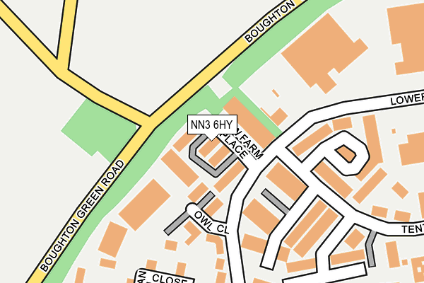
NN3 6HY lies on Low Farm Place in Moulton Park Industrial Estate, Northampton. NN3 6HY is located in the Boothville and Parklands electoral ward, within the unitary authority of West Northamptonshire and the English Parliamentary constituency of Northampton North. The Sub Integrated Care Board (ICB) Location is NHS Northamptonshire ICB - 78H and the police force is Northamptonshire. This postcode has been in use since August 1993.


GetTheData
Source: OS OpenMap – Local (Ordnance Survey)
Source: OS VectorMap District (Ordnance Survey)
Licence: Open Government Licence (requires attribution)
| Easting | 476640 |
| Northing | 265268 |
| Latitude | 52.280239 |
| Longitude | -0.878015 |
GetTheData
Source: Open Postcode Geo
Licence: Open Government Licence
| Street | Low Farm Place |
| Locality | Moulton Park Industrial Estate |
| Town/City | Northampton |
| Country | England |
| Postcode District | NN3 |
➜ See where NN3 is on a map ➜ Where is Northampton? | |
GetTheData
Source: Land Registry Price Paid Data
Licence: Open Government Licence
Elevation or altitude of NN3 6HY as distance above sea level:
| Metres | Feet | |
|---|---|---|
| Elevation | 110m | 361ft |
Elevation is measured from the approximate centre of the postcode, to the nearest point on an OS contour line from OS Terrain 50, which has contour spacing of ten vertical metres.
➜ How high above sea level am I? Find the elevation of your current position using your device's GPS.
GetTheData
Source: Open Postcode Elevation
Licence: Open Government Licence
| Ward | Boothville And Parklands |
| Constituency | Northampton North |
GetTheData
Source: ONS Postcode Database
Licence: Open Government Licence
| Owl Close (Lower Farm Road) | Moulton Park | 158m |
| Owl Close (Lower Farm Road) | Moulton Park | 179m |
| Tenter Road (Lower Farm Road) | Moulton Park | 181m |
| Tenter Road (Lower Farm Road) | Moulton Park | 206m |
| Red House Road | Moulton Park | 281m |
| Northampton Station | 5.1km |
GetTheData
Source: NaPTAN
Licence: Open Government Licence
| Median download speed | 4.5Mbps |
| Average download speed | 4.2Mbps |
| Maximum download speed | 6.14Mbps |
| Median upload speed | 0.8Mbps |
| Average upload speed | 0.8Mbps |
| Maximum upload speed | 0.95Mbps |
GetTheData
Source: Ofcom
Licence: Ofcom Terms of Use (requires attribution)
Estimated total energy consumption in NN3 6HY by fuel type, 2015.
| Consumption (kWh) | 265,403 |
|---|---|
| Meter count | 20 |
| Mean (kWh/meter) | 13,270 |
| Median (kWh/meter) | 5,642 |
GetTheData
Source: Postcode level gas estimates: 2015 (experimental)
Source: Postcode level electricity estimates: 2015 (experimental)
Licence: Open Government Licence
GetTheData
Source: ONS Postcode Database
Licence: Open Government Licence


➜ Get more ratings from the Food Standards Agency
GetTheData
Source: Food Standards Agency
Licence: FSA terms & conditions
| Last Collection | |||
|---|---|---|---|
| Location | Mon-Fri | Sat | Distance |
| Duncan Close | 18:30 | 12:45 | 242m |
| Summerhouse Road | 18:30 | 11:30 | 564m |
| Summerhouse Road | 18:30 | 567m | |
GetTheData
Source: Dracos
Licence: Creative Commons Attribution-ShareAlike
The below table lists the International Territorial Level (ITL) codes (formerly Nomenclature of Territorial Units for Statistics (NUTS) codes) and Local Administrative Units (LAU) codes for NN3 6HY:
| ITL 1 Code | Name |
|---|---|
| TLF | East Midlands (England) |
| ITL 2 Code | Name |
| TLF2 | Leicestershire, Rutland and Northamptonshire |
| ITL 3 Code | Name |
| TLF24 | West Northamptonshire |
| LAU 1 Code | Name |
| E07000154 | Northampton |
GetTheData
Source: ONS Postcode Directory
Licence: Open Government Licence
The below table lists the Census Output Area (OA), Lower Layer Super Output Area (LSOA), and Middle Layer Super Output Area (MSOA) for NN3 6HY:
| Code | Name | |
|---|---|---|
| OA | E00138468 | |
| LSOA | E01027218 | Northampton 002A |
| MSOA | E02005651 | Northampton 002 |
GetTheData
Source: ONS Postcode Directory
Licence: Open Government Licence
| NN3 6HZ | Owl Close | 73m |
| NN3 6AX | Tenter Road | 178m |
| NN3 6WL | Duncan Close | 224m |
| NN3 6AP | Moulton Park Office Village | 323m |
| NN3 6UR | Lower Farm Road | 507m |
| NN2 8XD | Rowley Way | 537m |
| NN2 8RD | 565m | |
| NN3 6GL | Summerhouse Road | 592m |
| NN2 8XE | Dixon Road | 618m |
| NN2 8XF | Jackson Close | 625m |
GetTheData
Source: Open Postcode Geo; Land Registry Price Paid Data
Licence: Open Government Licence