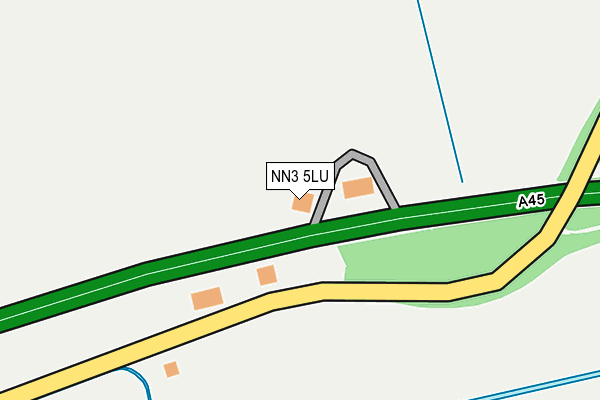
NN3 5LU is located in the Earls Barton electoral ward, within the unitary authority of North Northamptonshire and the English Parliamentary constituency of Daventry. The Sub Integrated Care Board (ICB) Location is NHS Northamptonshire ICB - 78H and the police force is Northamptonshire. This postcode has been in use since February 1990.


GetTheData
Source: OS OpenMap – Local (Ordnance Survey)
Source: OS VectorMap District (Ordnance Survey)
Licence: Open Government Licence (requires attribution)
| Easting | 482565 |
| Northing | 262608 |
| Latitude | 52.255472 |
| Longitude | -0.791834 |
GetTheData
Source: Open Postcode Geo
Licence: Open Government Licence
| Country | England |
| Postcode District | NN3 |
➜ See where NN3 is on a map | |
GetTheData
Source: Land Registry Price Paid Data
Licence: Open Government Licence
Elevation or altitude of NN3 5LU as distance above sea level:
| Metres | Feet | |
|---|---|---|
| Elevation | 60m | 197ft |
Elevation is measured from the approximate centre of the postcode, to the nearest point on an OS contour line from OS Terrain 50, which has contour spacing of ten vertical metres.
➜ How high above sea level am I? Find the elevation of your current position using your device's GPS.
GetTheData
Source: Open Postcode Elevation
Licence: Open Government Licence
| Ward | Earls Barton |
| Constituency | Daventry |
GetTheData
Source: ONS Postcode Database
Licence: Open Government Licence
| St Andrews Primary School (Ecton Brook Road) | Ecton Brook | 803m |
| St Andrews Primary School (Ecton Brook Road) | Ecton Brook | 836m |
| Primary School (Ecton Brook Road) | Ecton Brook | 873m |
| Primary School (Ecton Brook Road) | Ecton Brook | 907m |
| Parkside (Ecton Brook Road) | Ecton Brook | 909m |
GetTheData
Source: NaPTAN
Licence: Open Government Licence
GetTheData
Source: ONS Postcode Database
Licence: Open Government Licence


➜ Get more ratings from the Food Standards Agency
GetTheData
Source: Food Standards Agency
Licence: FSA terms & conditions
| Last Collection | |||
|---|---|---|---|
| Location | Mon-Fri | Sat | Distance |
| Ecton Brook Tso | 17:30 | 12:00 | 841m |
| Sheerwater Drive | 17:30 | 11:45 | 1,038m |
| Ecton Brook Road | 17:30 | 12:00 | 1,072m |
GetTheData
Source: Dracos
Licence: Creative Commons Attribution-ShareAlike
The below table lists the International Territorial Level (ITL) codes (formerly Nomenclature of Territorial Units for Statistics (NUTS) codes) and Local Administrative Units (LAU) codes for NN3 5LU:
| ITL 1 Code | Name |
|---|---|
| TLF | East Midlands (England) |
| ITL 2 Code | Name |
| TLF2 | Leicestershire, Rutland and Northamptonshire |
| ITL 3 Code | Name |
| TLF25 | North Northamptonshire |
| LAU 1 Code | Name |
| E07000156 | Wellingborough |
GetTheData
Source: ONS Postcode Directory
Licence: Open Government Licence
The below table lists the Census Output Area (OA), Lower Layer Super Output Area (LSOA), and Middle Layer Super Output Area (MSOA) for NN3 5LU:
| Code | Name | |
|---|---|---|
| OA | E00139156 | |
| LSOA | E01027353 | Wellingborough 009F |
| MSOA | E02005700 | Wellingborough 009 |
GetTheData
Source: ONS Postcode Directory
Licence: Open Government Licence
| NN3 5EG | Riverwell | 723m |
| NN3 5EA | Ecton Brook Road | 736m |
| NN3 5HJ | Millbank | 765m |
| NN3 5EN | Ecton Brook Road | 816m |
| NN3 5EW | Parkside | 816m |
| NN6 0QB | High Street | 822m |
| NN6 0BF | Barton Fields | 823m |
| NN3 5HW | Chedworth Close | 842m |
| NN6 0QA | High Street | 875m |
| NN3 5EJ | Vantage Meadow | 887m |
GetTheData
Source: Open Postcode Geo; Land Registry Price Paid Data
Licence: Open Government Licence